Updated 02.25.23 @ 8:28a
- The remainder of our weekend should be quiet on the weather front. Take the opportunity to enjoy a calmer couple of days as an active week awaits.
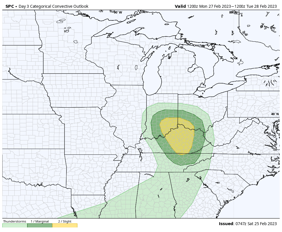
- A warm front will lift north through the region Sunday night with showers and embedded thunder. Temperatures will jump back into the lower and middle 60s across the southern portion of the state Monday morning. As a cold front swings into the relatively warmer and moist airmass, a line of stronger storms will be a good bet across the southern half of Indiana late Monday morning into early afternoon. A few of these may produce damaging winds and large hail, and there’s also potential for a quick spin up tornado. Strong and gusty winds (40-50 MPH) can also be expected across the entire region outside of storms.

3. Attention will then shift to mid week as multiple pieces of energy try and bundle together to generate another size-able storm. Confidence on any one particular solution is low at this distance, but with colder air pressing east, this system will likely have a more widespread wintry component on the north and west flank. No reason to speculate further from this distance, but know we’ll continue closely monitoring trends.
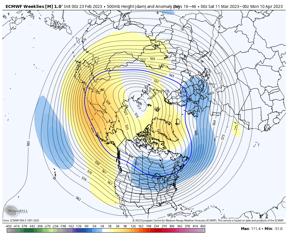
4. Finally, it continues to look like any and all who believed winter was over will be sorely mistaken. Confidence continues to grow in a cold to much colder than normal 2nd half of March, which likely continues to push into at least early April. Note the updated European Weeklies for the time period March 10 to April 10. That’s a classic look for significant late season cold. We’re also likely far from finished with wintry precipitation…


