Updated 02.13.23 @ 7:47p
You must be logged in to view this content. Click Here to become a member of IndyWX.com for full access. Already a member of IndyWx.com All-Access? Log-in here.

Feb 13
Updated 02.13.23 @ 7:47p
You must be logged in to view this content. Click Here to become a member of IndyWX.com for full access. Already a member of IndyWx.com All-Access? Log-in here.
Permanent link to this article: https://indywx.com/2023/02/13/video-latest-thoughts-on-wednesday-night-thursday/
Feb 13
Updated 02.13.23 @ 7a
First and foremost, we’ll have a fresh video discussion posted later this evening with updated thoughts on the chances of a few stronger storms up this way Thursday.
With only a couple weeks left in “meteorological winter,” many are asking is this it for the little cold and snow we’ve seen, relatively speaking? The short, easy answer to that question is “no,” but we wanted to dig in further and see if there are any reasons to buy into more of a prolonged period of colder than normal conditions on the horizon.
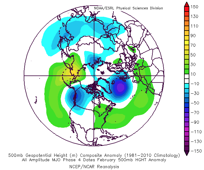
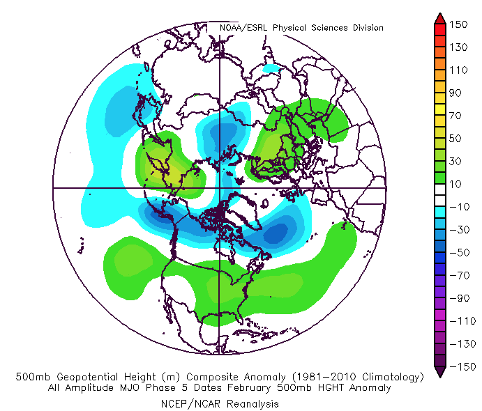
February is running close to 5° above average month to date. A large reason behind the warmth is thanks to the MJO rolling through the warm phases (remember, Phases 4 and 5 in February features large-scale eastern on CONUS wide upper ridging, as shown below).

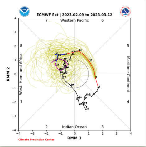
That said, as we rumble through the few weeks, model data suggests the MJO will race towards traditionally colder phases (and stormy, too) as we close February and head into the first month of meteorological spring.
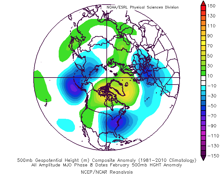
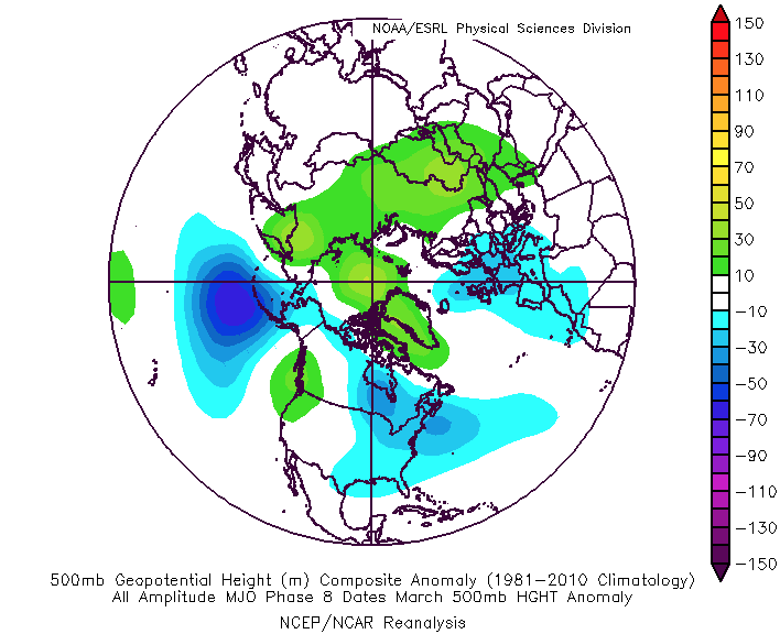
Draw your attention to the purple in Phase 8. A cycle through this phase at late February and March would bring a period (and more than just a day or two) or substantially colder than normal temperatures into the region.
That then begs the question, what comes of the NAO (North Atlantic Oscillation) and the PNA (Pacific North America pattern). Let’s take the latter first. I think it’ll be hard to completely shake the southeast ridge in this pattern. Despite the Nina fading, the influence on the greater regime still is quite pronounced and in some shape or form, I believe the negative PNA holds. That said, we do note the longer range guidance flipping the NAO negative as we get into March. Note the GEFS Extended below (should be noted that the European Weeklies also develop a negative NAO in March). Long time followers of IndyWx know as much as I don’t get excited about the NAO influence in Nov. or Dec., I jump all over this particular teleconnection late winter and spring. Why? In my research, it’s apparent the impacts and longer term effects of a negative NAO are much stronger across the eastern half of the country in Feb through early April.

Despite the resistance that will likely continue in some shape or form from the negative PNA, should we, indeed, see the MJO and NAO move into the expected phases shown above, this will set our region up for a 2-3 week period of colder than normal and stormy conditions just at the time most are wanting spring to come on with authority. Time will tell!
In the meantime, we look forward to having a fresh video discussion posted later this evening around the prospects of Thursday storms. Enjoy your Monday!
Permanent link to this article: https://indywx.com/2023/02/13/more-of-a-wintry-feel-set-to-return-as-we-get-ready-to-open-meteorological-spring/