Updated 02.09.23 @ 5:45a
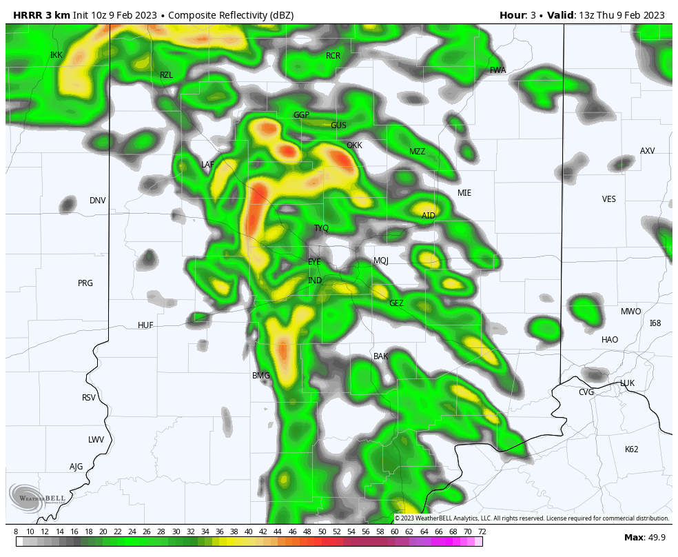
After a wet night, a line of storms will rumble through central Indiana over the next couple hours. These will likely precede some brief clearing as we move into the late morning hours.

While the storms will remain below severe levels, non thunderstorm wind gusts very well may approach, if not exceed, severe criteria late morning through the afternoon. Gusts approaching 60 MPH are a good bet in spots through the region. Unfortunately some power outages and tree damage is expected across the area through the evening.
After a mild start to the day, temperatures will fall around lunchtime through the 40s and into the 30s by the evening rush.

Much more later today in our updated video discussion, including a look at the longer range pattern to close February and into March, along with a first idea of the summer pattern!
