
Updated 07.03.22 @ 6:40a

Forecast Period: 07.03.22 through 07.13.22
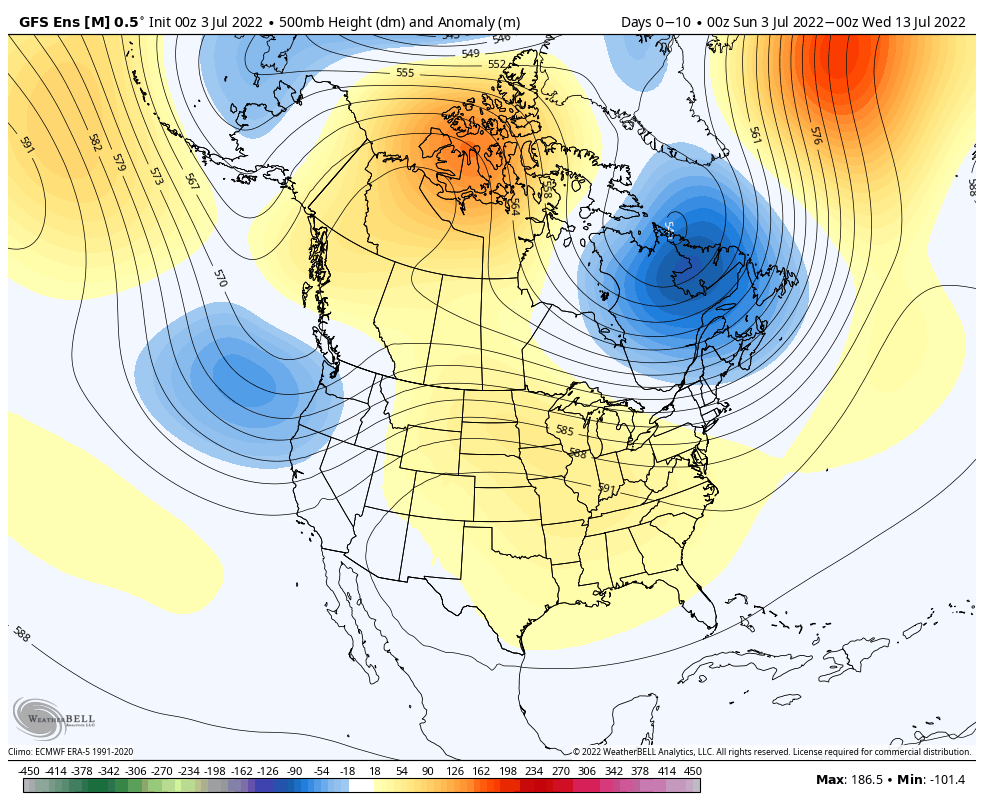
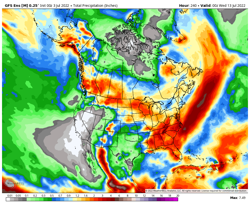
After a quiet holiday weekend, a much more active pattern will take hold as we navigate the 1st half of July. It won’t rain everyday, but chances of benefitting from soaking rain in more widespread fashion will be on the rise as we move into the middle and latter part of this week into the following week.
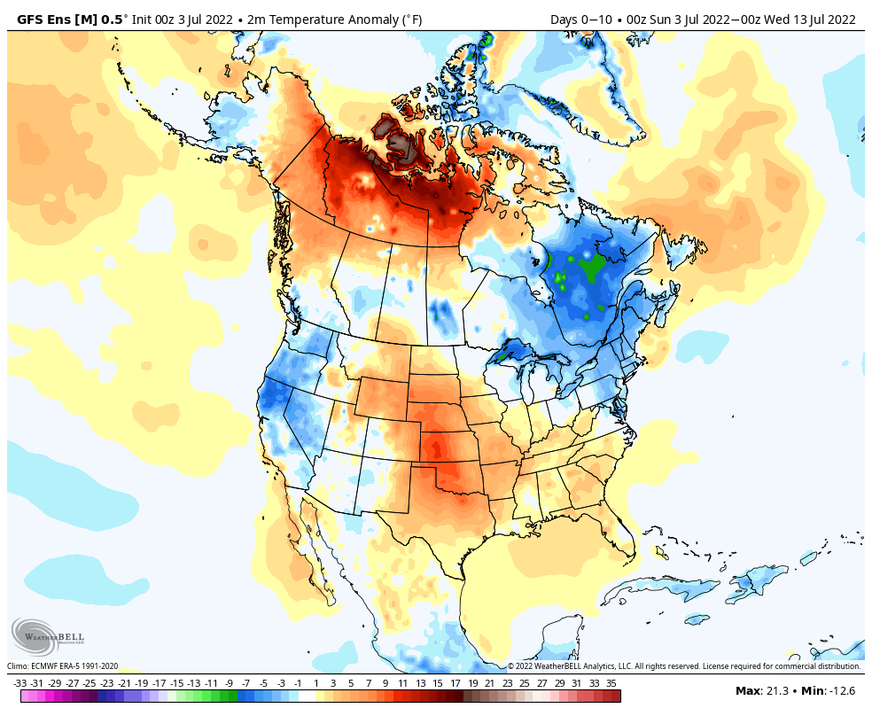
Serious heat will bake the Plains while a cooler pattern dominates the Northeast region. In between, here on the home front, we’ll note heat trying to expand northeast into the Ohio Valley (and there will be several 90°+ days thrown in the 10-day period), but each time it may look like the heat is here to stay for more than a few days, we’ll likely get cooling relief from cold fronts moving southeast around the periphery of the ridge.
We’ll have to pay close attention to some of the more “mature” storm complexes including a heightened threat of damaging straight line winds give the overall pattern. It’s impossible to pin down which complexes may include a better threat of severe weather from this distance, but this threat may include a closer look as we move into the middle and latter part of the week.
10-Day Rainfall Forecast: 1”-2”