
Updated 07.22.22 @ 7:15a
As we get set to flip the page to the last month of meteorological summer, there are some interesting developments brewing:
The MJO (Madden-Julian Oscillation) is showing signs of getting revved back up. This will likely have impacts not only closer to home (starting next week with a wetter, cooler shift) but also in the tropics (would imagine things are going to start getting much busier in the weeks ahead, including in the MDR, or “main development region” of the open Atlantic).
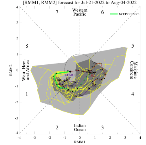
The question becomes, does the MJO continue in the renewed amplified state through the bulk of August or collapse back into the “null” phase?
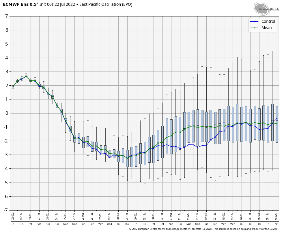
Secondly, the EPO (East Pacific Oscillation) is forecast to tank negative as we put a wrap on July and open August. This will go a long way in allowing a cooler regime (compared to where we are currently) and likely wetter time of things into our region as the ridge axis retrogrades west in the coming days.
The NEW JMA Weeklies are in and show the wetter, relatively cooler transition (not to say we won’t still see some hot days, but just that, overall, the pattern looks cooler in the coming few weeks) nicely into late August.
Week 1
Week 2

Weeks 3-4

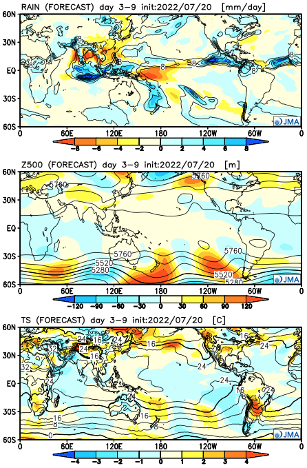
The fresh European Weeklies are also in and show a very similar regime compared to what the JMA highlighted above. Note the most significant heat is focused West while well above normal rainfall is shown from the Four Corners, south-central Plains, and East.


For what it’s worth, while we may get through the traditional dog days without the typical heat and dry conditions, I do envision a warmer than normal meteorological fall this year. But hey, the trade off may finally be a fast start to meteorological winter… Hang in there friends, we’re getting closer to the best time of year (at least in my humble opinion)…
More on all of that in the coming weeks! In the meantime, enjoy your Friday!