
Updated 07.05.22 @ 7:58a
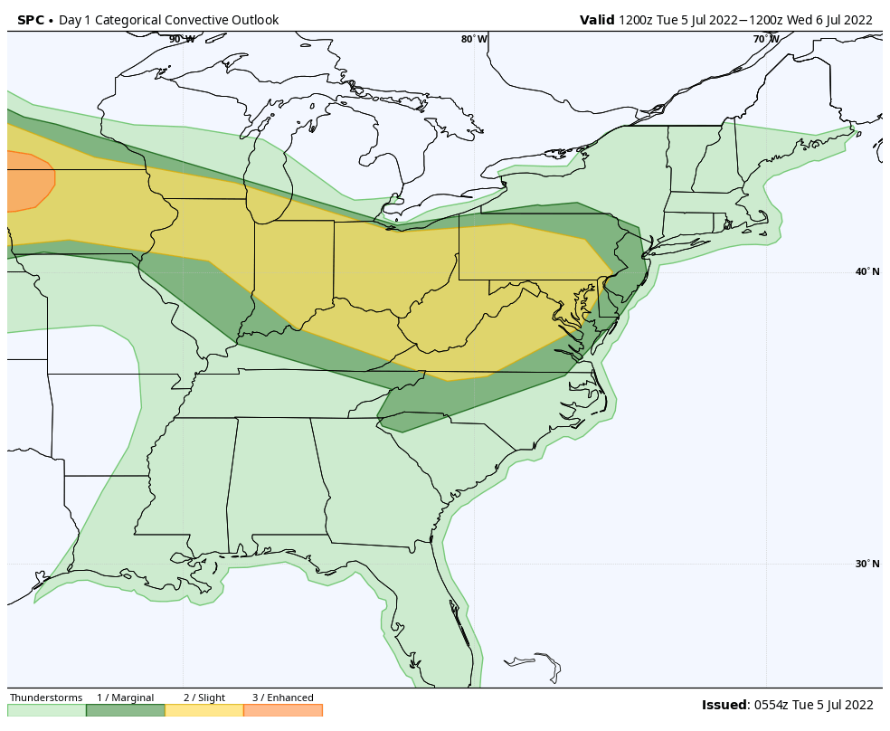
A very busy mid-summer pattern will take up residence through the remainder of the week. Multiple storm clusters will ride southeast into the region, some of which will feature severe wind gusts. The Storm Prediction Center includes a threat of severe weather for Indiana today through Thursday (this will likely get extended into the Friday/ Saturday time period before drier, more stable air can work in here).


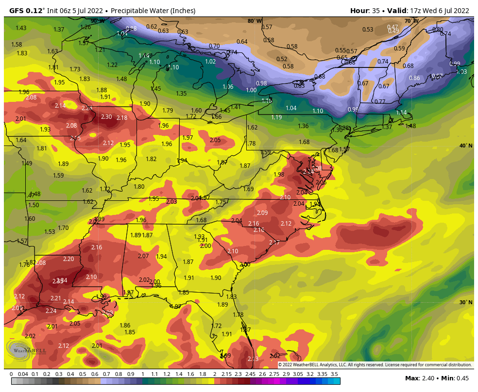
Localized flash flooding will also become a concern, especially towards mid and late week as these storm clusters track over the same areas. Juicy precipitable water values (2”+) will help feed these storm clusters, turning them into prolific rain makers at times. It should be noted that some central IN communities have missed out on recent rains, so rainfall rates of 2”+ / hour falling on rock hard soils will have no problem running off and leading to flash flooding at times.
Drier air will eventually build in here by the weekend and this will lead to a temporary pull back in rain/ storm coverage, and a much more pleasant airmass. Timing, yet again, is on our side.
Tomorrow is a travel day so please expect a later than normal client video post. Should have things online by mid evening, or so, Wednesday.