You must be logged in to view this content. Click Here to become a member of IndyWX.com for full access. Already a member of IndyWx.com All-Access? Log-in here.
October 2020 archive
Permanent link to this article: https://indywx.com/2020/10/23/video-timing-out-when-strong-storms-arrive-today-chilly-close-to-the-month/
Oct 22
VIDEO: Storms Ignite Ahead Of Sharply Colder Air Friday PM; Looking Into Early November…
You must be logged in to view this content. Click Here to become a member of IndyWX.com for full access. Already a member of IndyWx.com All-Access? Log-in here.
Permanent link to this article: https://indywx.com/2020/10/22/video-storms-ignite-ahead-of-sharply-colder-air-friday-pm-looking-into-early-november/
Oct 22
NEW JMA Weeklies Are In; November Preview…
This evening’s client video will have our complete long range update included within. This morning we wanted to review the latest JMA Weeklies and look ahead to at least a “hint” of what November could provide:
In short, the evolution from Week 1 to Weeks 3-4 shows the anomalous cold spreading east, but modifying from the mid-winter like conditions presently across the northern Plains by the time the chill reaches the eastern seaboard.
Week 1
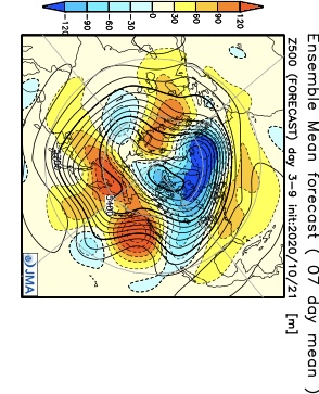

Notice how the pattern is expected to remain wetter than normal during the Week 1 period.
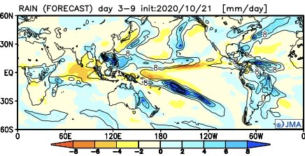
Week 2 features the chill spreading east and a drier pattern evolving. We agree with both.
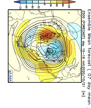
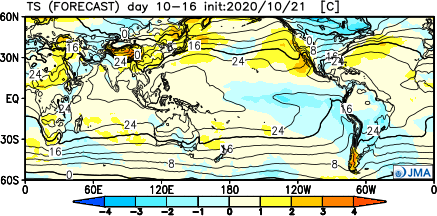
By the time we get to the Weeks 3-4 period, a northeastern ridge is shown to develop with the ‘mean’ trough position settling into the West. I would expect future updates to trend warmer across the East during this time frame and, conversely, colder across the West.

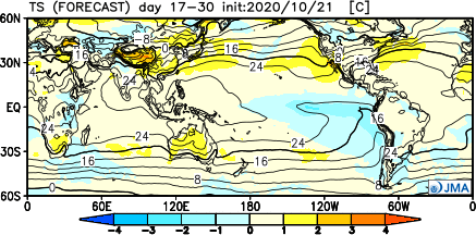
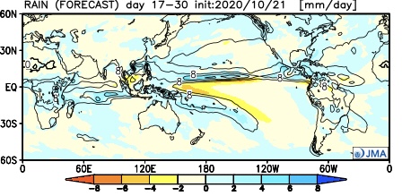
By this time, of course, we’ll be into November. While our complete November Outlook will be posted next week, I believe it’ll be an average to slightly above average month from a temperature perspective, locally (after the chilly start). Some of this has to do with the expected MJO movement and likelihood for the ‘mean’ trough to be favored across the West.
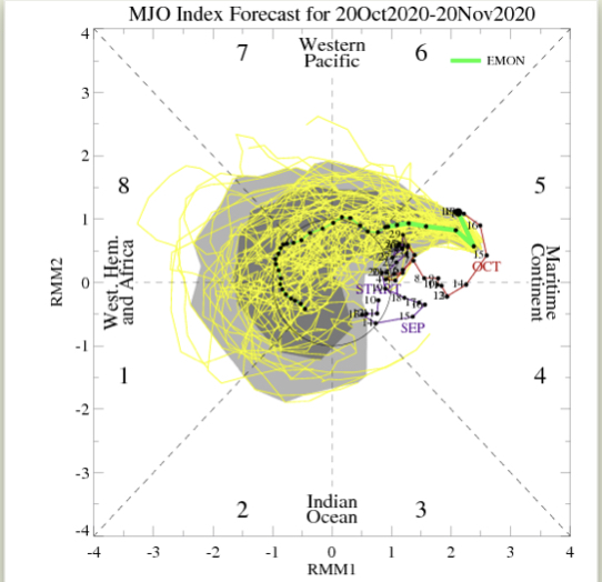

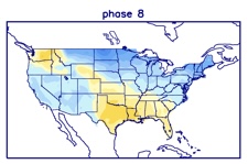

More later tonight! Have a great Thursday!
Permanent link to this article: https://indywx.com/2020/10/22/new-jma-weeklies-are-in-november-preview/
Oct 21
VIDEO: No Changes To The Idea Of A Very Active Close To The Month; Timing Out Storms To End October…
You must be logged in to view this content. Click Here to become a member of IndyWX.com for full access. Already a member of IndyWx.com All-Access? Log-in here.
Permanent link to this article: https://indywx.com/2020/10/21/video-no-changes-to-the-idea-of-a-very-active-close-to-the-month-timing-out-storms-to-end-october/
Oct 20
Evening Client Video: From “Drought To Flood” Tonight For Some, Unfortunately; Early Next Week Also Presents A Problem…
You must be logged in to view this content. Click Here to become a member of IndyWX.com for full access. Already a member of IndyWx.com All-Access? Log-in here.
Permanent link to this article: https://indywx.com/2020/10/20/evening-client-video-from-drought-to-flood-tonight-for-some-unfortunately-early-next-week-also-presents-a-problem/
Oct 20
VIDEO: T-storms Rumble In Tonight; Pattern Takes On A Potential Wintry Side For Some Next Week…
You must be logged in to view this content. Click Here to become a member of IndyWX.com for full access. Already a member of IndyWx.com All-Access? Log-in here.
Permanent link to this article: https://indywx.com/2020/10/20/video-t-storms-rumble-in-tonight-pattern-takes-on-a-potential-wintry-side-for-some-next-week/
Oct 19
VIDEO: Timing Out Additional Heavy Rain; A Busy Pattern Will Take Us Into November…
You must be logged in to view this content. Click Here to become a member of IndyWX.com for full access. Already a member of IndyWx.com All-Access? Log-in here.
Permanent link to this article: https://indywx.com/2020/10/19/video-timing-out-additional-heavy-rain-a-busy-pattern-will-take-us-into-november/
Oct 19
Active Close To October…
Our annual Winter Outlook will debut Sunday morning, November 1st.
A frontal boundary will remain draped over the Ohio Valley through midweek before lifting north as a warm front late week. As we gear up for the weekend, this same front will barrel southeast as a cold front. While it won’t rain the entire time, the end result will be quite an active week with periods of rain (at times heavy).

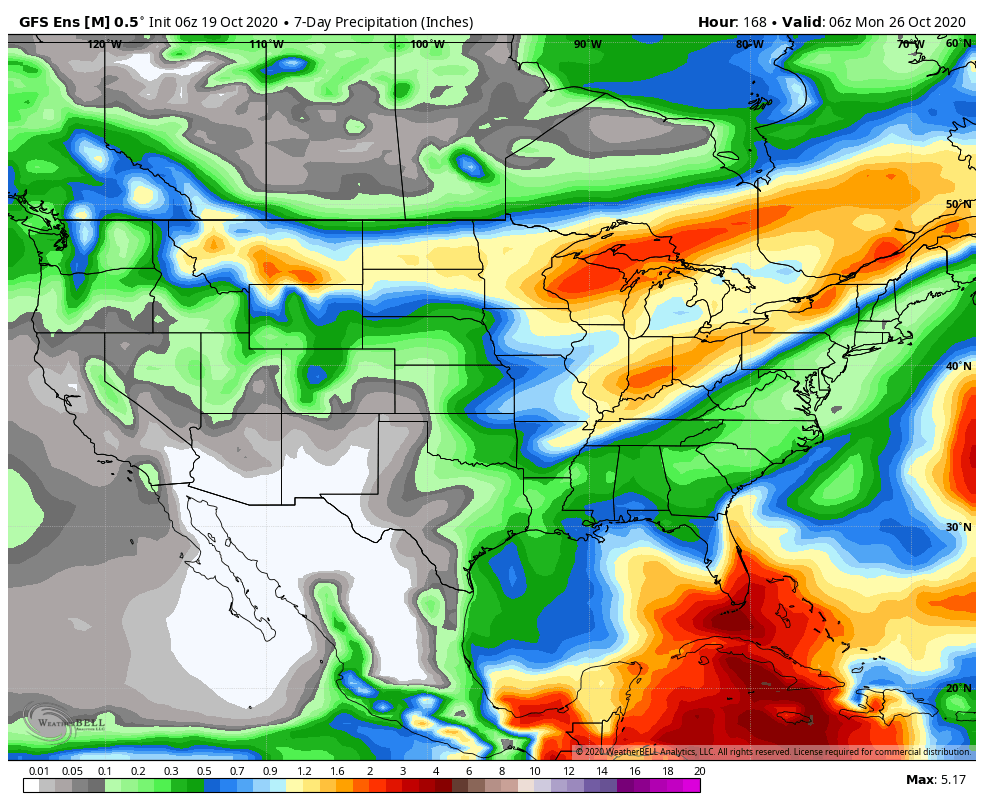
Looking ahead, it appears as if best chances for concentrated rain will come Tuesday night into Wednesday morning, Friday evening, and Sunday into next Monday. This is a hectic pattern and we’ll fine tune if needed. Widespread 1”-2” rain totals (locally heavier amounts) can be expected for the northern half of the state by early next week with 2”-3” totals (again, locally heavier) across the southern half of Indiana (generally along and south of I-70).
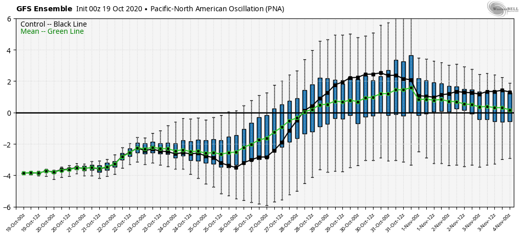
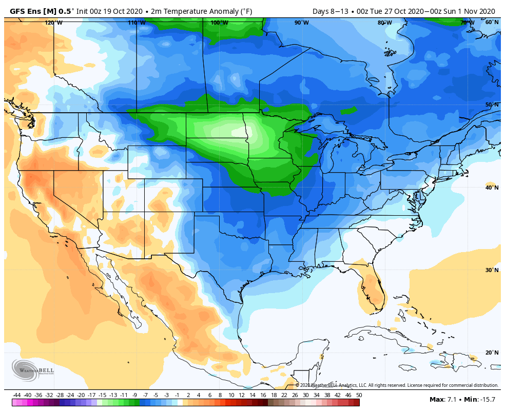
As the PNA pops positive, a colder than normal airmass, and coldest so far this autumn, will settle southeast prior to Halloween. This is the type of pattern that should generate a multi day hard freeze with temperatures falling deep into the 20s early morning.
Permanent link to this article: https://indywx.com/2020/10/19/active-close-to-october/
Oct 18
VIDEO: Heavy Rain Overspreads South-Central Indiana Tonight; Unsettled Week Ahead…
You must be logged in to view this content. Click Here to become a member of IndyWX.com for full access. Already a member of IndyWx.com All-Access? Log-in here.
Permanent link to this article: https://indywx.com/2020/10/18/video-heavy-rain-overspreads-south-central-indiana-tonight-unsettled-week-ahead/
Oct 17
VIDEO: Gearing Up For An Active Week…
You must be logged in to view this content. Click Here to become a member of IndyWX.com for full access. Already a member of IndyWx.com All-Access? Log-in here.
Permanent link to this article: https://indywx.com/2020/10/17/video-gearing-up-for-an-active-week/
