Considerable cloudiness will be around today, but we should hold off on any significant rainfall until Monday (only expecting sprinkles or areas of drizzle beforehand). It’ll be a chilly day with highs struggling to make it out of the 40s today.

As we move into Monday, the first of 2 waves of moisture will overspread the state. We think a more widespread shield of rain (still primarily on the light side) will arrive early-to-mid afternoon, continuing into Tuesday morning.
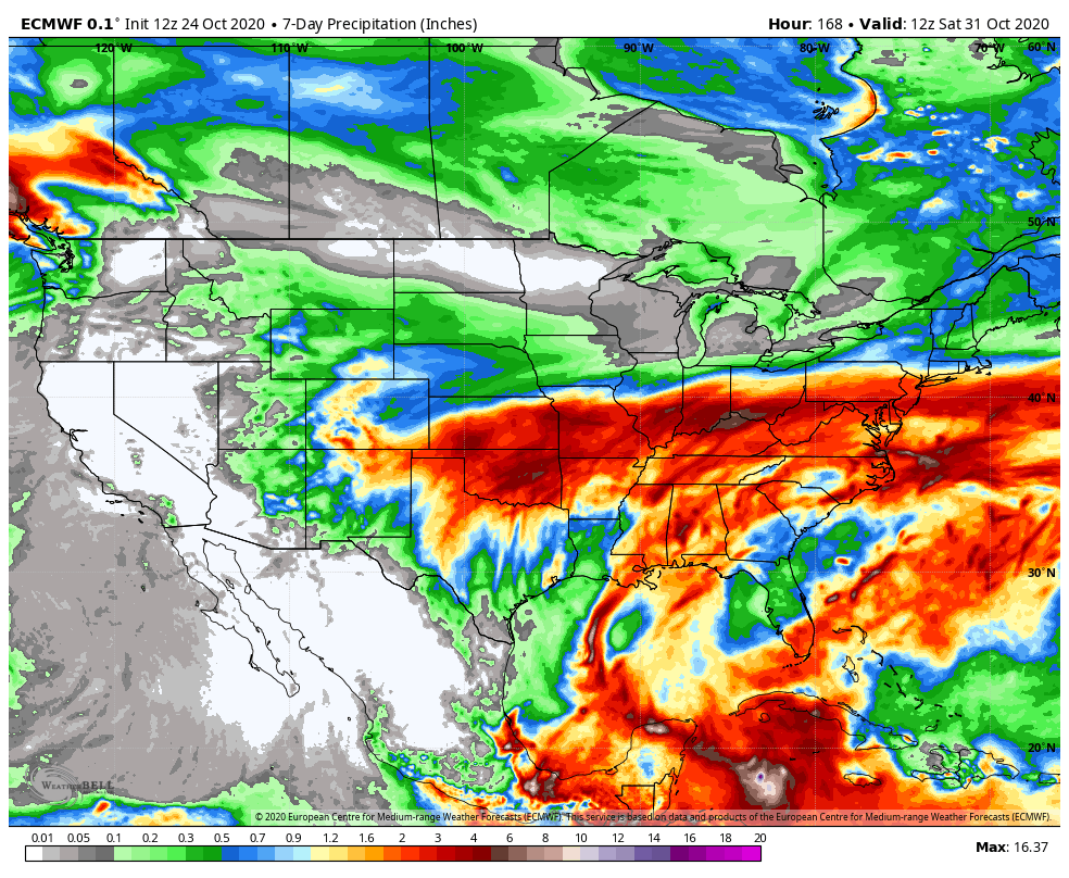
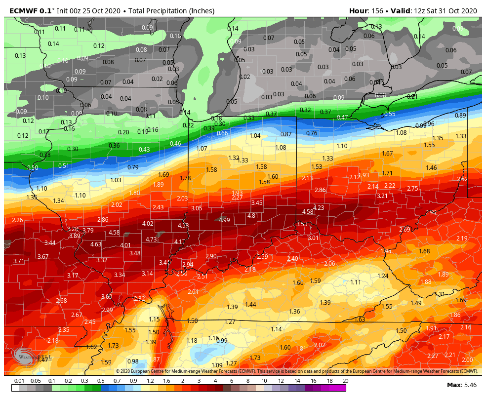
In general, rainfall amounts should check-in between 0.25″ and 0.40″ across central Indiana with this “1st wave” (most of which falls Monday PM).

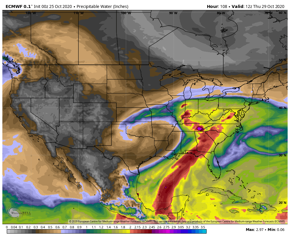
Things become more complex by midweek as a stronger surface low moves out of the Plains and across the Ohio Valley. Additionally, we’ll need to keep close eyes on Zeta’s remnants as it’s possible the aforementioned storm system could pull the remnant tropical moisture into the mix. Regardless of whether or not tropical moisture directly or indirectly gets involved, a period of heavy rain is likely Wednesday evening through the day Thursday.

Precipitable water values will approach 2″ for a period of time midweek, supporting the likelihood of heavy rainfall. (Also note the deep, tropical plume feeding into the Southeast region, courtesy of Zeta’s remnants).
Additional rainfall midweek should be in the 1.5″ to 2.5″ range for most of the region, but locally heavier amounts are possible, especially across southern portions of the state.
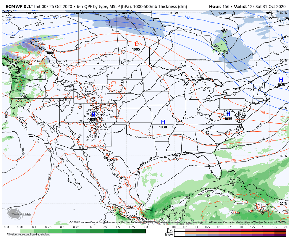
We’ll clear all of this mess out of here as we head into the weekend and we still believe we’re looking at ideal Halloween weather- dry, crisp, and sunny, thanks to a sprawling area of high pressure.