
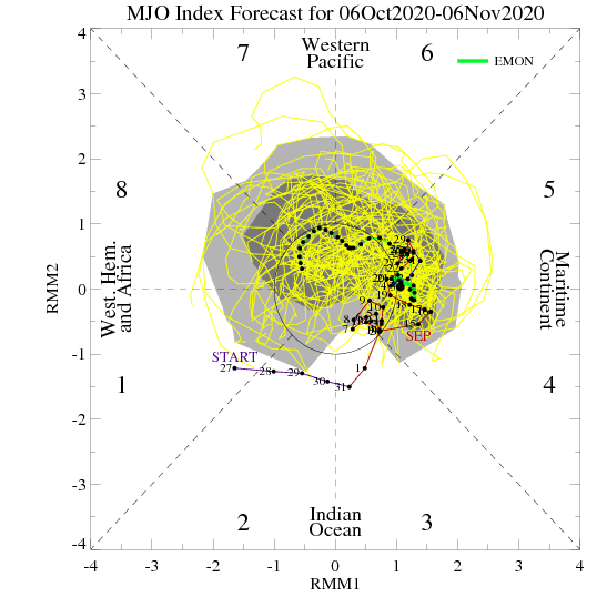
As the fall season “matures” the same MJO phase last month can lead to a much different weather pattern this month (November and so on). Note how the latest European monthly MJO model takes things through 5, 6, 7, and 8 by early November.
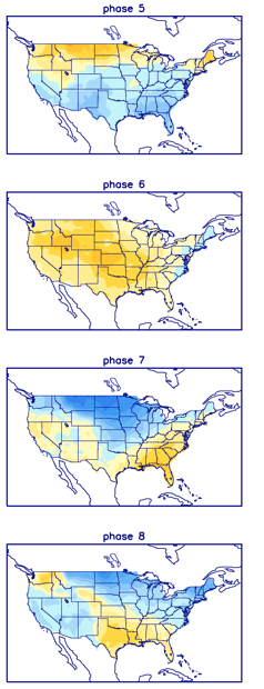
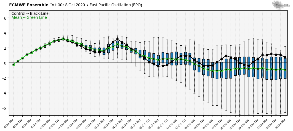
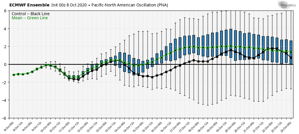
With greater amplitude, I’d say this would take the driver seat behind the pattern evolution into early November, but that’s not the case. Instead, we’ll want to continue to closely monitor the happenings with the EPO and PNA.
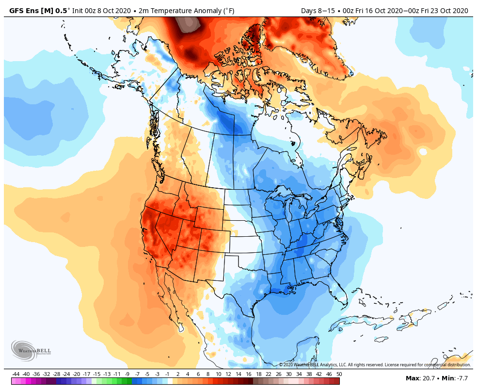
Both are pegged to move into favorable phases to bring the chill back into the East as we move through late October.
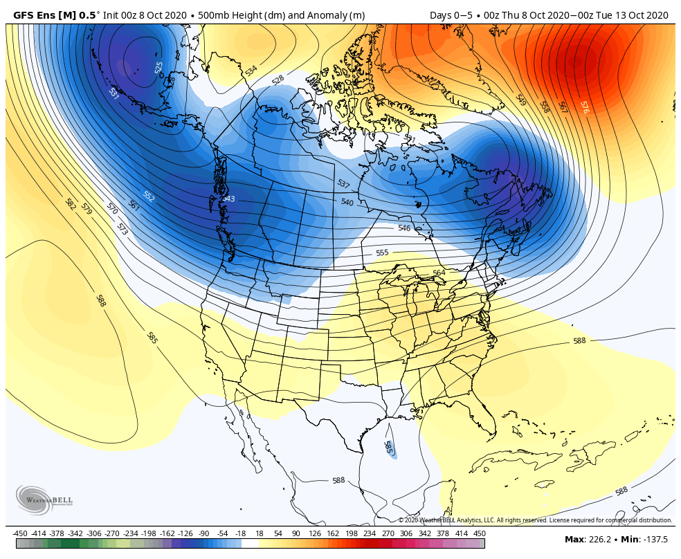
We think next week will feature a “step-down” process to a much chillier following week (Oct. 17th-23rd).

The new JMA Weeklies into the office this morning show a similar pattern evolution:
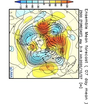

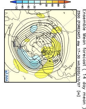
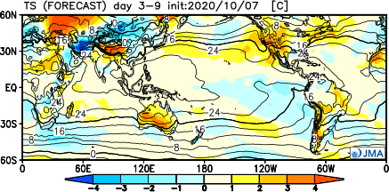

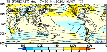
If anything, I’d expect this model to cool further over time in that Weeks 3-4 period. It’s also interesting to see the high latitude blocking shown to remain intact (that can really begin to have more of an impact downstream once to November).
Unfortunately, it’s a continued dry pattern. We’ll have more frequent frontal passages as we move through the back half of the month, but these will likely be moisture starved for the most part. It still doesn’t look like a wholesale wetter pattern will kick in until later in November.