
The latest JMA Weeklies are in and are beginning to “hint” at where I think the ‘mean’ winter pattern is going. While we’re not ready to lock in to that pattern yet, chances of more meaningful rainfall will be on the increase over the next few weeks across the Ohio Valley, including central Indiana. Before we look at the specific 500mb, rainfall, and temperature patterns, let’s take a look at the pattern drivers into the first few days of November:
The PNA (Pacific North America pattern) is forecast negative to begin the period before transitioning positive around the 25th.
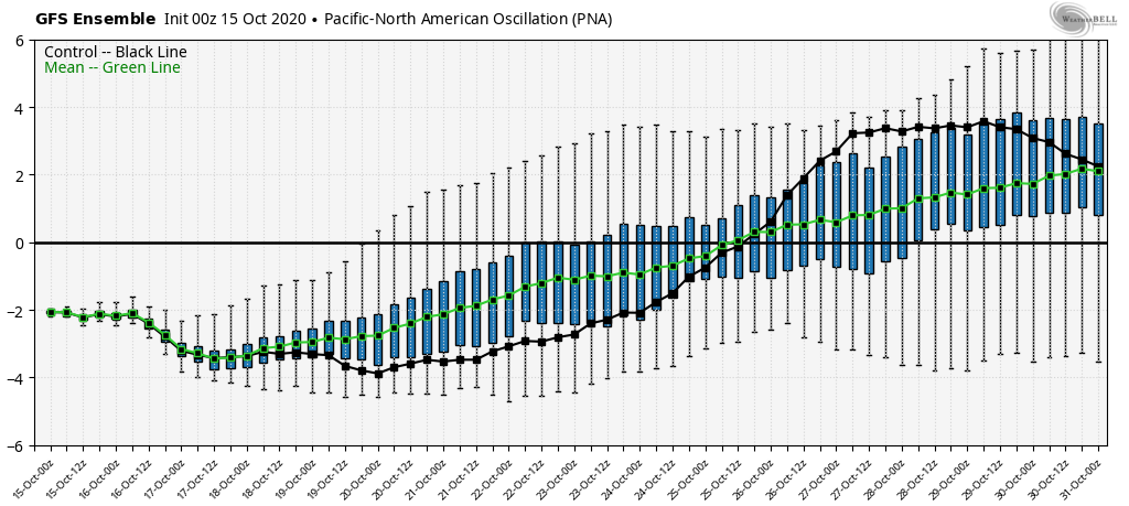
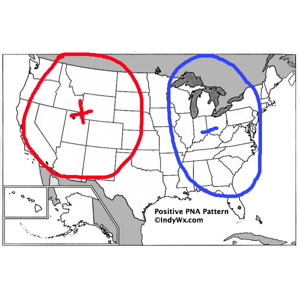
Simply put, the Pacific North American pattern measures the upper air pattern between the Aleutian Islands (in Alaska) to the West coast of the US mainland. When the PNA is negative, this typically drives a western trough and eastern ridge. Conversely, when the PNA is positive, we see the opposite occur (eastern trough and western ridge).

Simply looking at the PNA (keep in mind we also have to take into account other elements), with it being forecast strongly negative through the next week, it gives pause for the chill being able to lock in for any length of time.
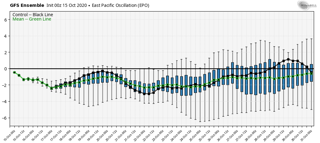
The EPO (East Pacific Oscillation) is forecast negative throughout the period. As mentioned yesterday, the EPO measures the upper air pattern between the east Pacific Ocean and Alaska. During negative phases, a trough is favored (and associated cooler than normal pattern) across the East. Positive phases drive the trough into the West and lead to a milder ridge across our portion of the country.
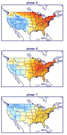
We also need to keep a close eye on the MJO (Madden-Julian Oscillation). We’ve posted many times on this in the past (you can search the archives if bored ;-)). Note the potential impacts of the MJO movement over the next couple of weeks below. Keep in mind, Phase(s) 5, 6, and 7 in late October are much different come winter.
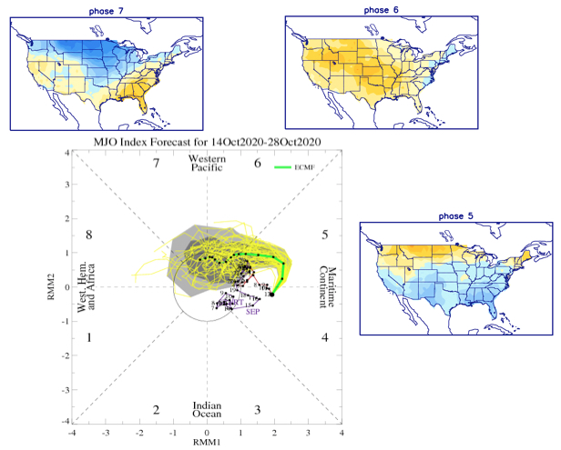
Not to get ahead of ourselves here, but the early thinking is that we’ll spend a lot of time in Phases 5, 6, and 7 this winter. Note how those phases blow torch come the December through February time period.
Given all of what we’ve described from a pattern driver perspective above, we believe the next 2-3 weeks will run cooler than normal as a whole, but that’s not to say there won’t be periods of transitional warmth thrown in the mix (remember, we have the negative PNA to deal with in the short-medium range period). We’ll need to keep a close eye on the potential of a bigger jab of unseasonably cold air to close the month and open the first couple of days of November.
Let’s take a look at the new JMA Weeklies:
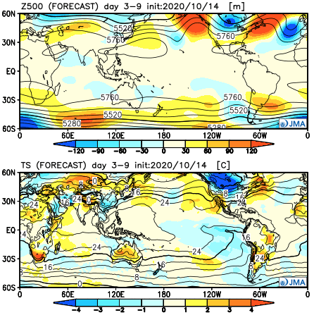
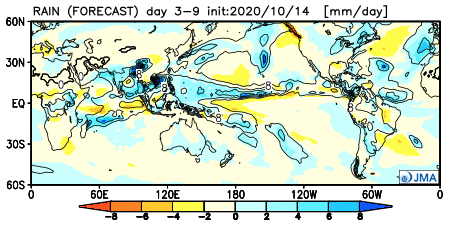
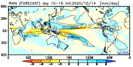
Week 1– top to bottom: upper air pattern, temperature anomalies, and rainfall
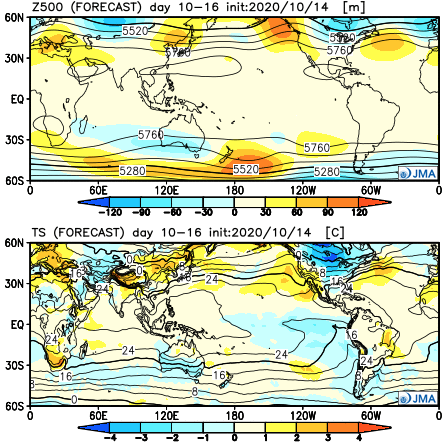
Week 2
Weeks 3-4
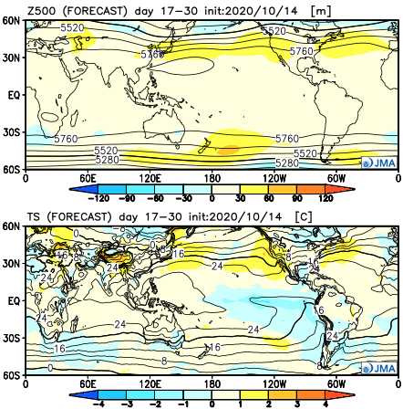

A couple of take-aways: Given the pattern drivers (teleconnections) above, I’d be surprised if the model doesn’t trend colder in the Weeks 2-3 time period moving forward. Secondly, notice how the wet anomalies are beginning to show up around the Ohio Valley. While not yet to where I think this pattern is going to go from a precipitation perspective, we’re beginning to transition to more active/ wetter times during this period.
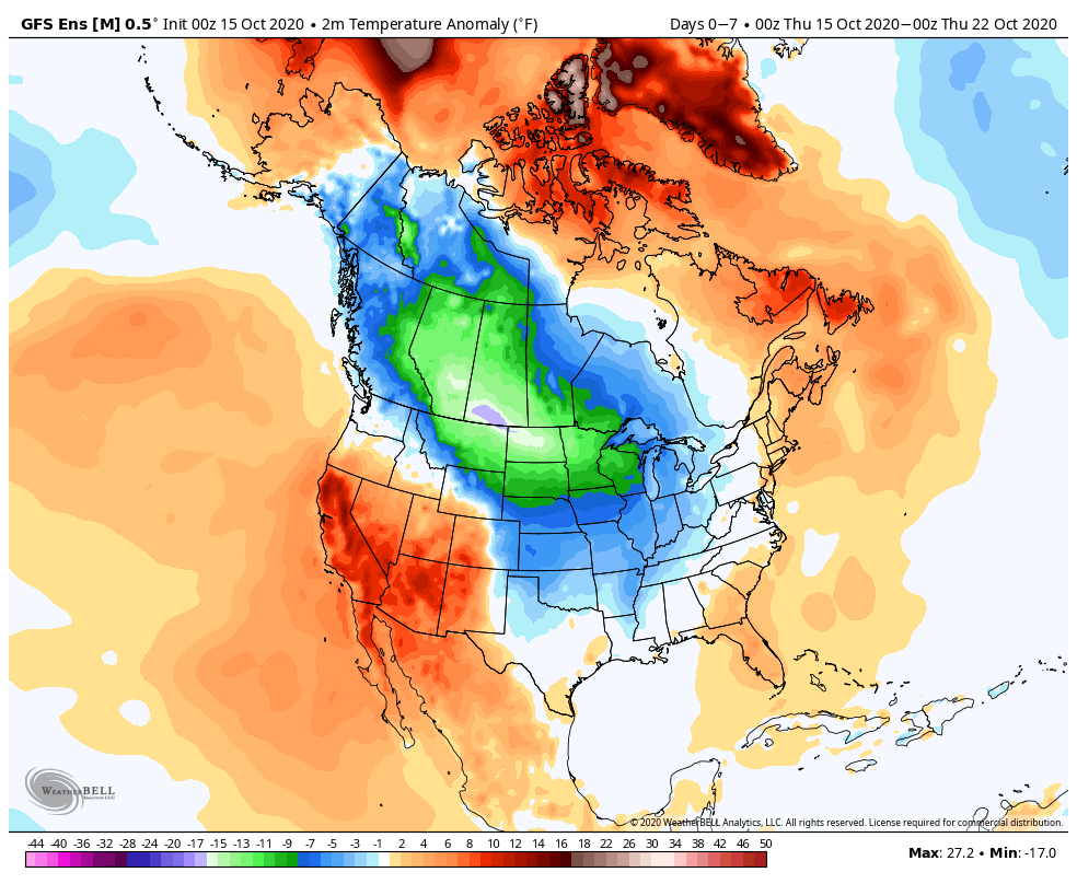
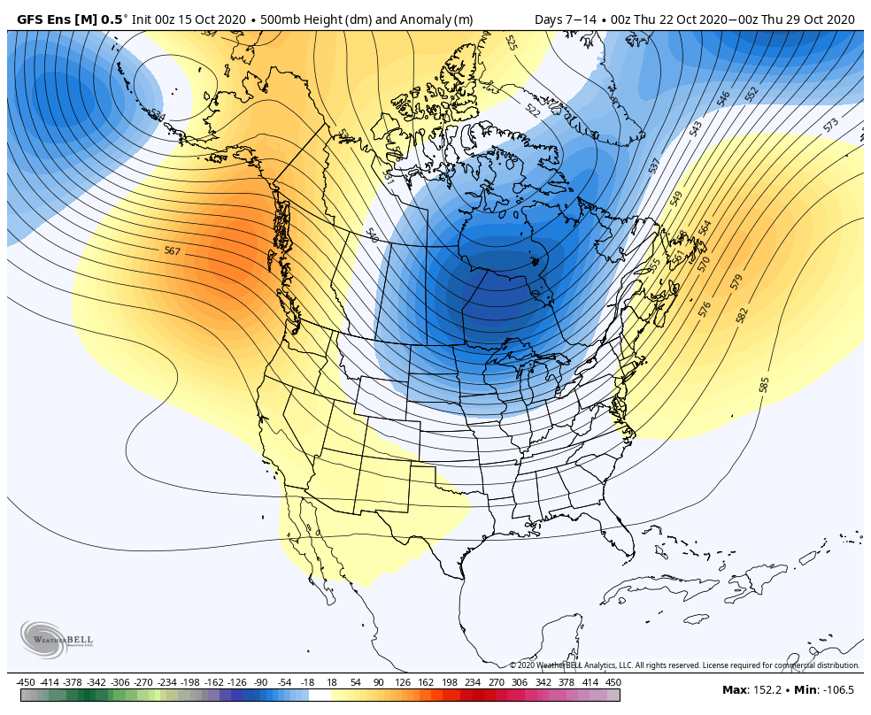
The latest GFS ensemble sees a similar pattern over the next couple of weeks.
Week 1

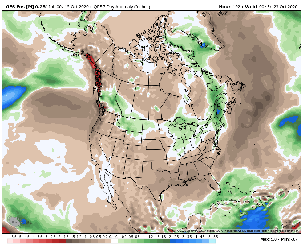
Week 2


Notable storm dates:
10/18 to 10/19
10/22 to 10/23
10/25 to 10/26
10/30 to 10/31