
You must be logged in to view this content. Click Here to become a member of IndyWX.com for full access. Already a member of IndyWx.com All-Access? Log-in here.
June 29, 2020 archive
Permanent link to this article: https://indywx.com/2020/06/29/monday-evening-video-tropical-airmass-locks-in-more-on-our-july-outlook/
Jun 29
July 2020 Outlook: The Heat Is On…
As we head into “halftime” of meteorological summer, there’s good reason to believe the hottest stretch of weather for a big chunk of the country awaits. So far this summer, Indianapolis has only hit the 90° mark a total of (3) times. If our idea is correct, that number will go much, much higher in the month ahead.
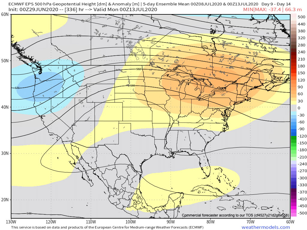
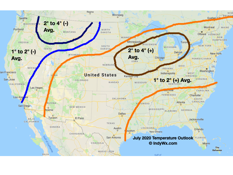
A highly amplified pattern will take up residence for the majority of the month which is certainly unusual for this time of year. Anomalous cold will set up shop out West while heat bakes the Plains into the Ohio Valley, Great Lakes, and Northeast. Given the ingredients in place, there’s reason to believe this kind of pattern will “repeat” itself throughout a good chunk of the month. At least locally, we think this will be a rather humid heat, with timely rains throughout the month. Some of this rain will likely come from “ridge riding” storm clusters that ride the periphery of the ridge that will retrograde west from time to time during the pattern transition.
Modeling, overall, is in good agreement with the upper pattern.


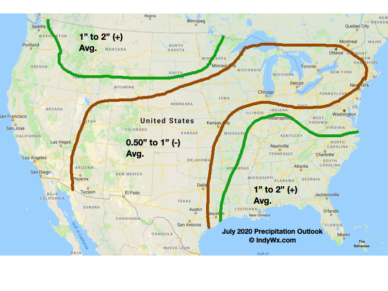
Our official July Outlook is below. Officially for central Indiana, we’re forecasting temperatures to run 1° to 2° above normal with near to slightly above normal rainfall (1″ give or take either direction). Greatest concerns for drier conditions will reside through the southern and central Plains into the Great Lakes region.
Permanent link to this article: https://indywx.com/2020/06/29/july-2020-outlook-the-heat-is-on/