
Weekly Highlights:
I. Cristobal’s remnant moisture
II. Strong cold front delivers unseasonably cool close to the week

Forecast Period: 06.06.20 through 06.13.20
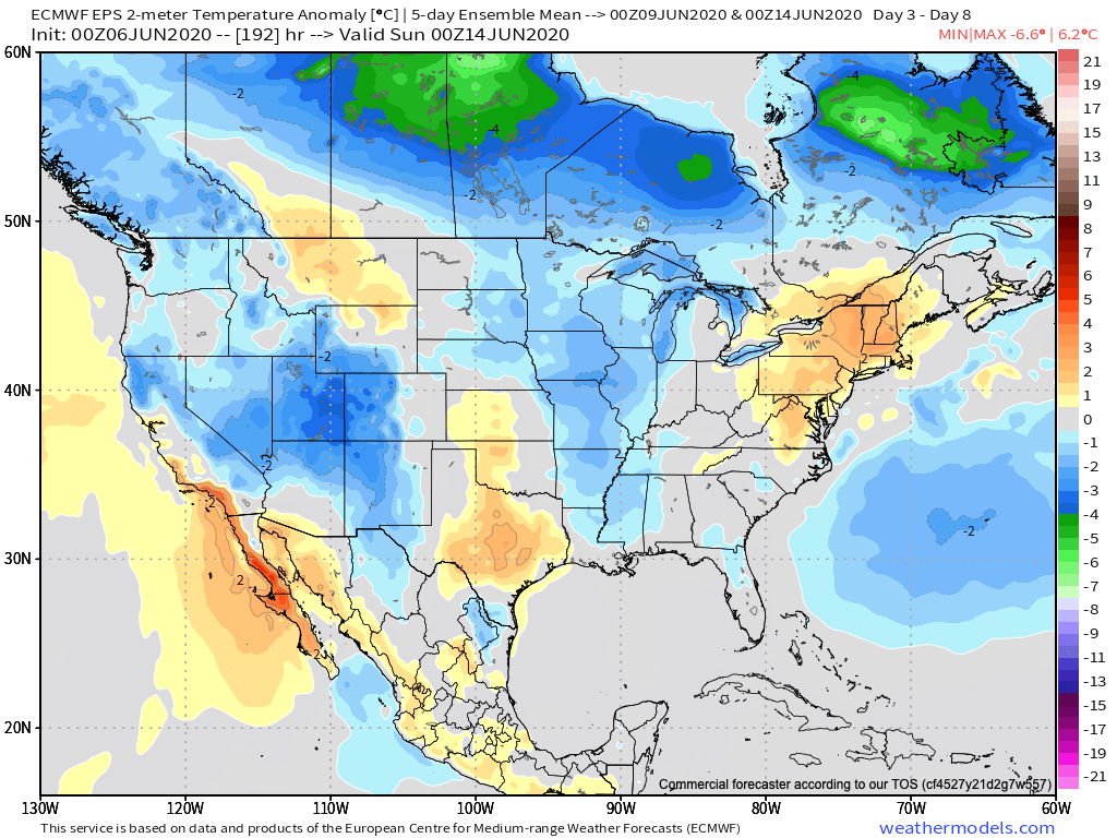
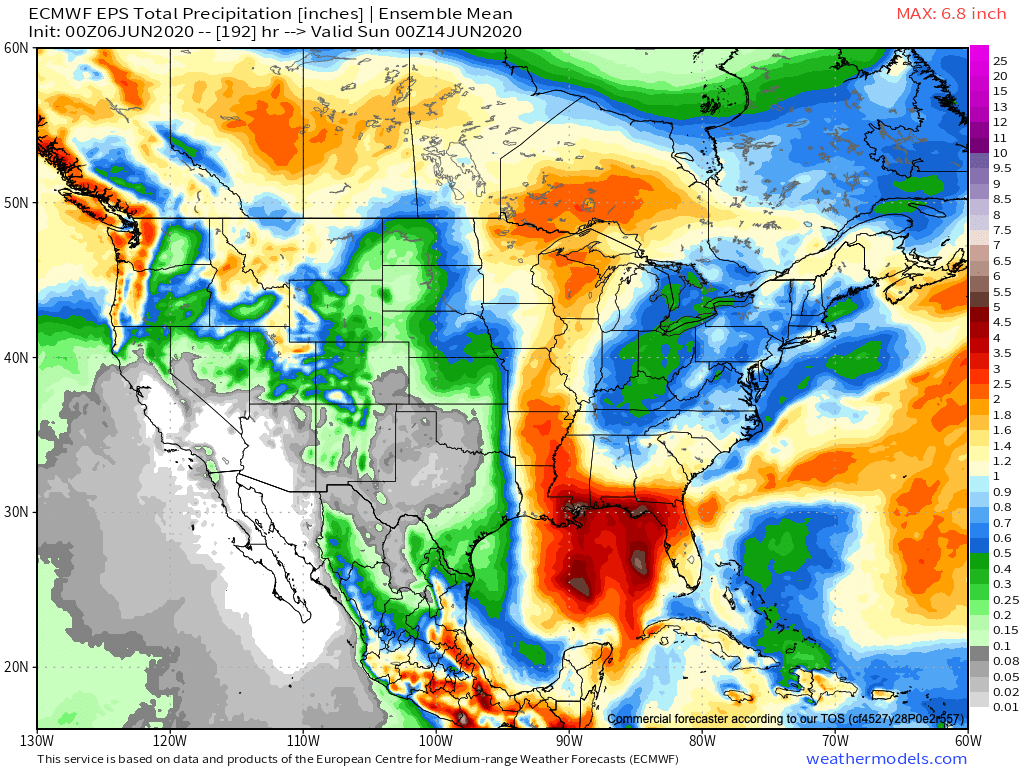
Though it’ll still be a warm weekend, less humid air will be welcomed with open arms. Dry conditions will prevail through the weekend and as we open up the new work week, including plentiful sunshine. All eyes through the weekend will be on the Gulf of Mexico and Tropical Storm Cristobal. Cristobal will slowly strengthen over the next 24-36 hours before making landfall as a strong tropical storm along the southeast LA coastline. While we still don’t think we’ll be directly impacted by Cristobal’s remnants (those will track through the MS Valley and into the Upper Midwest), the fetch off the Gulf Coast directly ahead of a midweek cold front will lead to better chances of rain late Tuesday into Wednesday. That aforementioned cold front will be the first of two fronts to sweep the region before week’s end. The second front that blows through Friday will usher in a fall-like airmass next weekend.