August 18, 2019 archive

New Thoughts Around The Upcoming Winter…

While we’re still a couple months away from debuting our official annual Winter Outlook, we’re deep in research mode for what the ’19-’20 winter season may produce across central Indiana.

The very warm northeast Pacific sea surface temperatures are of the upmost interest.

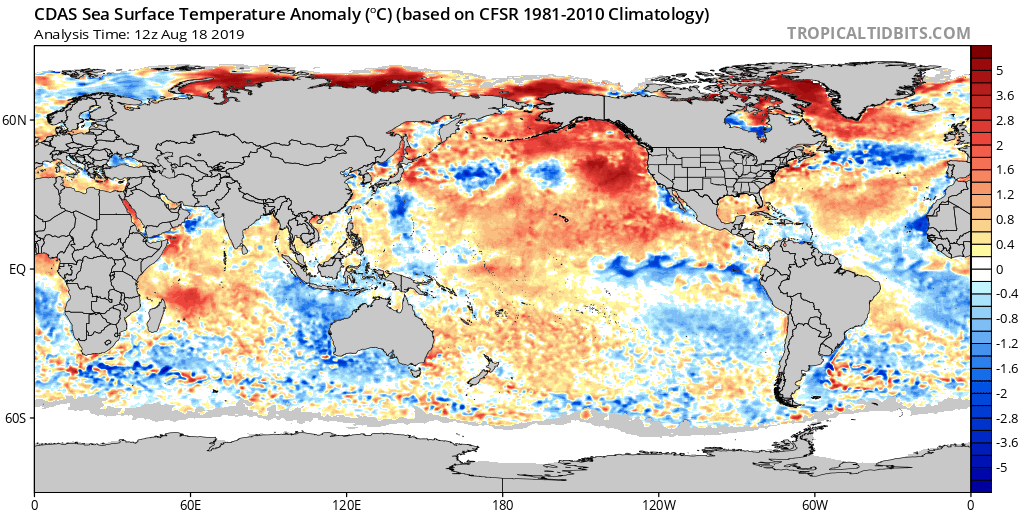
Note how the northeast PAC waters continue to warm:

These warm waters continue to “raise an eyebrow” and will have likely have a rather significant say in what ultimately takes place later this winter across a widespread portion of the country.

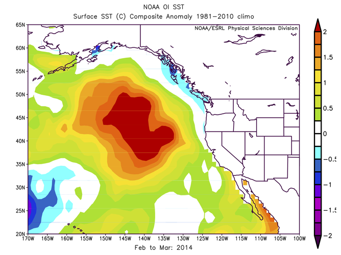
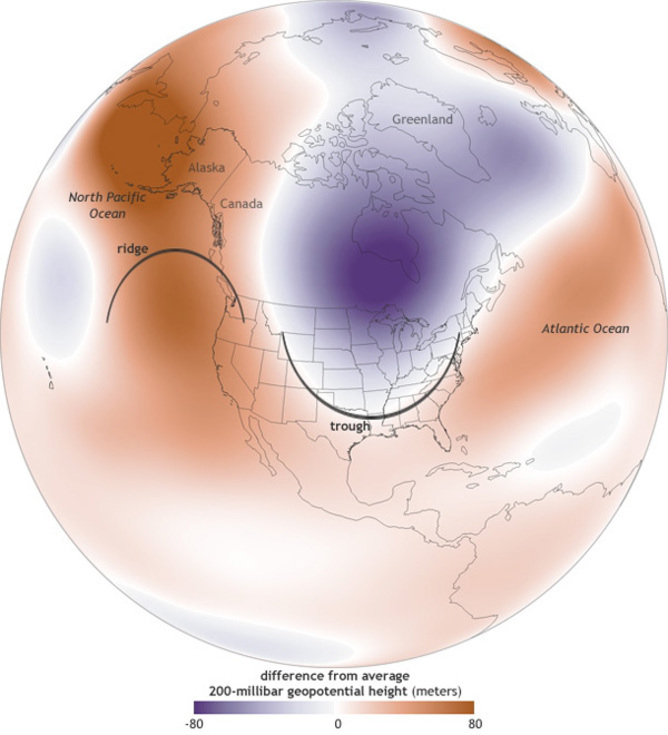
We don’t have to think too terribly far back to the infamous ’13-’14 winter and what the “warm blob” produced:

Image courtesy of iflscience.com

Some of the new climate models are going to a similar look at 500mb for the upcoming winter season:

In fact, one could easily make the argument with such anomalous ridgBing across western Canada, there should be more of a downstream effect (more of a significant trough across the eastern portion of the country).

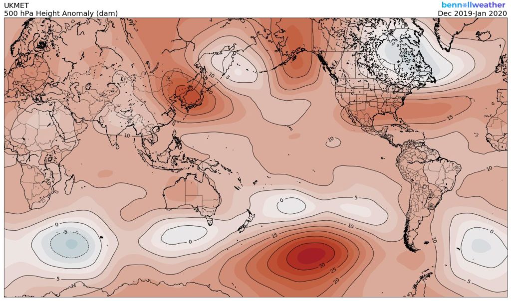
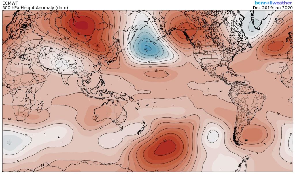
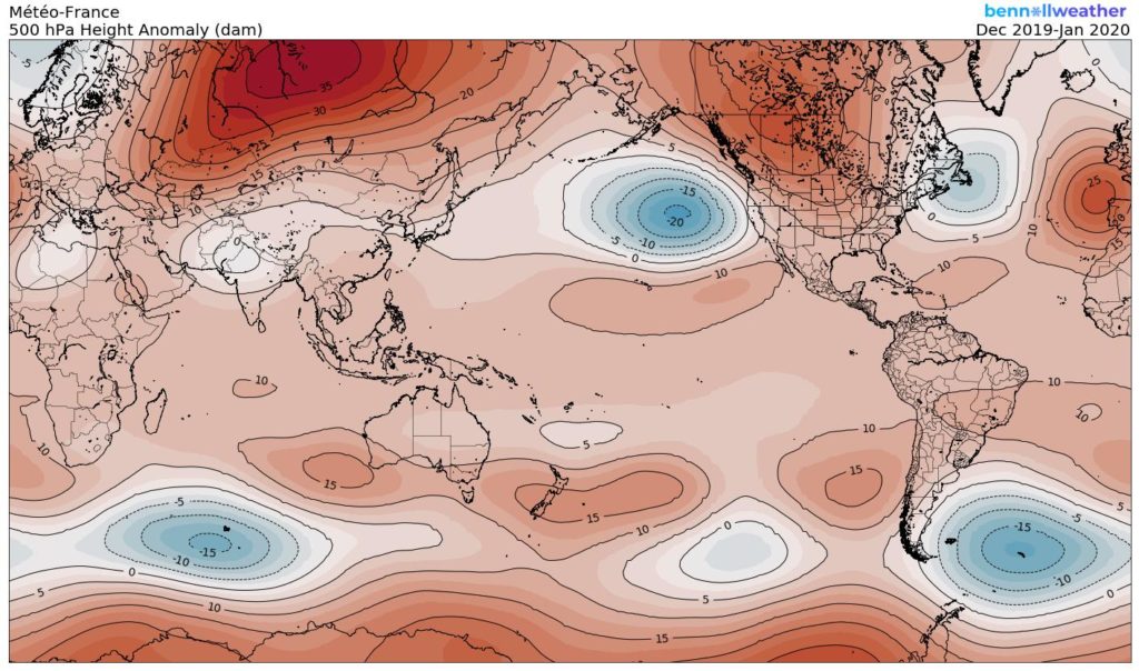
While there will be many more factors that we’ll have to build into the upcoming winter outlook, the warm NE PAC waters most certainly argue (and strongly at that) for a rather persistent western Canada/ NW Conus ridge and more of an eastern trough…

Permanent link to this article: https://indywx.com/2019/08/18/new-thoughts-around-the-upcoming-winter/

Weekly AG And Severe Weather Update…

Forecast period: 08.18.19 through 08.25.19

7-Day Precipitation: Rainfall is expected to run near average through the forecast period. We’re forecasting widespread 0.50″ to 1″ amounts to be common across central Indiana, but there will be locally heavier amounts where strong storms track.

7-Day Temperature Outlook: Temperatures are expected to run near average through the forecast period- balanced by a warmer than normal open to the period and cooler than average close.

Severe Weather Outlook: An active weather pattern will remain with us through the 1st half of the new week. In addition to the threat of severe weather today, we’re also closely monitoring the potential of strong to severe storms Tuesday night-Wednesday as a cold front slices into the hot and humid air mass in place. The pattern will turn much calmer once we get to the 2nd half of the week as cooler, drier air builds in.

Day 1: After a quiet start to our Sunday, a line of thunderstorms is expected to form to our northwest this afternoon. That line should move southeast and begin to impact central Indiana late afternoon into the early evening hours. Some of the stronger cells will promote the chance of large hail and damaging straight line winds.

Day 3: Scattered thunderstorms will remain in the forecast Monday, but widespread severe weather isn’t anticipated. As we look ahead, a cold front will slice into the hot and humid air mass in place across the Ohio Valley Tuesday night into Wednesday. As you might expect, the clash of air masses between significantly cooler and drier air behind the boundary will lead to scattered to numerous storms during the transition. Accordingly, we’ll need to remain on guard for the threat of additional severe weather (threats similar to that of today) during that time frame before much quieter, calmer weather takes over Wednesday night into next weekend.

Permanent link to this article: https://indywx.com/2019/08/18/weekly-ag-and-severe-weather-update-4/

IndyWx.com