High pressure will remain in control of our weather to open the new work week, keeping most of the area dry. We do note the latest high resolution guidance pops a few showers later this afternoon, but these should remain isolated at best (not even worth changing that “partly cloudy” icon on the 7-day ;-)).
That will begin to change tomorrow as the first of a series of frontal systems begins to impact our weather. We anticipate showers and thunderstorms to become scattered-to-numerous Tuesday afternoon and evening.
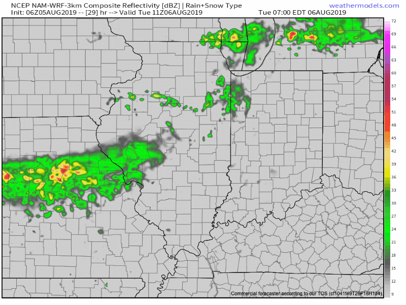
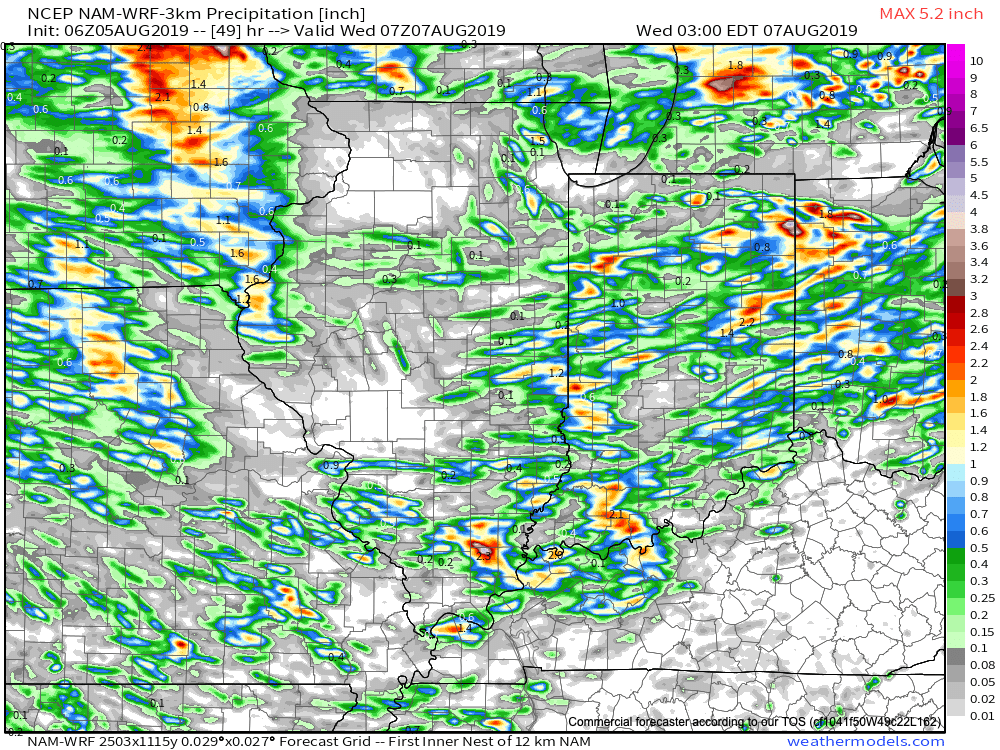
Rainfall amounts won’t be “uniform,” but there will be some locally heavy downpours scattered about the region.
A second front will blow through the state Thursday afternoon with additional chances of scattered showers and thunderstorms.

While it certainly won’t rain the entire time over the upcoming few days, areas that need moisture will be in luck with a good shot of picking up between 0.40″ to 0.80″ on a widespread basis. There will be locally heavier amounts in excess of 1″.
Once Thursday’s front pushes south, high pressure will arrive in time for the weekend and will supply another beautiful stretch of weather by mid-August standards.

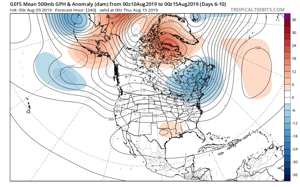
Looking further ahead, the more active pattern will continue into next week with the potential of a fairly strong system impacting the Midwest, Ohio Valley, and Great Lakes early to mid next week. This would be the system referred to last week as the one that could really serve as a reminder Fall is just around the corner (rain and storms followed by a gusty northwest wind and September-like air). We’ll continue to keep an eye on things!