
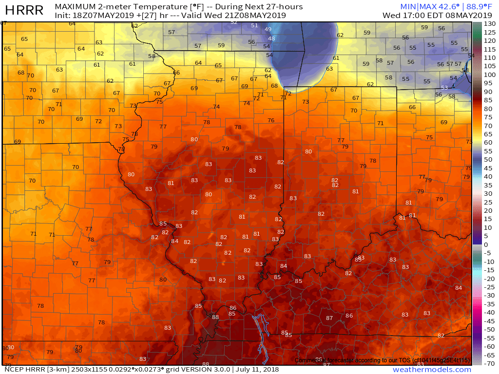
I. A couple widely scattered light showers have flared up this afternoon, but most central Indiana neighborhoods have enjoyed dry conditions with sunshine and temperatures in the mid-upper 70s. Look for more of the same Wednesday, including filtered sunshine through a good chunk of the day. Warm Air Advection (WAA) will help boost temperatures into the lower 80s for most of the immediate area.
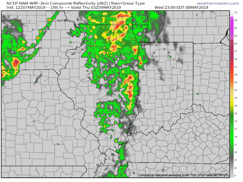
II. Better aerial coverage of showers and thunderstorms will develop late Wednesday night into Thursday night. We believe 3 rounds of showers and storms are possible during this time frame (at least impacting portions of the central Indiana viewing area):
- Late Wednesday night into the predawn Thursday
- Thursday afternoon
- Thursday evening as the cold front sweeps through the state
III. High pressure will build into the region as we close the week. This will lead to improving weather conditions, including increasing sunshine. A very nice close to the work week/ open to the weekend is dialed up! Make those patio plans now!

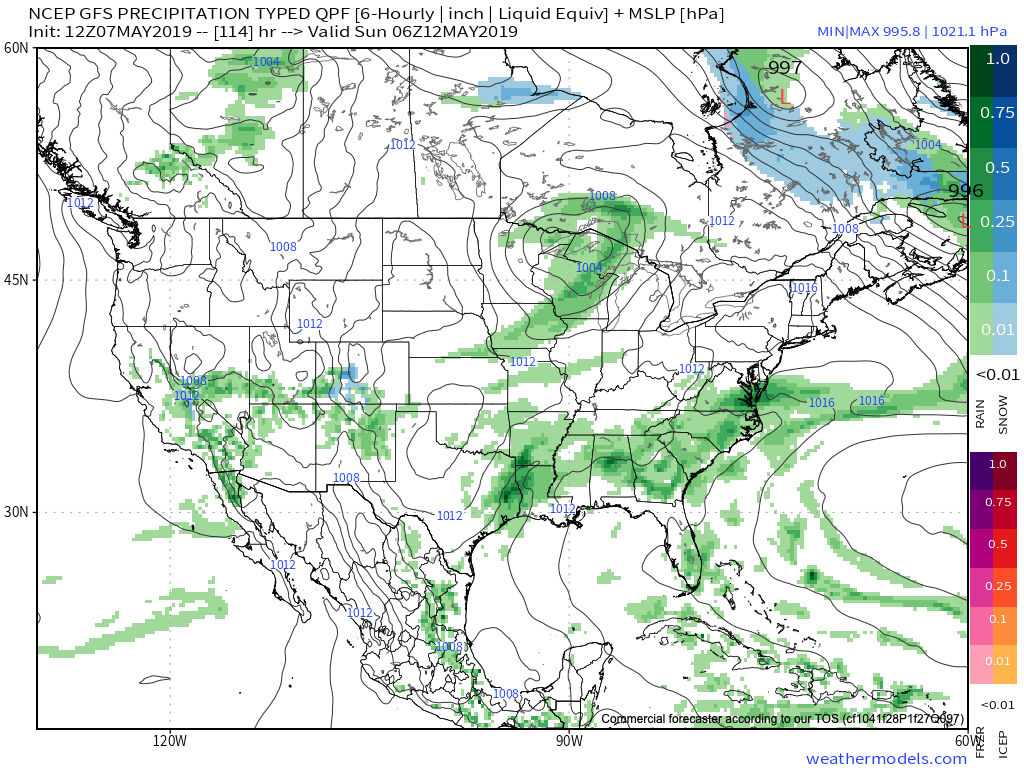
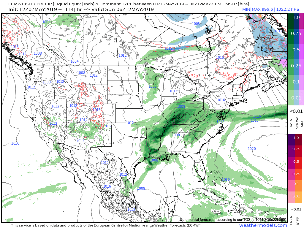
IV. Modeling differs on the handling of our weekend weather feature(s). The GFS (image 1) maintains the idea of a dry Saturday, followed by showers Sunday as a cold front sweeps through the region. Moisture would be limited with such a solution. The European (image 2), however, is more bullish on a more widespread rain event arriving Saturday PM into Sunday AM. Stay tuned as we work to reach some sort of agreement between the data.
V. After a cooler than normal period of weather through the middle of the month, we’re thinking the coolest anomalies will pull back into the intermountain west and 4-Corners region. Do we foresee any major late-May heat? No, but we should moderate against the norms during the last week to 10 days of the month.
After a drier stretch of weather through the mid-May period, precipitation should return to at least average levels through the late month stretch. Early indications would then suggest wetter than normal times return as we get set to open June…