
Forecast Period: 05.05.19 through 05.12.19
7-Day Precipitation: Rainfall is expected to run above average through the period.

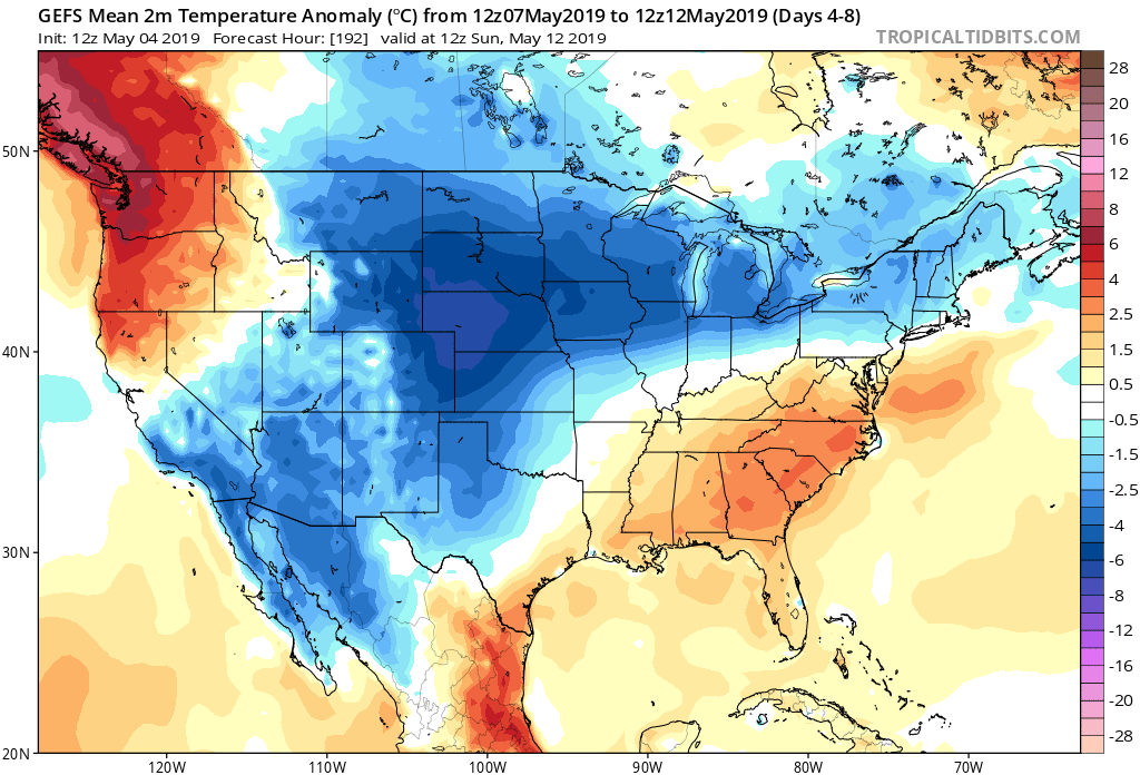
7-Day Temperatures: Above average temperatures are expected through the early portion of the period before things trend cooler than average by late week into next weekend.
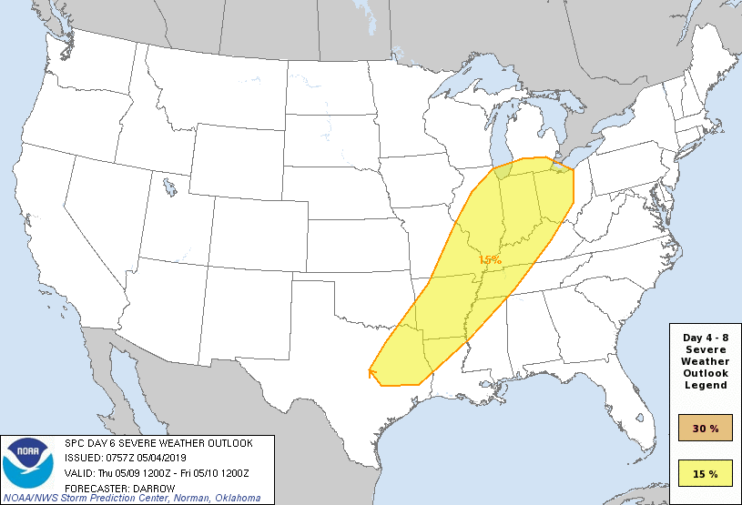
Severe Weather: While a major, widespread severe weather outbreak isn’t expected, we’ll have to keep close eyes on Wednesday evening into Thursday as a surface low tracks into the Great Lakes and drags an associated cold front into a warm and rather muggy air mass in place. Though still several days out, the potential is present for a few strong to severe storms, including large hail and damaging wind threats.
Summary: Another active week is ahead, including a couple rounds of more widespread shower and thunderstorm activity. Most concentrated storm activity should come Wednesday evening into Thursday and feature the potential of locally heavy rainfall. Widespread rainfall this week should total 1″ to 1.5″ with locally heavier totals. The bulk of this rain will fall Wednesday into Thursday. Looking further ahead, the good news here is that high pressure looks to build in as we get set to wrap up the work week and head into next weekend, helping to supply a period of dry weather Friday and throughout the weekend. (Fingers are crossed).