Brief: Accumulating snow
Forecaster: McMillan

What: Accumulating snow
When: Sunday morning into the evening
Temperatures: Upper 20s to lower 30s
Wind: E 10-20 MPH
Blowing/ Drifting: Minimal
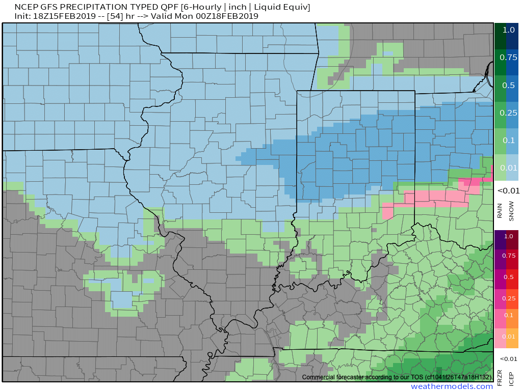
We’re heading into the 2nd consecutive weekend with a snowy close across at least portions of central Indiana- especially along and north of I-70. Upper level energy will get snow going during the predawn hours Sunday before potentially a more significant period of snow takes hold late morning into the afternoon. This is thanks to a surface wave moving northeast along the OH River eventually into western PA. We believe just north of the surface low a stripe of snow (potentially to the tune of 3″ to 5″) will develop from east-central IN into OH and on into central PA. We’ll have to fine tune this as we progress into the weekend. Please stay tuned.
Confidence: Medium