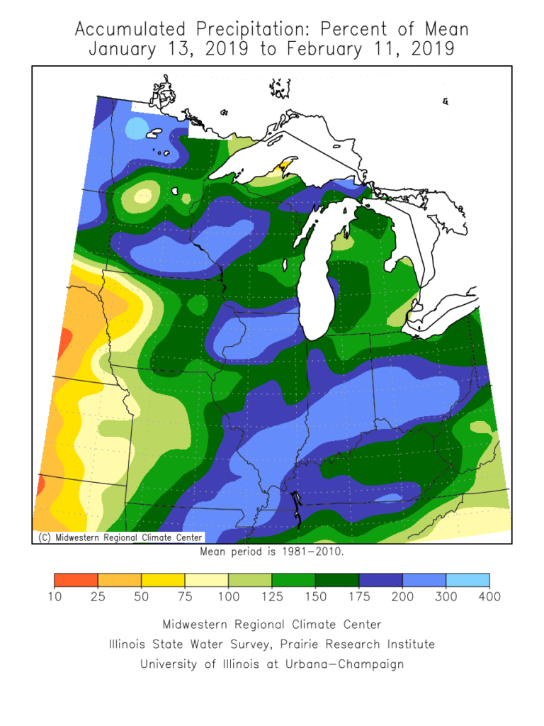
Over the past month, a widespread portion of the Ohio Valley, including central Indiana, is running close to 200% of average in the precipitation department. There’s no wonder flooding issues have resulted in spots- especially across the lower OHV region.
As we look ahead, the active storm track will persist, but there will be one key missing ingredient from the better part of the past couple of weeks and that’s more in the way of sustained cold. After reviewing some of the latest data, there’s no reason to change our ongoing idea of the transitional period (in the midst of that now) giving way towards one that will feature more in the way of “lock and load” cold in that 2.18 through 3.10 time period. We expect this period will run well below average in the temperature department and above average in the snowfall category. Snow removal clients, we recommend gearing up for a busy time of things over the upcoming few weeks.
The basis of this idea initially focused squarely on the MJO and the fact that modeling was keying in on things swinging into the favorable cold phases of 8, 1, and 2.
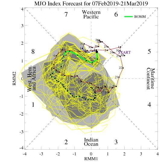
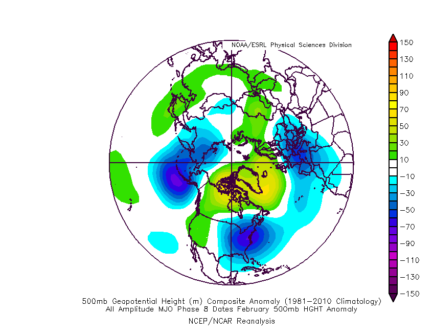
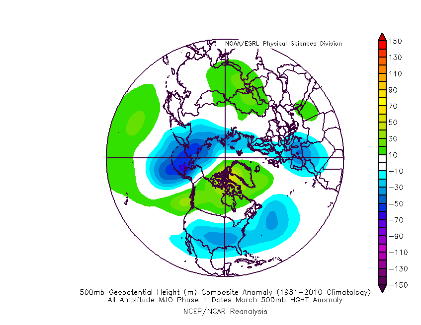
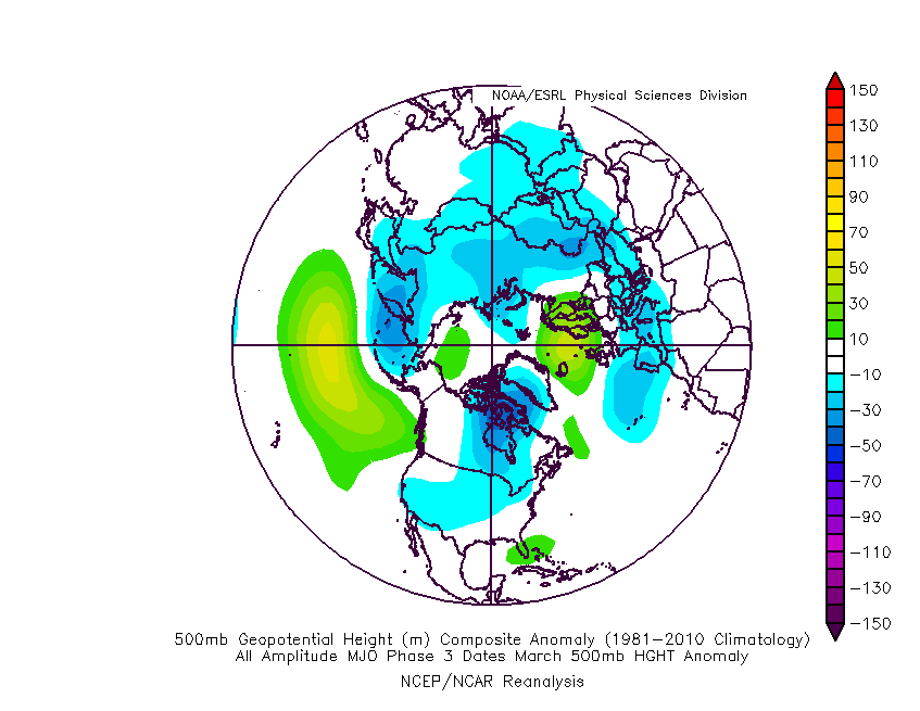
Taken at face value, this would be the corresponding upper air look in those respective phases:
Phase 8 (coldest)
Phase 1
Phase 2
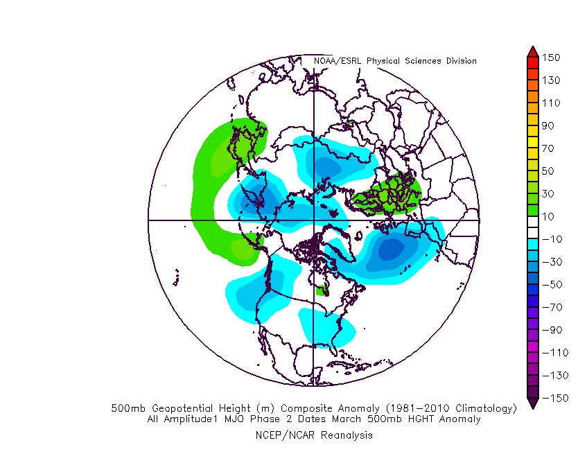
Phase 3 (cold begins to “back into the west and there’s at least a hint of the SE ridge returning)
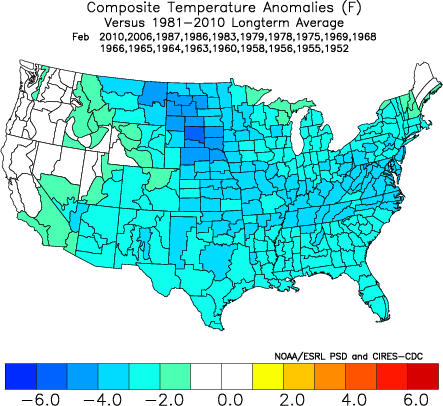
As most longtime followers know, we put more stock into the NAO state during the latter winter and spring months, as this teleconnection can “trump” others during this time frame. We notice the NAO is forecast to trend negative as we progress through the back half of February.

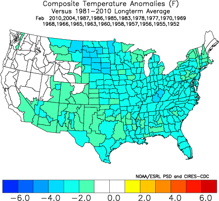
A negative NAO will result in widespread cold this time of year:
After remaining strongly positive for the past couple of weeks, the AO is forecast to plunge negative as we progress through the remainder of February. Again, this increases confidence on a return of more sustained and significant cold potential.

It should also be pointed out that the active pattern should continue, especially considering the southeast ridge should put up some resistance over the upcoming couple of weeks. The latest ensemble products would agree in the mean upper air pattern:

With colder air overwhelming the pattern, more of these storms will be capable of producing impactful wintry precipitation over the upcoming few weeks. After storms grab the headline, attention will shift to the possibility of another significant arctic blast before the end of the month.
In the more immediate term, we continue to keep close tabs on the following dates for the potential of snow and/ or ice:
I. Friday night, 2/15 and Saturday, 2/16- southern half of Indiana
II. Sunday, 2/17
III. Tuesday night, 2/19 and Wednesday, 2/20
