We don’t see any reason to alter our thinking of how the upcoming (4) weeks plays out:
This week features a transitional pattern back to a predominantly colder and snowier than average period from 2/18 through 3/10.
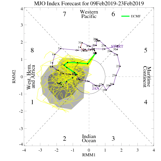
The MJO continues to have Phase 8 on its mind.


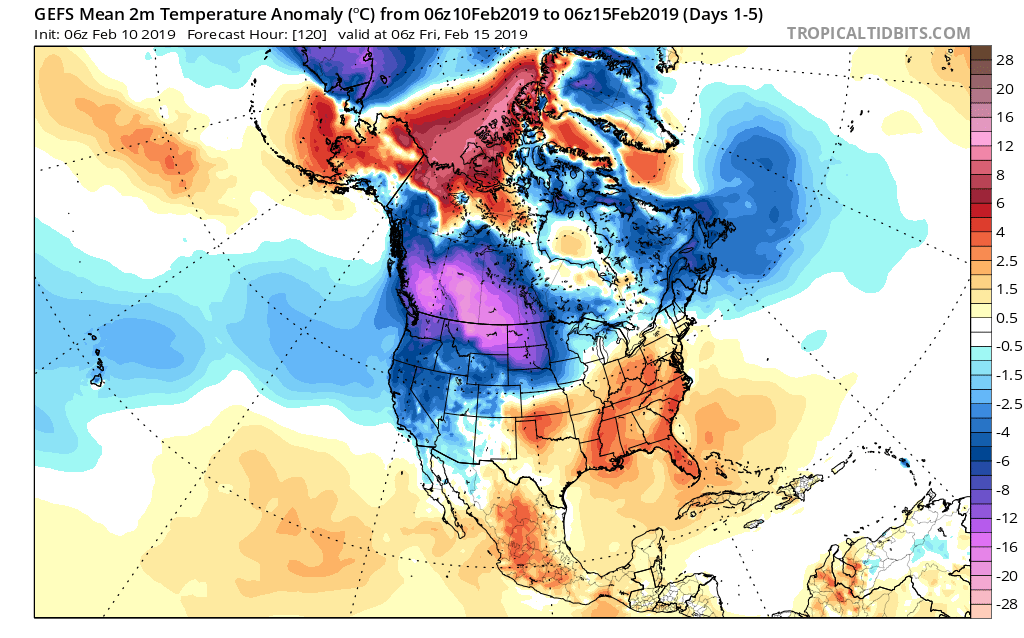
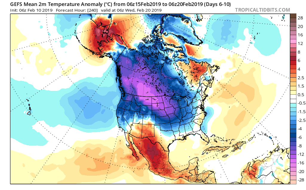
To no surprise, the GEFS is going right to what a Phase 8 should yield:
Days 1-5

Days 6-10

Days 10-14

With widespread cold set to once again overwhelm the pattern, the active storm track will begin to take on an increasingly snowy theme in the aforementioned period. This is a type pattern that may once again challenge cold records somewhere in the late February or early March time frame. While likely not to the magnitude of the bitter blast a couple weeks ago, it wouldn’t surprise us in the least to head back to record daily cold territory before pulling out of this pattern and heading on towards spring.
