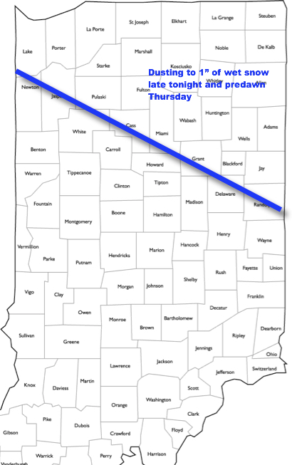
I. It’s a state divided this afternoon with winter across the northern third of the state (most are in the 30s), seasonable spring conditions central (low-mid 60s), and 70°+ downstate. Unfortunately, we’ll all turn colder tonight and as low pressure scoots east across the Ohio Valley, it’ll help pull a swath of wet snow across the northern half of Indiana after midnight through the predawn hours Thursday. Further north and northeast, a wet accumulation of an inch or less can be expected.
 II. We’ll turn cooler to close the week, but with an increasingly sunny time of things, we forecast a very pleasant open to the weekend. High pressure will remain in control of our weather into early next week. Really the only item of interest will be a gusty easterly breeze at times Sunday into Monday. We’ll watch a storm system get shunted south and stay dry here. Overnight lows will remain chilly through the weekend.
 III. The next opportunity for meaningful precipitation should arrive the middle of next week (Tuesday-Wednesday) time frame, and even this doesn’t look like a big deal. From this distance, it seems like 0.10″ to 0.25″ will come from that system.
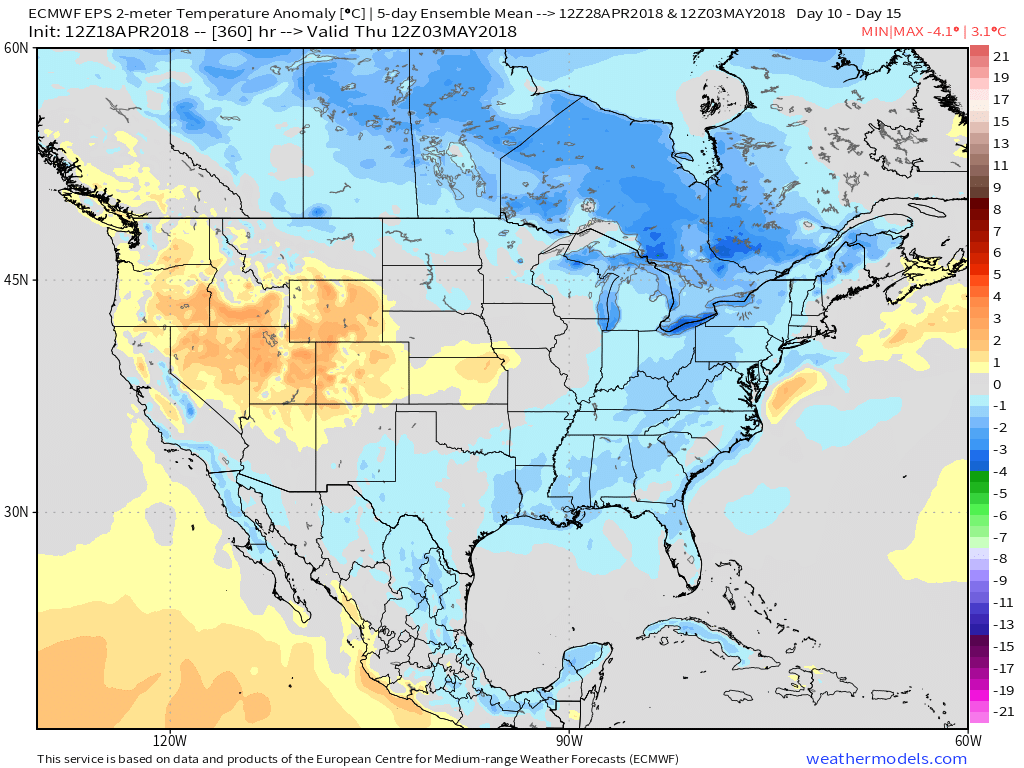
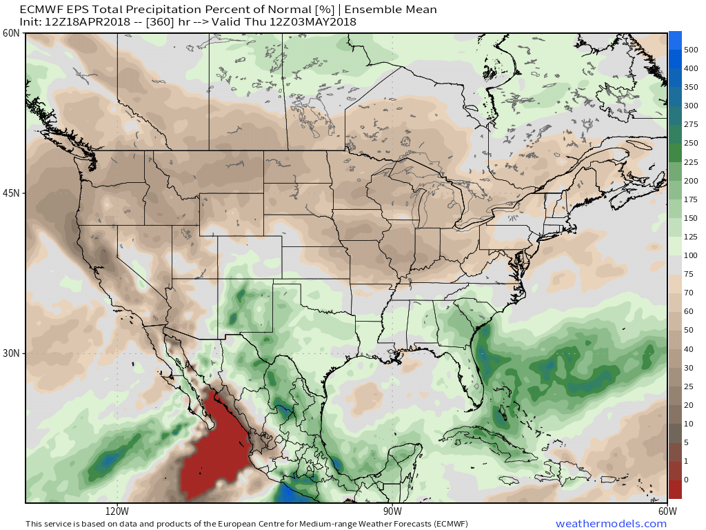
 IV. As we look ahead, the relative cold looks to relax as we put a wrap on April and open May. Additionally, we also note the EPS painting much of the northern tier into the Ohio Valley with a drier than normal signal. Sure looks like conditions are finally improving for #Plant18 to get underway in earnest…