Another Active Week Ahead…
Saturday will feature unseasonably refreshing conditions as we’ll remain under the influence of an area of low pressure tracking off to our northeast. Look for considerable cloudiness today along with highs around 10° below average. Enjoy it as significant heat looms late next week.
 Sunshine will increase for the second half of the weekend and highs will respond- mid 80s after a refreshing start Sunday morning.
High pressure will briefly build in and control our weather through the early part of the new week. An attempt of a thunderstorm complex to impact central Indiana Monday should be thwarted by a drier air mass in place. That said, moisture will increase Tuesday and beyond and a more active regime will return. Multiple thunderstorm complexes (some heavy) will rumble across the Ohio Valley and Mid West Tuesday through Thursday.
 While it’ll certainly turn more humid through midweek, the rain and storms will keep temperatures at seasonable levels. All of that changes once to Thursday and Friday as a building ridge of high pressure expands across the Ohio Valley.
 This will limit rain chances and potentially offer up the hottest air of the summer. We expect 5-6 days of low-mid 90s for highs and oppressive overnight lows in the lower to middle 70s.
 Thankfully, the hot dome will retrograde west and lead to “less hot” and increasingly stormy conditions after the first week of July. An active northwest flow pattern will take hold and provide an active time of things during this period.

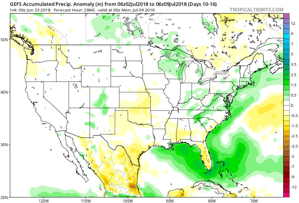


 An early look at next weekend shows general agreement with the GFS and European forecast models: drier air returning along with slightly cooler air. We’ll keep you updated!
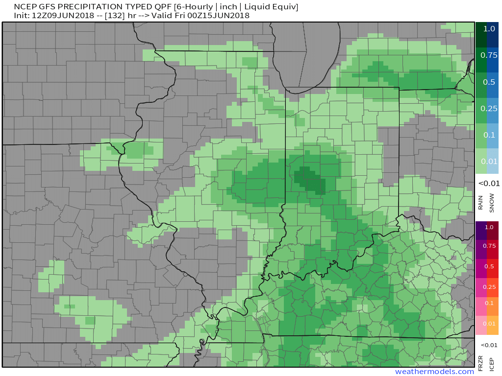
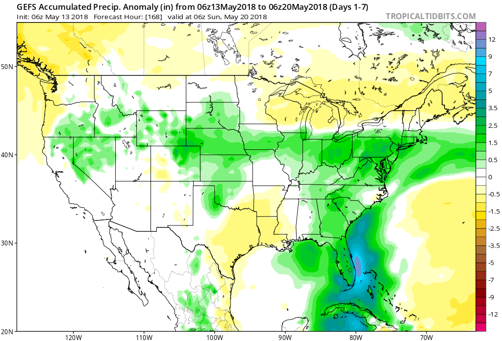
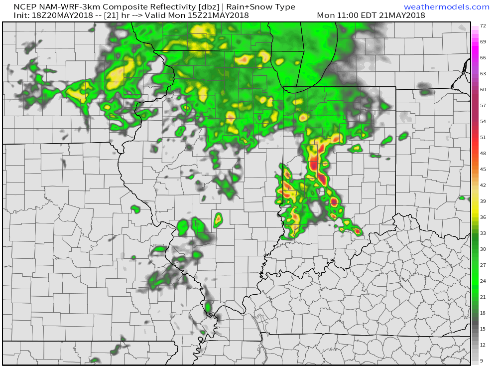 By the time all is said and done late Monday night and early Tuesday, expect widespread rainfall totals between 0.50″ and 1″ with locally heavier amounts where the stronger storms track.
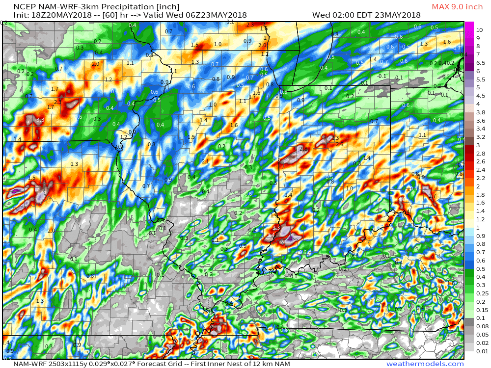 High pressure will build into the region through the midweek stretch and result in increasingly sunny and pleasant conditions. With a drier air mass in place, overnight lows will fall into the 50s through the midweek period.
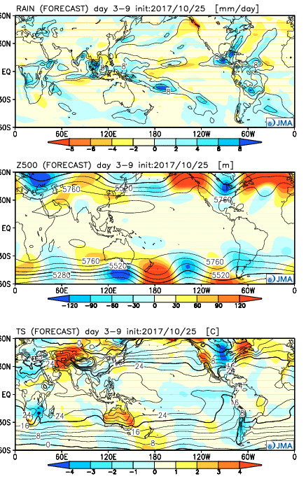 Week 2:
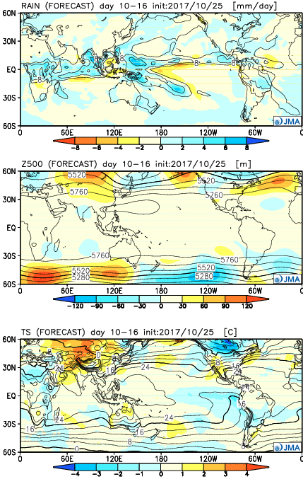 Weeks 3-4:
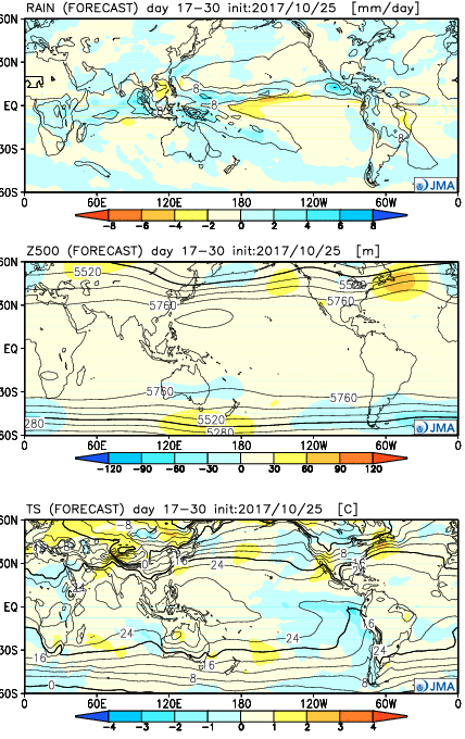 28 Day Mean:
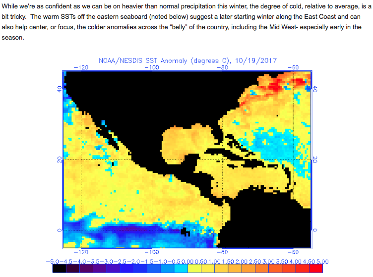
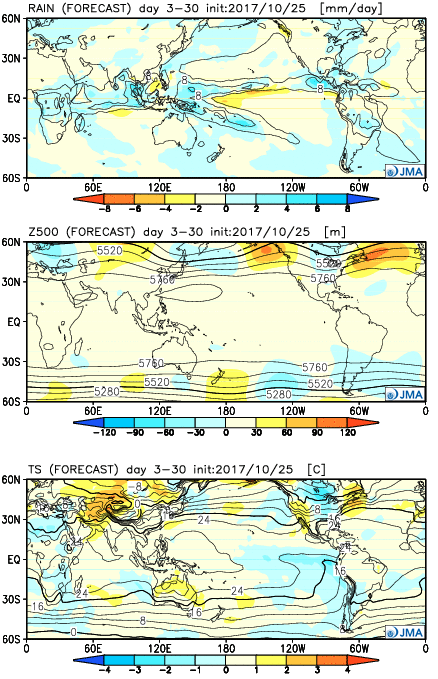 After the cold start to the month, the JMA Weeklies suggest ridges will “bookend” the country as November evolves, especially the Northeast region. This fits our research, as well, and fits the pattern, overall. If you haven’t had an opportunity to read our