Looking At The Week Ahead…
Rainfall of significance is over, and thankfully so. Many area rainfall totals checked in between 4″ and 7″ and while significant, the overall forward motion of Gordon’s remnants moved much quicker than forecast guidance suggested, ultimately limiting flooding issues from being even worse.
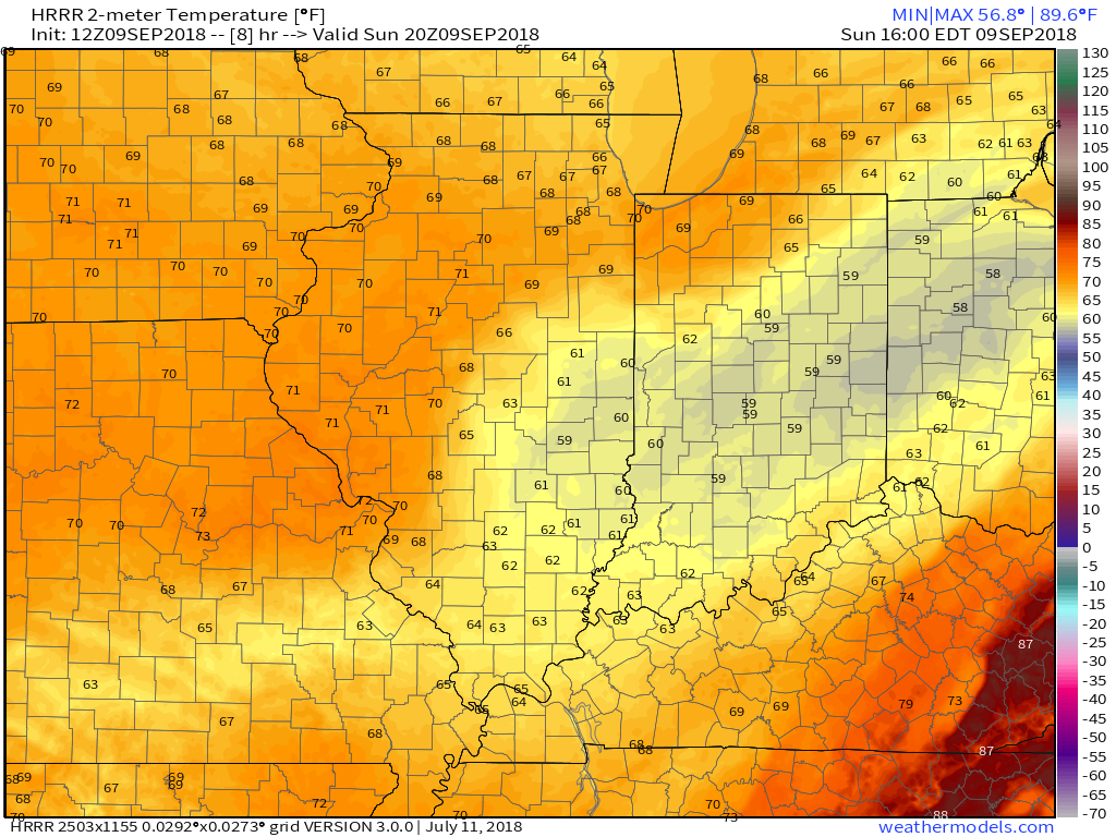
Today we’re left will overcast skies, patchy drizzle at times, gusty winds, and MUCH cooler air. In fact, the majority of our Sunday will be spent in the 50s. In case you’re wondering, November 1st is the “average” first day with a high in the 50s- 59° to be exact.


High pressure will return to open the work week. We’ll still likely deal with more clouds than sun on Monday, but as high pressure builds directly overhead Tuesday, more in the way of sunshine will return. Temperatures will be very pleasant through the first half of the work week- lows in the 50s and highs in the 70s.
 All eyes will shift to Florence by midweek. She’ll likely go through a period of significant strengthening on her journey closer to the southeast US coast with a potential landfall along the Carolina coastline Thursday. There’s still time to watch things unfold, but confidence is increasing on a potential major hurricane making landfall later this week.
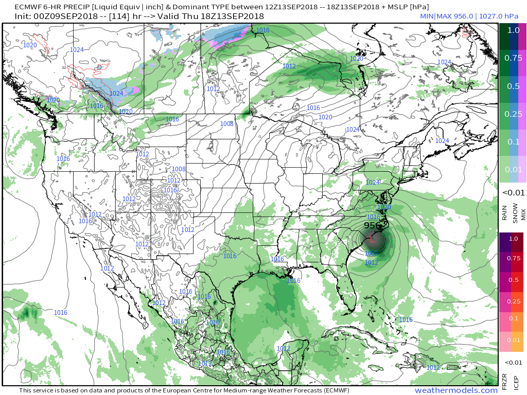 Unfortunately, the upper air pattern and lack of a steering current would lead to Florence either stalling out or “meandering” around the mid-Atlantic region for potentially several days…
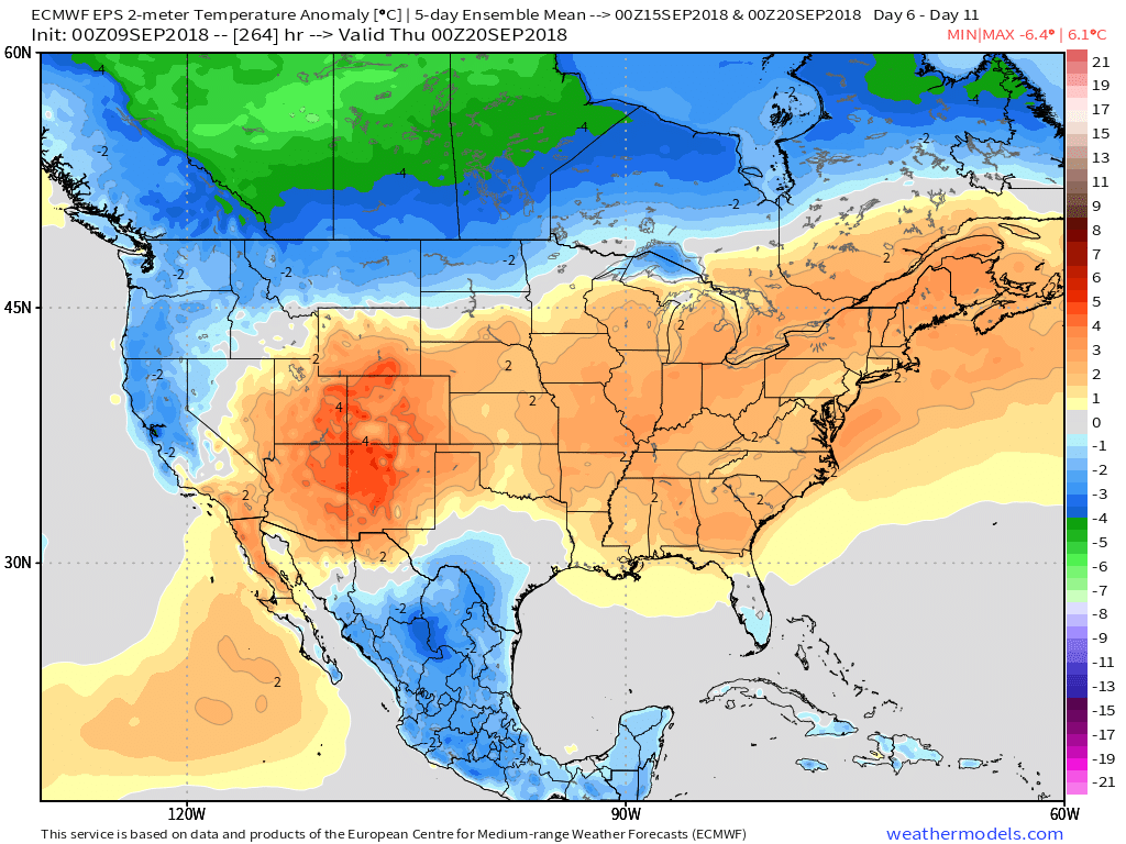
Meanwhile, back here on the home front, our fall-like early week feel will transition to warmer times as we move into late week and next weekend. Highs in the mid 80s will return with lows in the mid to upper 60s.

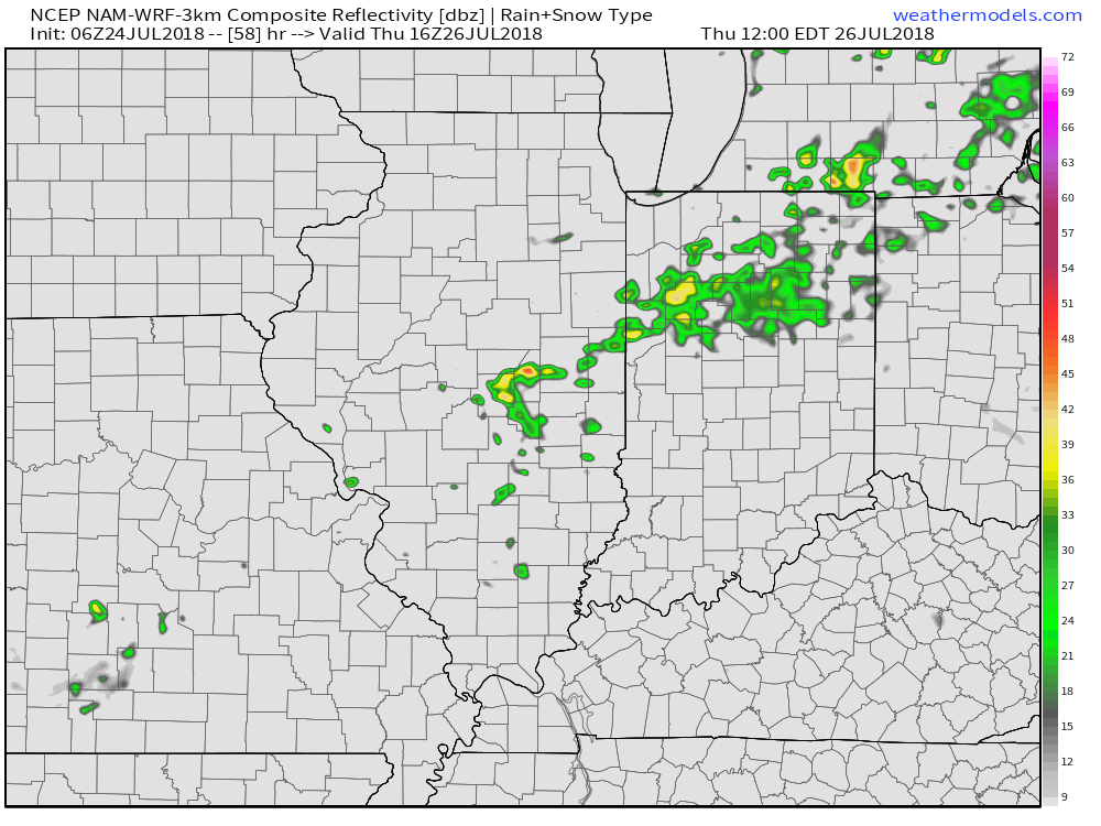


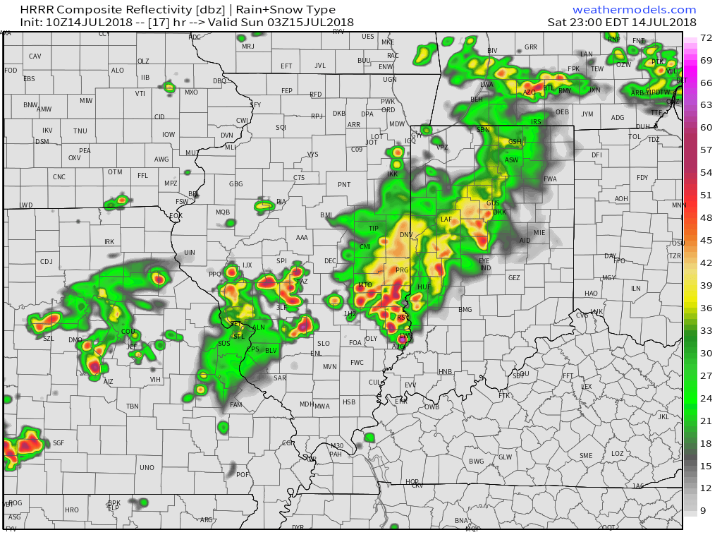
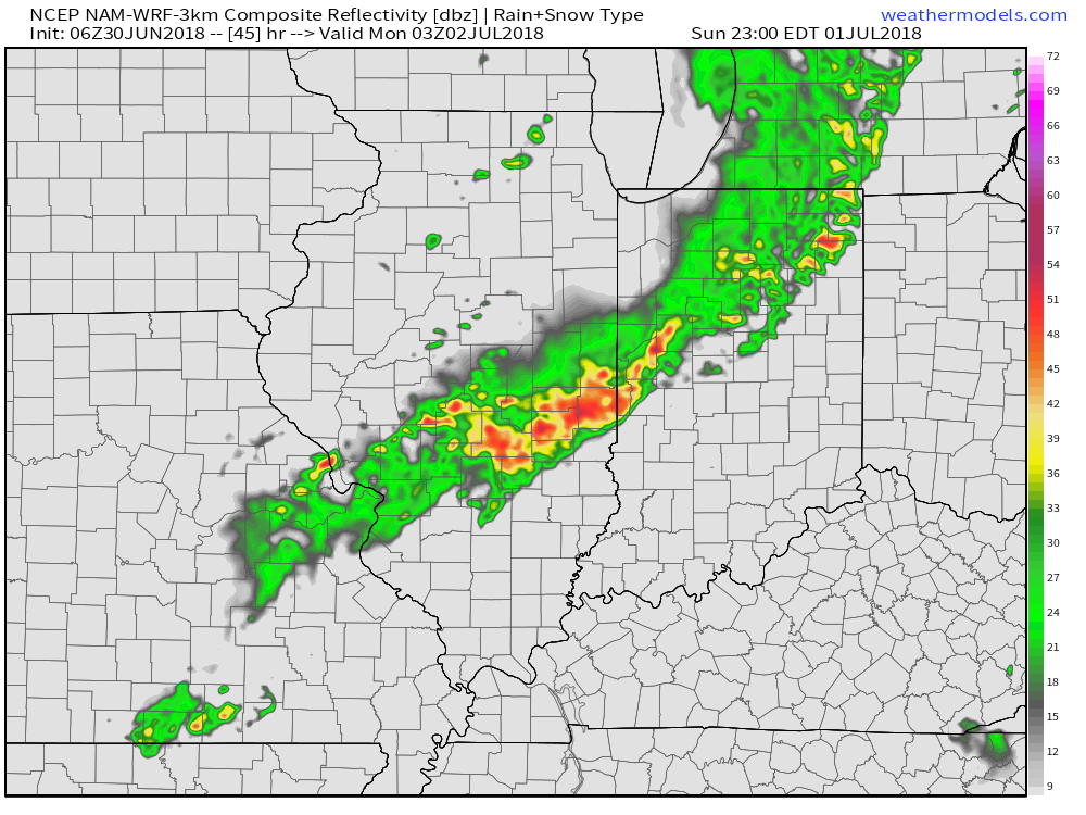
 We’ll notice thunderstorms becoming more numerous for our friends in Illinois through the afternoon and evening, but central Indiana should remain mostly dry until tonight. Forecast radar products want to bring these storms into the state after the 7p to 8p time frame. We’ll keep close tabs on radar trends this afternoon.
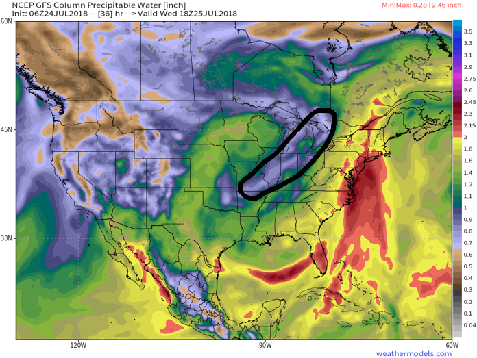
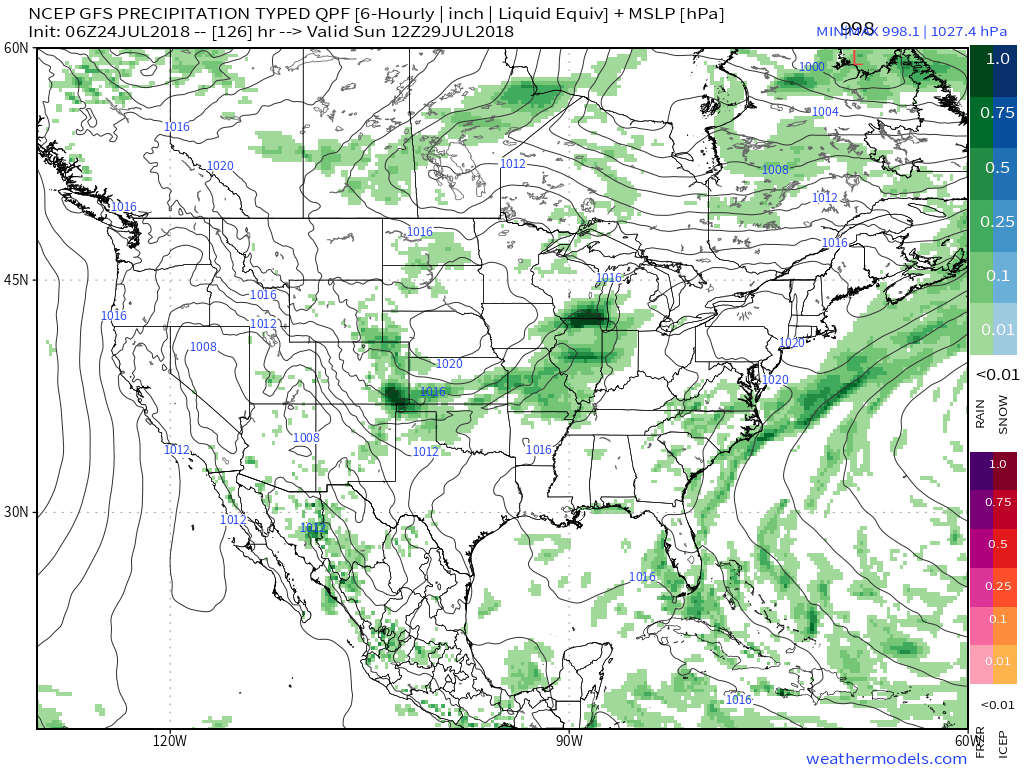
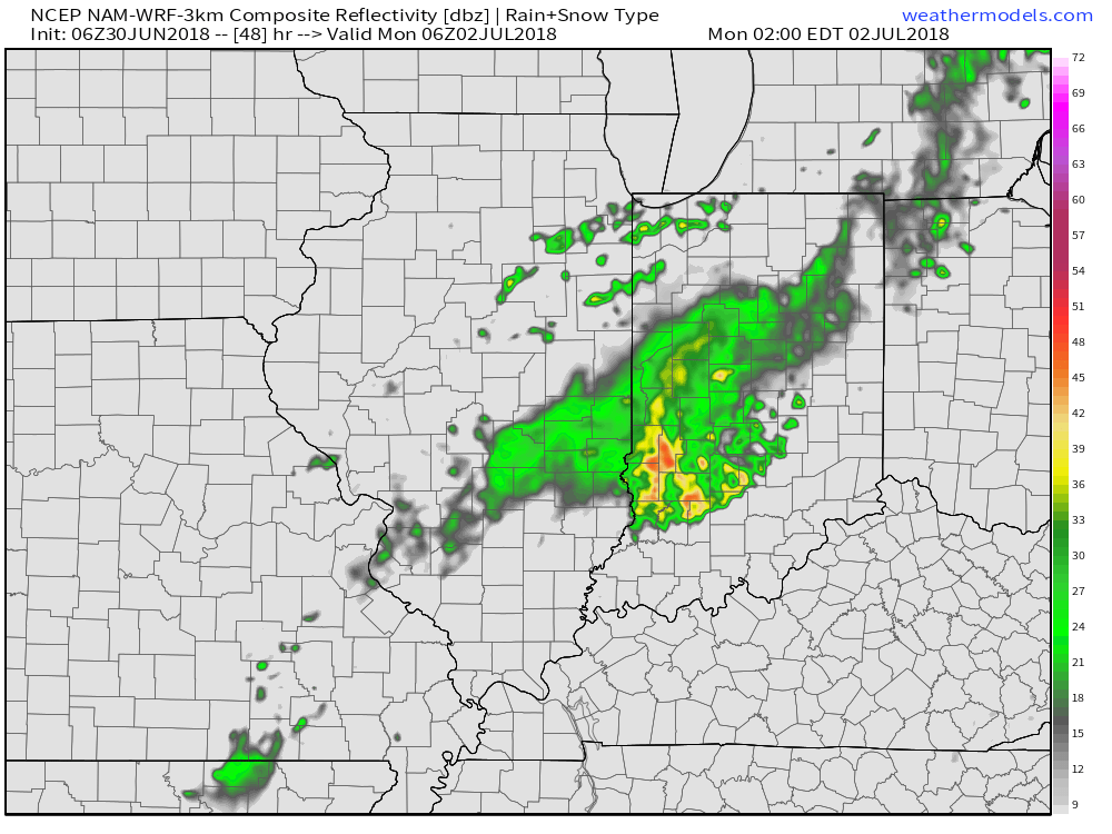
 (Again, with high moisture content, any thunderstorm that passes through your neighborhood will be capable of producing torrential rainfall). For that matter, the same story can be said with storms that develop Sunday and Monday, as precipitable water values will remain around 2″ until the front sweeps through the state.
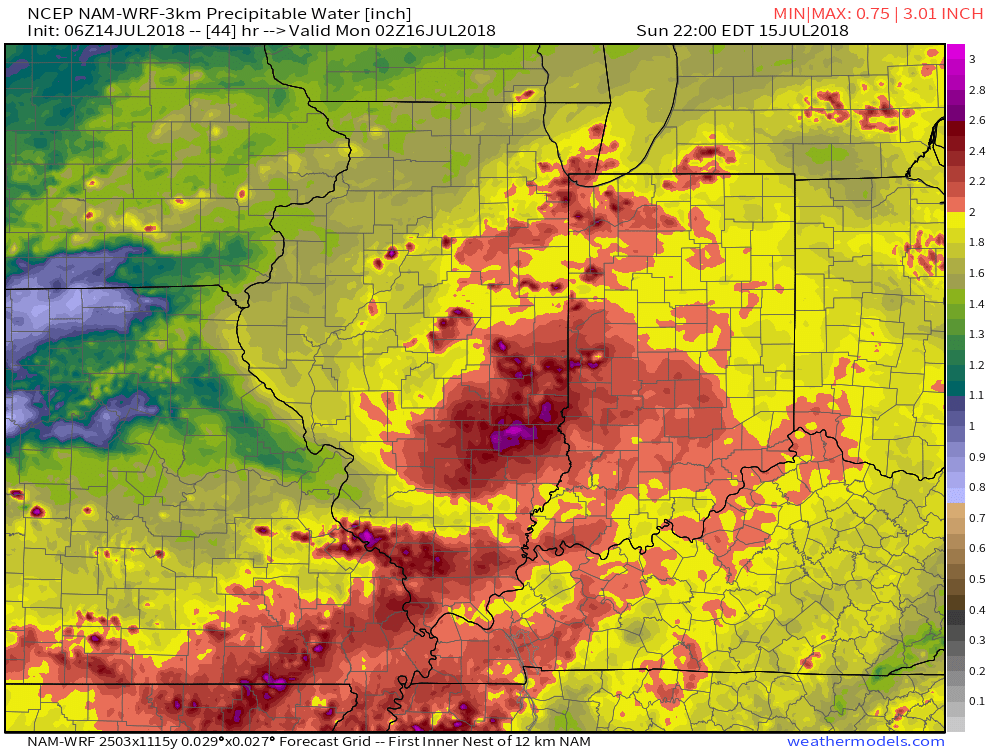
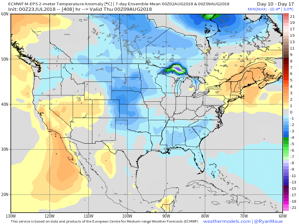
 Overall, dry conditions should prevail until late next weekend when a secondary, even stronger, front will make a run at the region. We’ll ramp storm chances back up ahead of this expected front and the air mass behind the boundary in the Week 2 time period will be even cooler than we we’ll enjoy the middle part of the upcoming week.
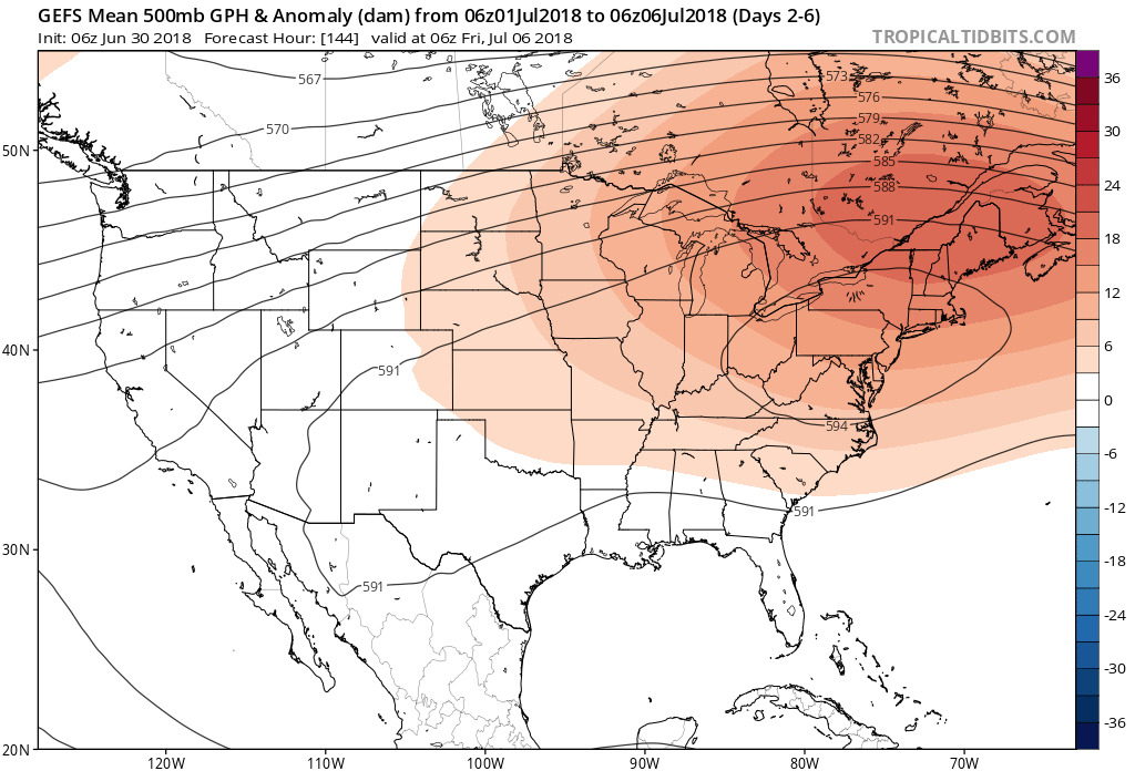
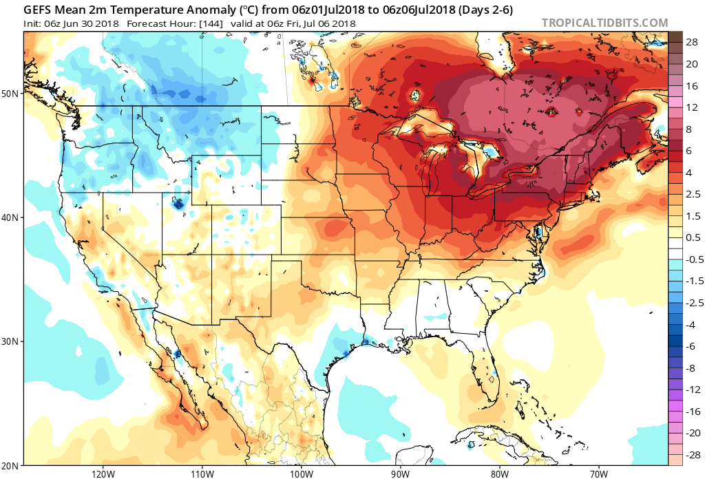
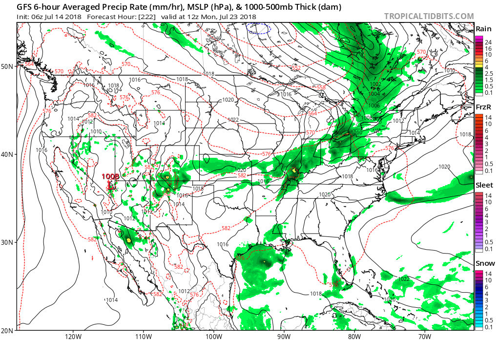 Speaking of cool, the pattern continues to look vastly different as we put a wrap on the month than what we’ve grown accustomed to over the past couple of weeks. Note the dominant trough the models show setting up shop over the Mid West…
 More specific to central Indiana, daily highs in the lower to middle 90s and overnight lows in the lower to middle 70s will continue into late next week. For the most part, this is a dry pattern, as well, BUT there will be a few exceptions.
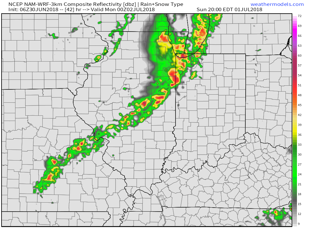
 Thereafter, additional isolated to widely scattered storm coverage is possible- primarily during the afternoon and evening hours, but more than not will remain rain-free. 7-day precipitation totals check in this morning in the 0.25″ to 0.75″ range.
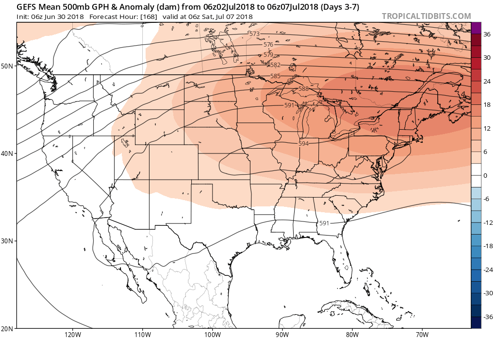

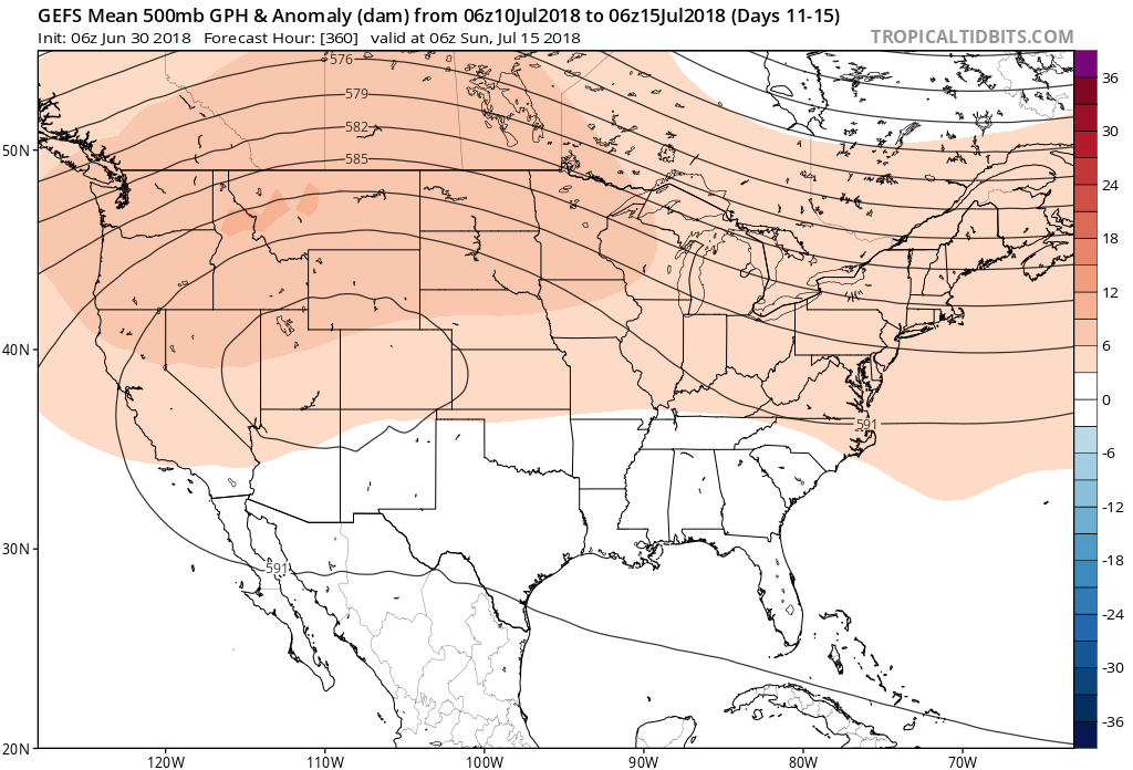 Not only will this likely lead to a cooler second half of July, but should also offer up an increasingly active and wetter northwesterly flow for our immediate region.