I. A weak weather maker will help spread a mixture of light rain and snow across the state later today, particularly this afternoon and evening. Precipitation amounts will remain light and insignificant, but serve as a nuisance as you go about your weekend plans.
 II. We’re hopeful for much needed sunshine Sunday as we’ll be in between storm systems, however any sun that we see won’t last long.
A rather ominous setup for heavy rain will take place Monday into Wednesday. This will include a combination of ingredients as a strong southeast ridge will prevent much forward motion of a “wavy” front that will drape itself across the Ohio Valley region. Additionally, the subtropical jet will transport moisture-rich air northward into the area (true Gulf of Mexico connection).
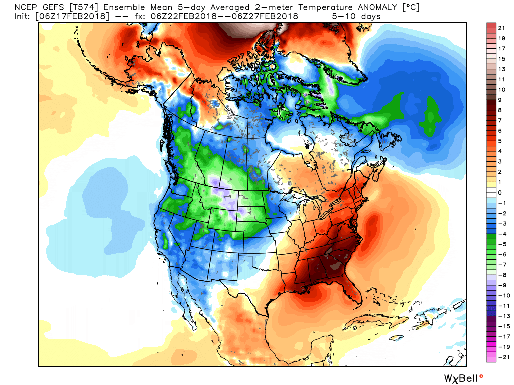
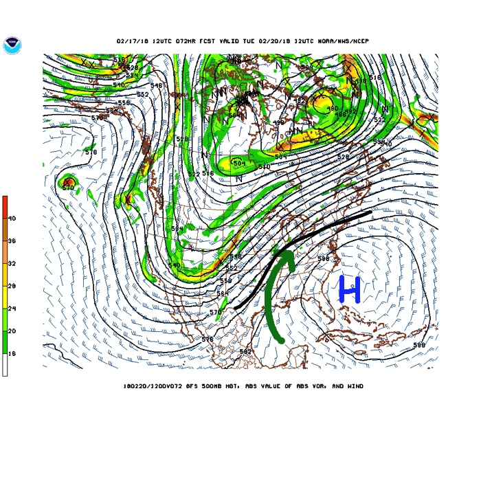 While this is an unseasonably warm pattern (we forecast highs of 50°, or above, 5 out of 7 of the upcoming days, and at least 2 60°+ days), it’s one that will likely result in periods of heavy rain not only next week, but in waves over the upcoming 10 days.
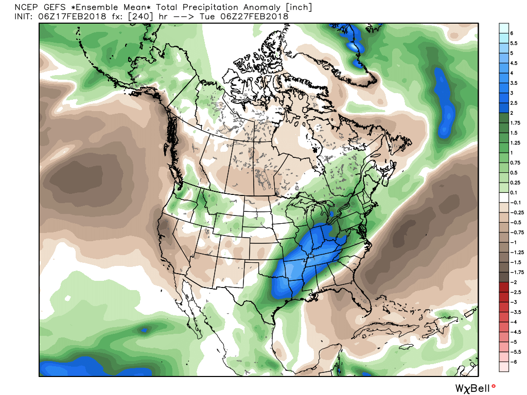 Widespread 10-day rainfall numbers of 3″ to 4″ will be likely in this setup, including locally heavier amounts of 5″ to 6″ in spots. Certainly, if you live near waterways we suggest having a plan in place as it’s not a matter of if, but when flooding takes place in spots across the region with such a setup.
III. Longer-term, we still need to be wary of the potential of a colder pattern returning as we get into March. That forecast deep negative arctic oscillation (AO) has to raise an eyebrow for the possibility of making up for lost time in the cold weather department before we can signal “all clear” on winter…


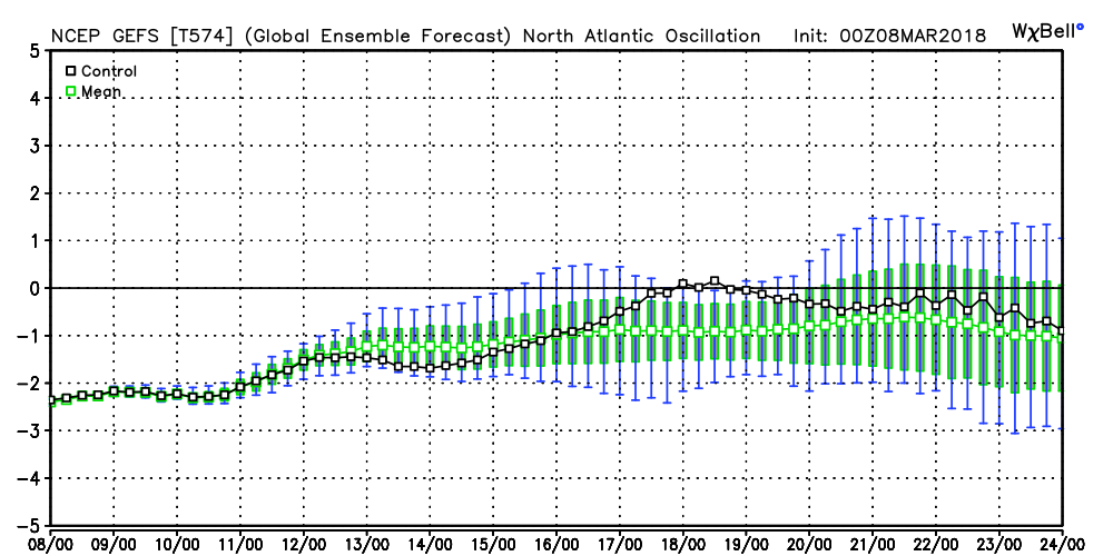
 It should be no surprise that the GEFS 5-day temperature anomaly shows widespread below normal air centered on March 22nd.
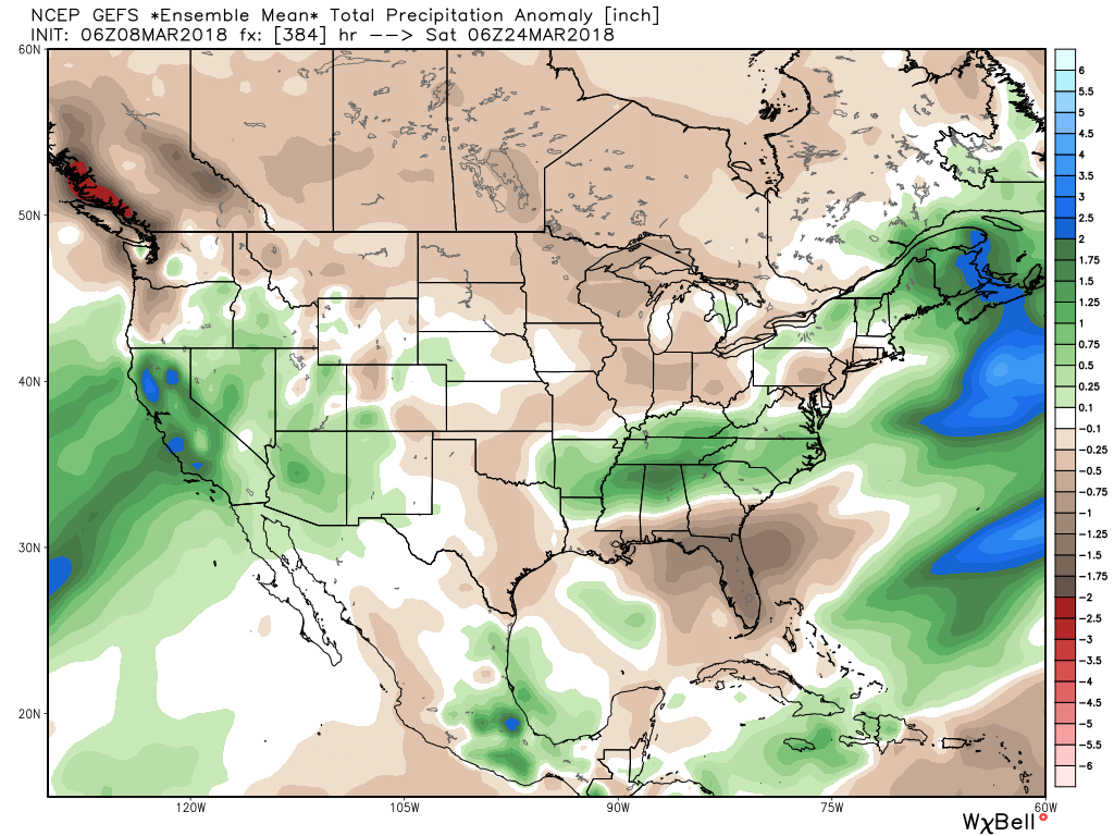
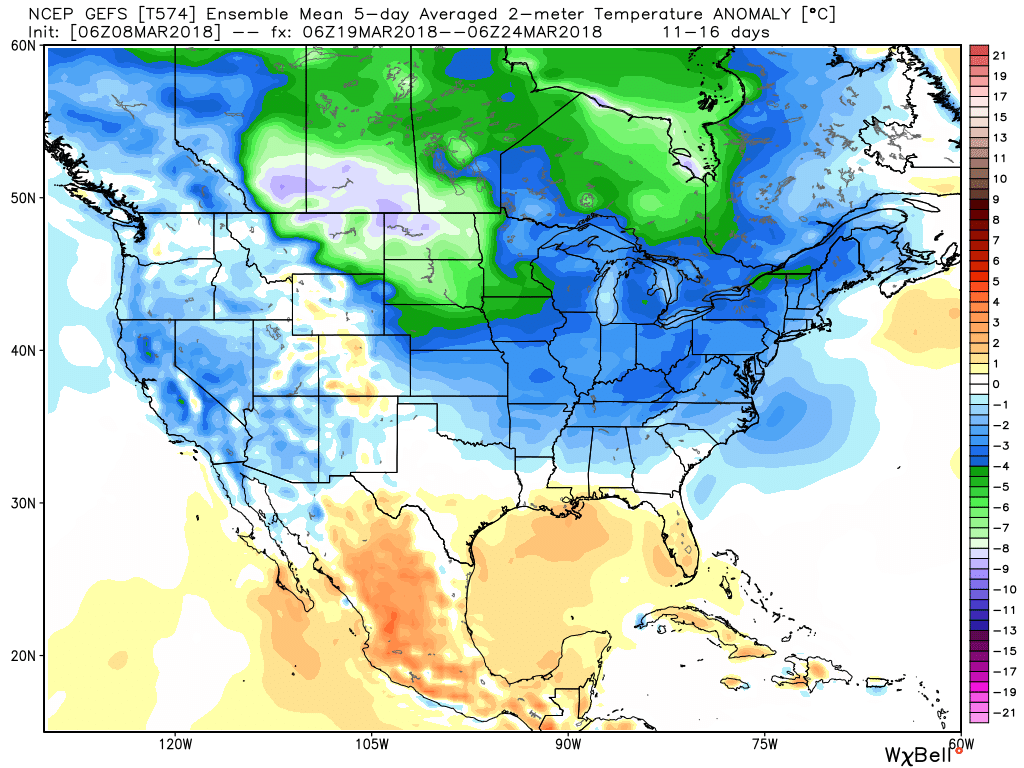 This doesn’t mean brief surges of warmth, originating in the southern Plains, can’t shoot into the Ohio Valley for a couple of days. Perhaps we’ll “luck out” and enjoy a briefly milder time for St. Patrick’s Day. This does, however, mean that overall we have a long, long way to go before “stick and hold” spring can arrive, locally, and the balance of the upcoming 2-3 weeks looks colder than average.
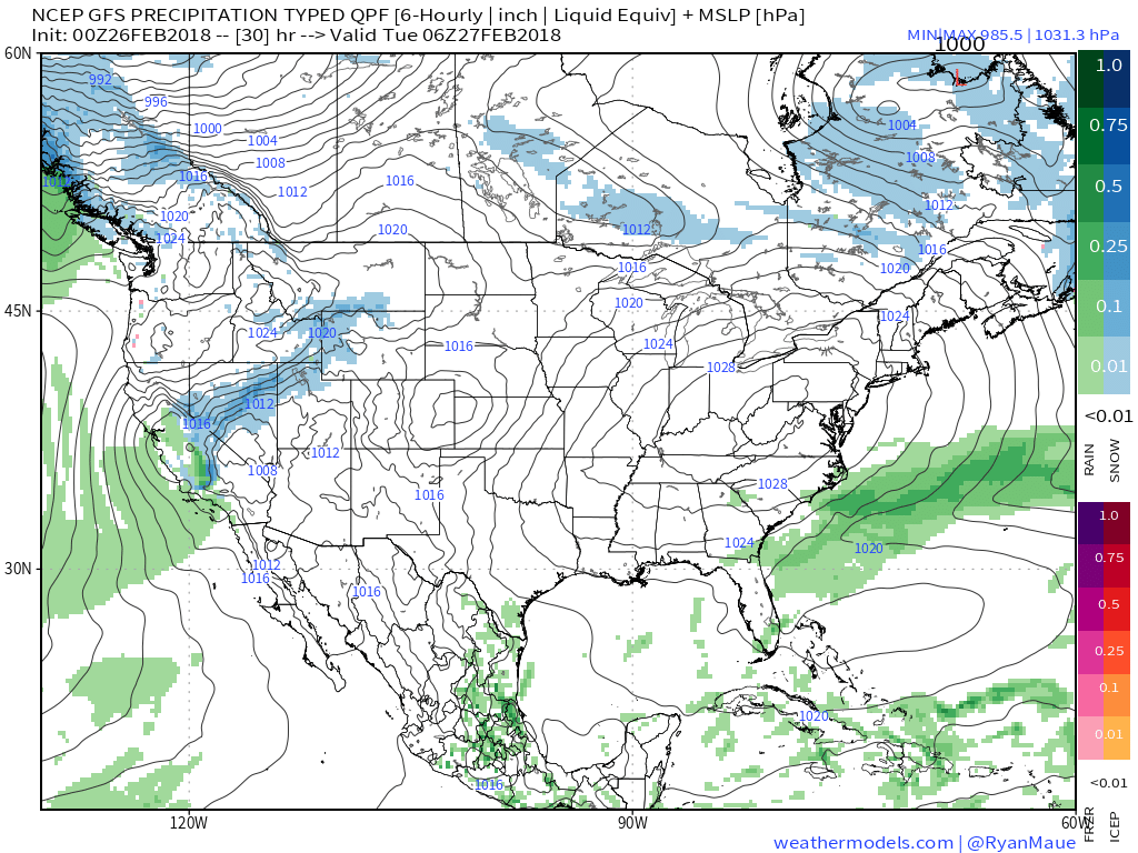 II. Our next weather maker will arrive midweek and provide a few showers Wednesday (not a huge deal from a precipitation perspective). However, as a deepening surface low tracks into the Great Lakes Thursday morning, a period of heavier rain and even thunder is possible. In general, this looks like a 0.50″ to 1.00″ type event.
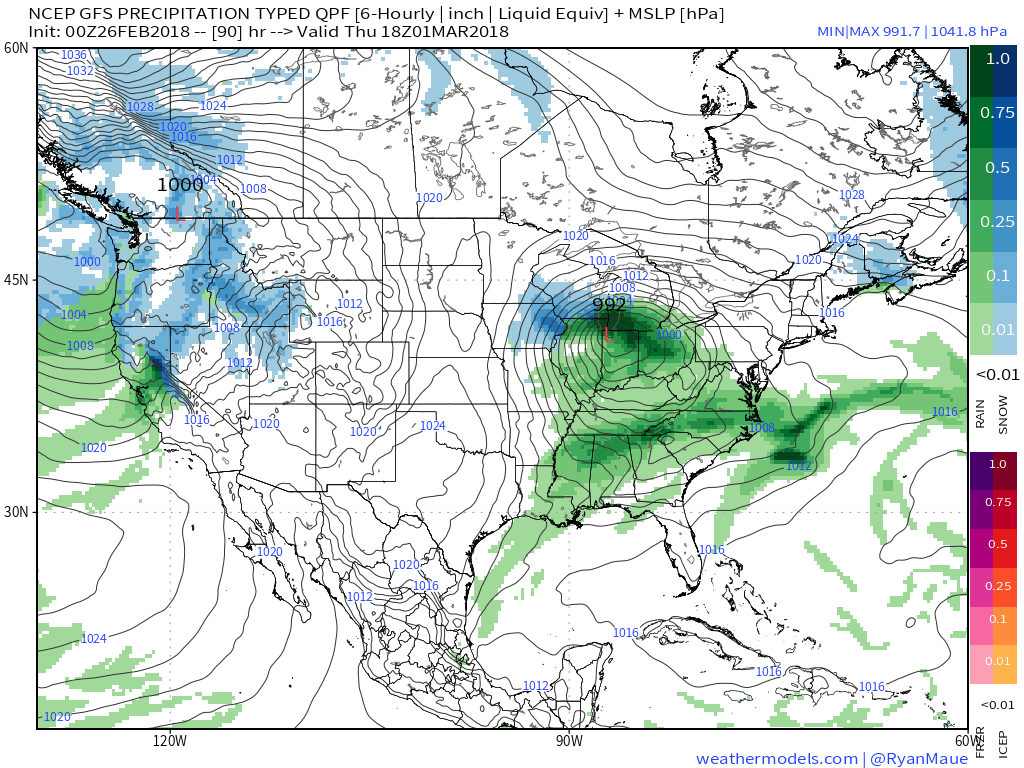
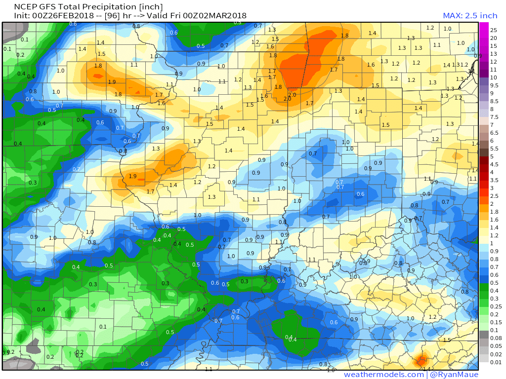 III. Somewhat cooler air will whip in behind the low, allowing leftover precipitation to end as a couple wet snowflakes across the northern half of the state Friday morning. The bigger story will be the “bumpy” start to Friday with strong and gusty north winds.
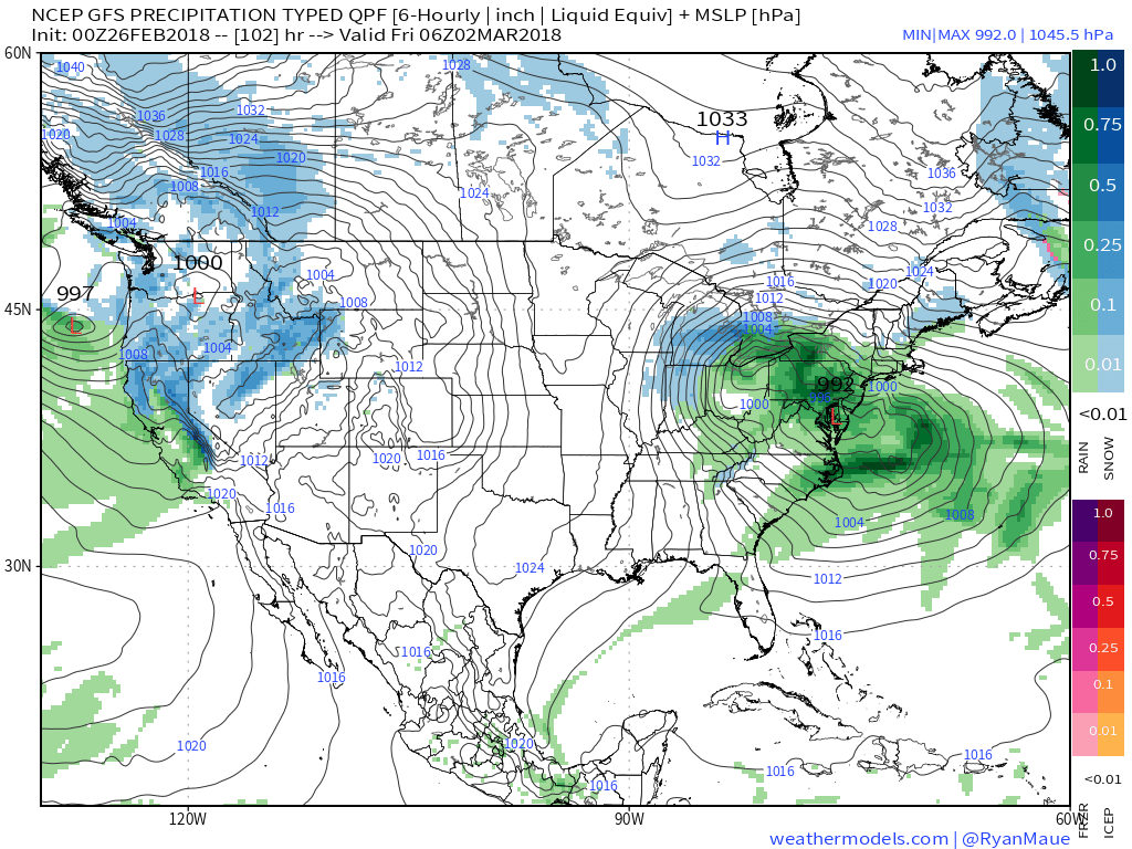 IV. High pressure returns for the weekend and with it will come a return of sunny skies. Though the mornings will be frosty, afternoon temperatures will “warm” to pleasant levels, especially with the increasingly strong early-March sun angle.
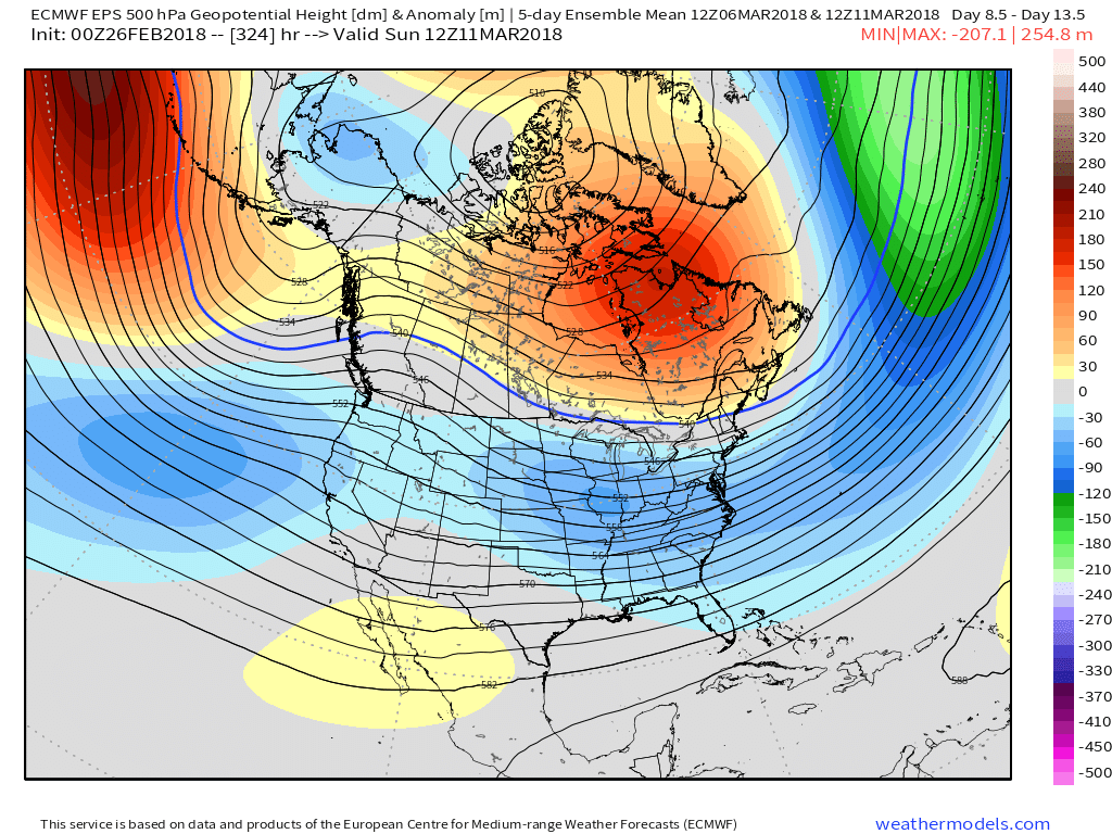
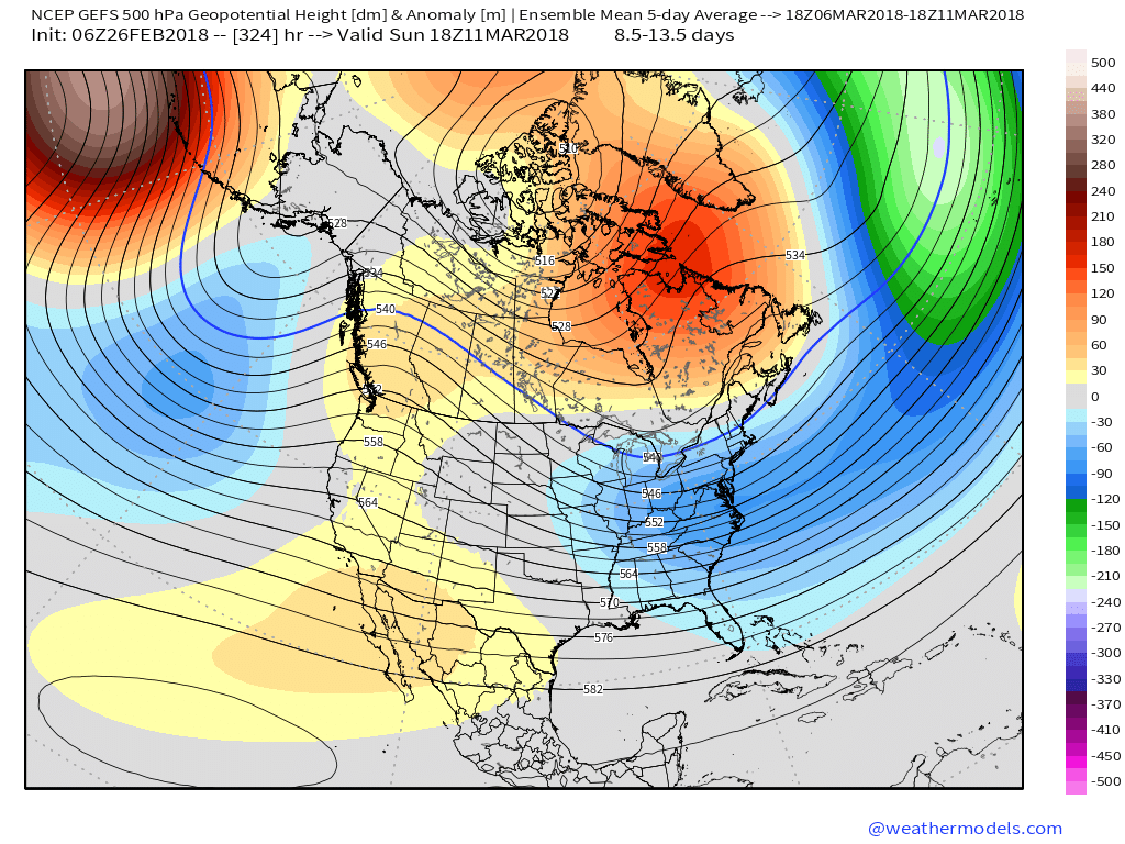
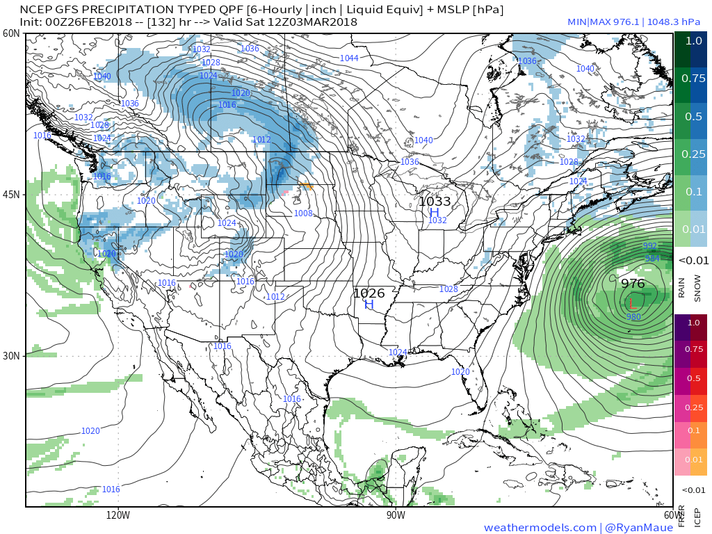 V. Looking ahead, let’s keep a close eye on the second week of March. Potential is present for a stormy period to emerge under the block. We note the GEFS and EPS (respective ensembles of the GFS and European models) are in relative agreement on a stormy, cold look during this time frame. While far too early for specifics, the potential is there for a rather widespread wintry event from the Plains into the Northeast.
 II. We’re hopeful for much needed sunshine Sunday as we’ll be in between storm systems, however any sun that we see won’t last long.
 While this is an unseasonably warm pattern (we forecast highs of 50°, or above, 5 out of 7 of the upcoming days, and at least 2 60°+ days), it’s one that will likely result in periods of heavy rain not only next week, but in waves over the upcoming 10 days.
 Widespread 10-day rainfall numbers of 3″ to 4″ will be likely in this setup, including locally heavier amounts of 5″ to 6″ in spots. Certainly, if you live near waterways we suggest having a plan in place as it’s not a matter of if, but when flooding takes place in spots across the region with such a setup.