Dinnertime Rambles: A Lot Going On In The Weather Department The Next Few Weeks…

This is a “locked and loaded” weather pattern that will require a great deal of attention over the next 2-3 weeks. We’ll have to take things one at a time, but the combination of strong storms to start, much colder air on the horizon, and the potential of wintry “fun and games” in the 6-10 day period is enough to hopefully distract you from the day-to-day news, and provide a little extra entertainment during these unprecedented times.

First things first and that’s the short-term storm situation:

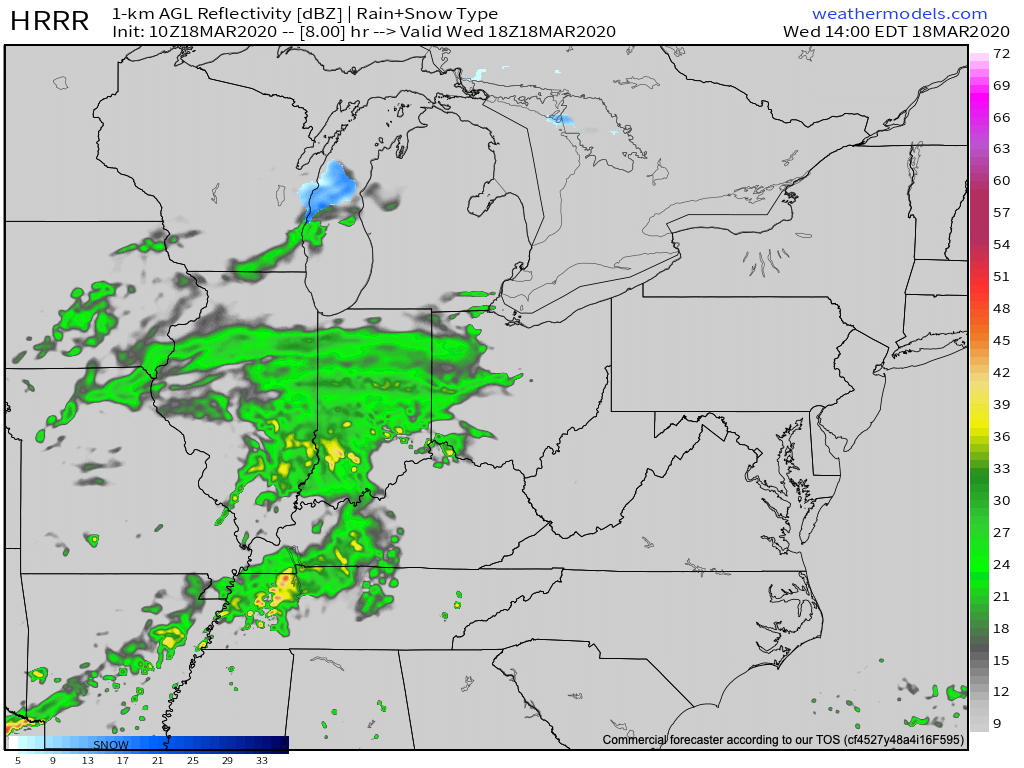
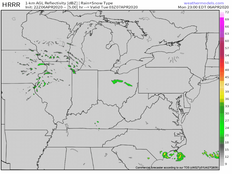
All is quiet this evening, but a warm front currently draped from central IA, IL, and into southern IN will begin lifting north during the overnight. As this takes place, thunderstorms will erupt across northern Indiana late evening into the overnight hours before riding southeast into northern and central Ohio. A few stronger cells are possible, but most of these should remain below severe levels. Most of central Indiana should miss out on this activity.

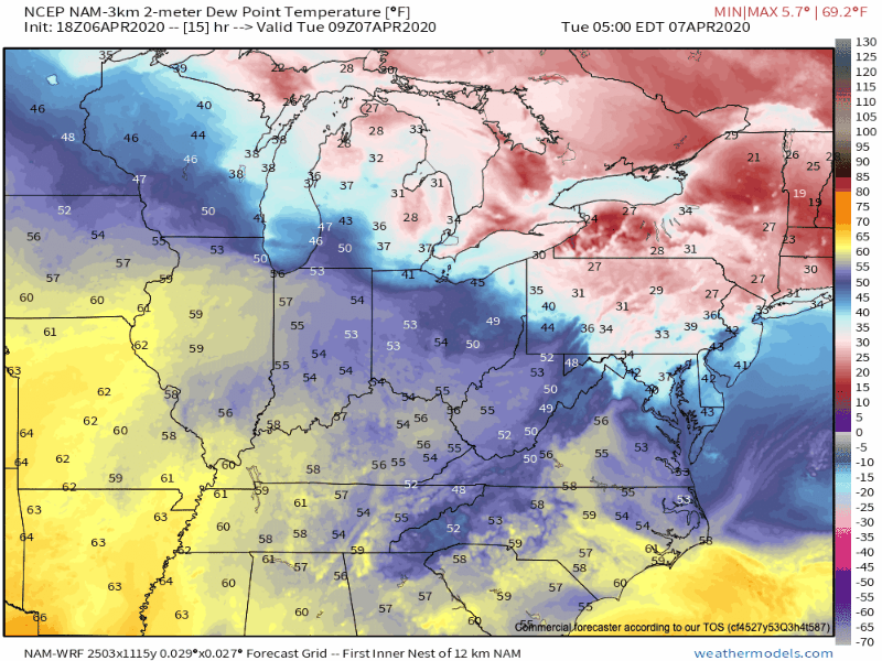
With the warm front placed well north of the area tomorrow, the warmest temperatures of the spring thus far are expected. Additionally, that associated southwesterly flow will aid in moisture transport north through the day. Stepping outside tomorrow, you’ll certainly feel the difference with the increased warmth and humidity. Highs should top out in the middle 70s for most of central Indiana with dew points (shown below) climbing into the middle 60s.

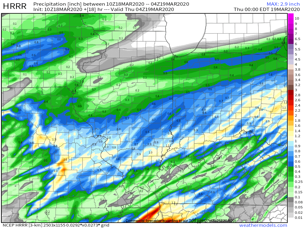
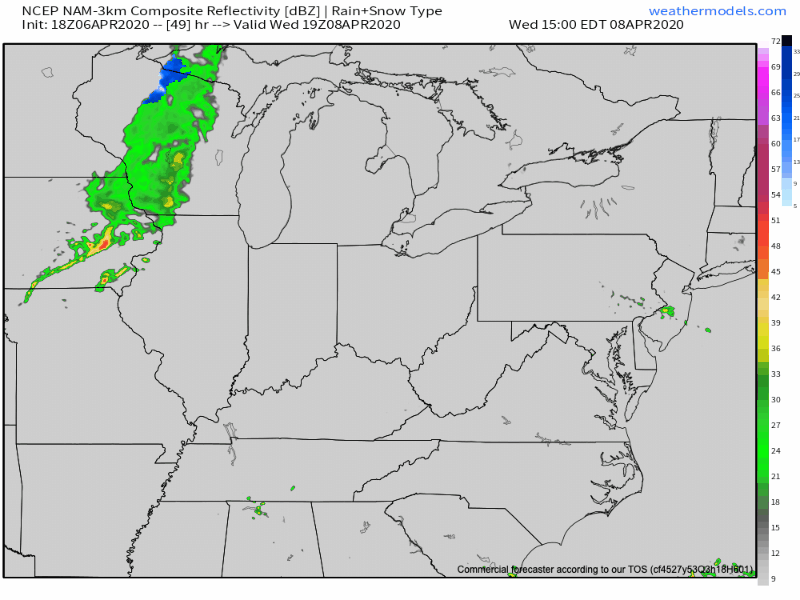
The bulk of our Tuesday should be rain and storm free, but that will begin to change late tomorrow night as a new round of storms begins to organize. While high resolution guidance continues to struggle with the exact placement of this new round of storms, we’d encourage those across all of central and southern parts of the state to remain weather-aware tomorrow night and set those weather radio alerts to “on.” The primary concern of strong to severe storms that may develop late tomorrow night (mostly after 10p) includes large hail and the potential of damaging straight line wind. The Storm Prediction Center (SPC) maintains a good chunk of the immediate region in a Slight Risk tomorrow night into the predawn hours Wednesday.

Finally, one last round of showers and thunderstorms will accompany a strong cold front late Wednesday night into early Thursday morning (most of these should remain below severe levels).

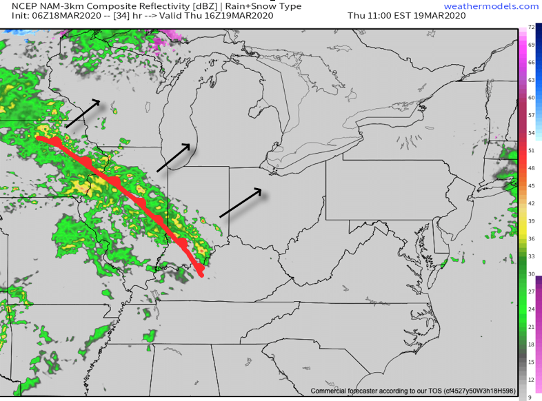
Thursday will feature much cooler and blustery conditions as that northwest flow develops.

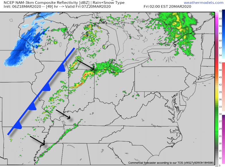
Thankfully, high pressure will briefly gain control of our area as we close the work week and head into the first half of Easter weekend. This will allow calmer weather conditions to return, but “brief” is the key word.

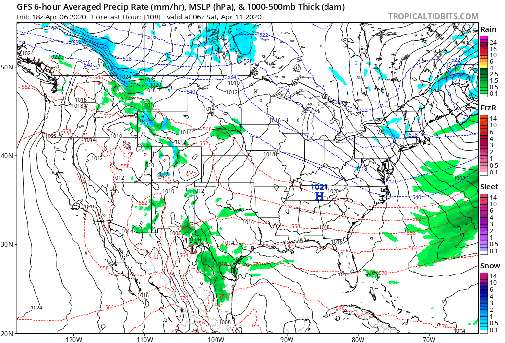
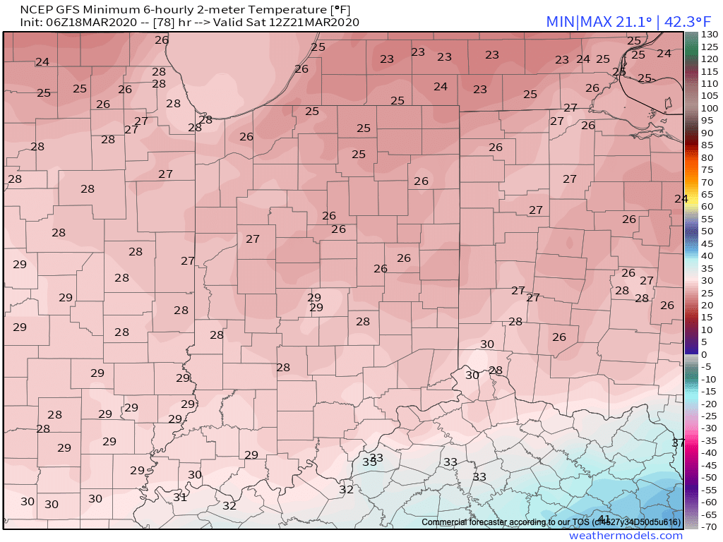
By Easter, itself, a new system will deliver rain before potentially ending as wet snow late Sunday night.

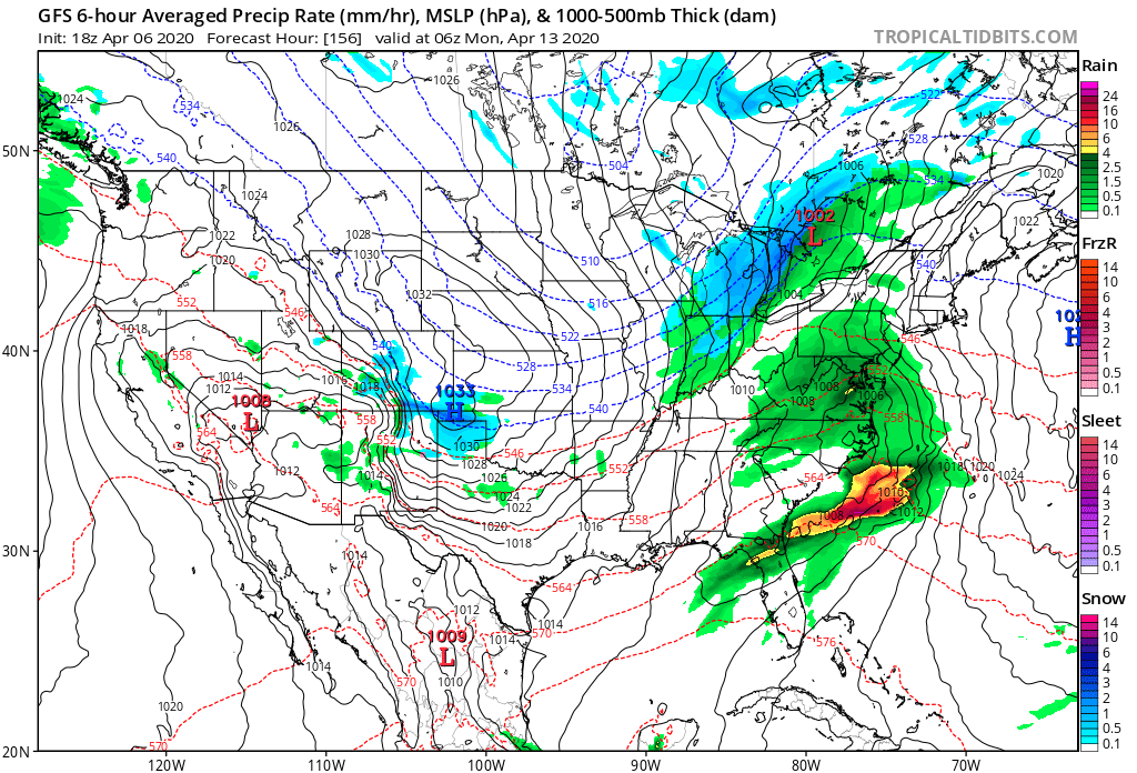
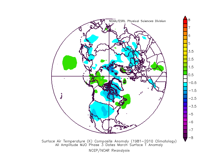
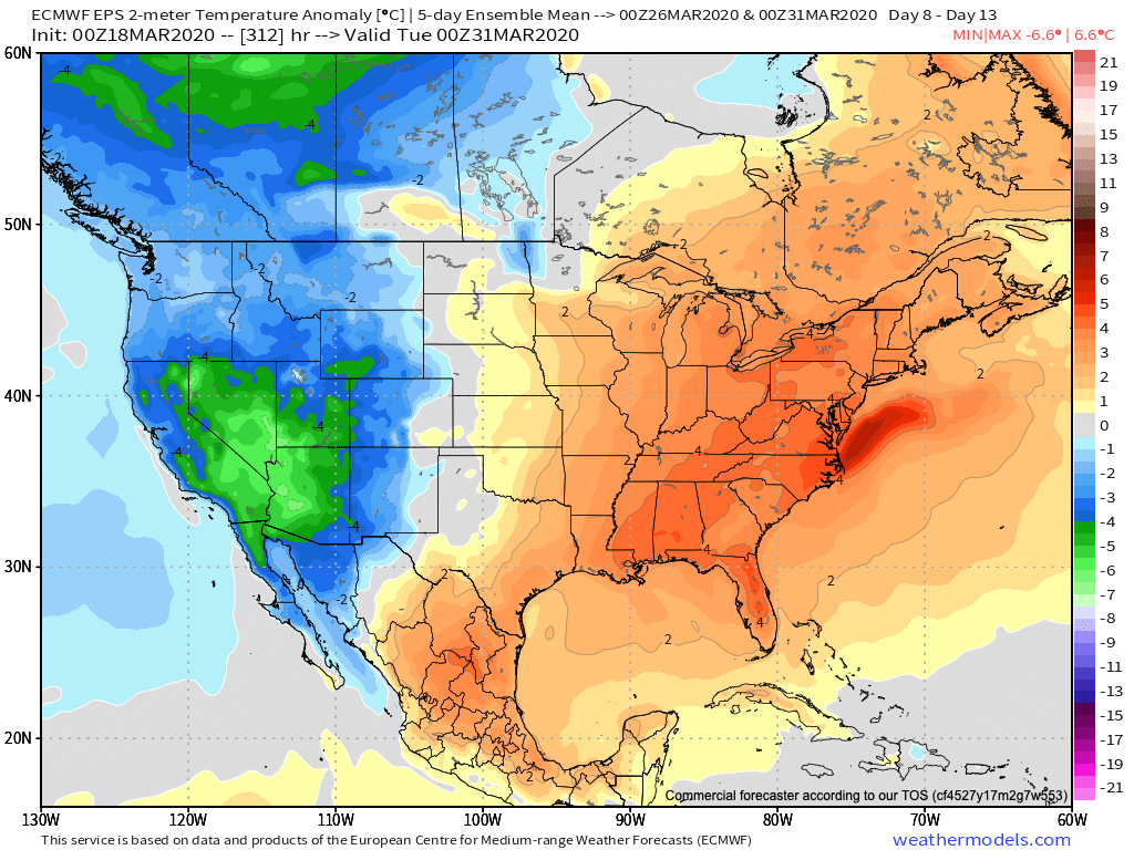
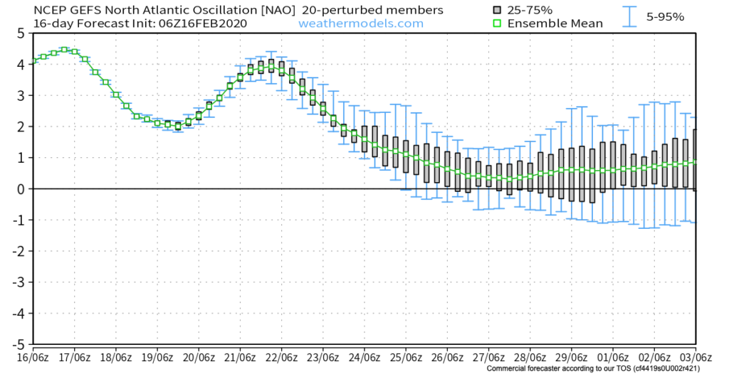
Even colder air will follow early next week, and we’re not done where that came from. There are indications on this evening’s computer models that the upper air pattern may come together to allow for a rather significant “phased” storm system in the longer range. It’s certainly far too early to speculate on that, but whether there’s a strong storm or not, the combination of a developing negative EPO and MJO with eyes set to rumble through Phases 1,2, and 3 lead us to believe this isn’t just some fleeting chilly pattern. Instead, this is liable to take up residence for the better part of the upcoming 2-3 week period. Big storm or not in the Week 2 time frame, it’s a safe bet those along and north of the Ohio River or into the high ground of the east TN/ western NC mountains haven’t seen the last of the snow for the season.

Remember, we’re only the messenger…

Wednesday Morning Rambles: Midweek Storms, MJO Impacts On Late March Pattern…

I. The morning is off to a quiet, chilly start, but clouds will lower and thicken through the morning and rain will soon follow. Periods of moderate to heavy rain can be expected this afternoon into the early evening hours, including widespread 0.50″ to 1″ with a few locally heavier amounts.

Rain will become widespread across the region through the afternoon.
Most of central Indiana can expect between 0.5″ and 1″ by midnight.

II. A changeable weather day is on tap Thursday with a couple of rounds of storms expected- late morning and again during the evening and night. The initial round of storms will lift northeast across the state Thursday morning into early afternoon, courtesy of a warm front. Highs will flirt with 70° tomorrow afternoon once the storms move out.

A cold front will then sweep through the region during the overnight. Additional storms (some potentially strong to severe) will take place as the front moves through the region.

A few storms may be strong to severe as the cold front moves through Thursday evening-night.

III. We’ll turn MUCH colder, but at least the sunshine will return as we move through the weekend. Lows in the 20s can be expected.

IV. Our next storm system looks to arrive Tuesday. From this distance, it appears this will be a potent system, including strong winds and heavy rain.

V. Longer term, we continue to watch the various players align. The MJO looks to amplify and rumble into Phase 3 by late March. The movement through Phases 1-2 can at least generate transient cold for our neck of the woods before Phase 3 favors the brunt of the cold across the West. Interestingly, this is what the latest European ensemble is also showing.

Thursday Morning Rambles…

Quick update from the road this morning- a more extensive video update will hit later this evening with fresh long range thoughts! I. Upper level energy and reinforcing cold air…

You must be logged in to view this content. Click Here to become a member of IndyWX.com for full access.  Already a member of IndyWx.com All-Access?  Log-in here.

Meteorological Spring A Couple Weeks Away, But Trends Suggest Winter’s Not Done…

With the exception of a rain maker blowing through the region Monday evening into Tuesday, we’re heading into a relatively quiet weather pattern for the upcoming 7-8 days. A couple of days of well below average temperatures will follow Tuesday’s cold front before weekend moderation takes place. With the shift in the pattern (albeit likely only for a brief period of time), we thought we’d look ahead to what may loom to close February and head into March.

As we’ve discussed in the past, the EPO and MJO are the keys to the pattern, and will continue to be through March. Some of the recent trends with both features would suggest cold is going to fight back as we head into late Feb and early March (spike positive in the EPO also boosts our confidence the pattern will warm over the weekend and into early parts of Week 2). This would likely be met with a return of an active storm track through our neck of the woods.

Both the GEFS and EPS paint a developing negative EPO as we close the month and welcome March. Secondly, the MJO is looking more and more like it’ll move out of the traditional winter warm phases and towards a much colder Phase 8. Collectively, these features should give pause to anyone thinking the kick-off to meteorological spring will be met with dry, warm weather. In reality, the opposite would more than likely result- stormy with colder than normal weather.

This is also the time we begin leaning more heavily on the influence a negative NAO can have on the pattern. Should this teleconnection get into the negative territory in March, then we’d be talking about a potential colder pattern lasting for 10-14 days towards one that would reload to result in colder, wintry conditions lasting into April. While not there yet, it’s certainly worth keeping an eye on in the coming days and weeks.