Updated 11.27.21 @ 5:56a
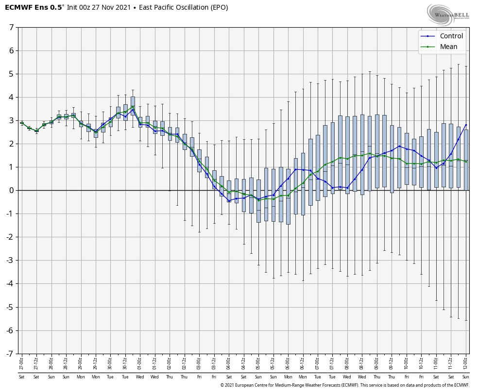
The theme of the better part of the autumn season has been a story of contradicting signals- teleconnections and MJO alike. When we look ahead to the beginning of meteorological winter (Dec. 1st), it sure appears that will continue to be the story. For a brief moment the East Pacific Oscillation (EPO) tries to go negative. This is interesting in and of itself as only a couple days ago the EPO was forecast positive during this period.
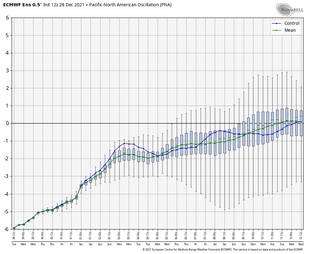
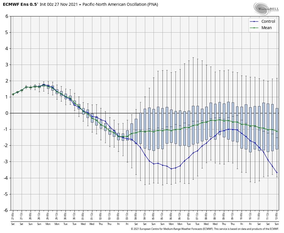
Meanwhile, the PNA is forecast negative to open the month.
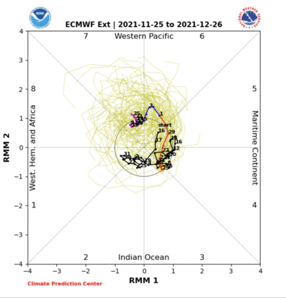
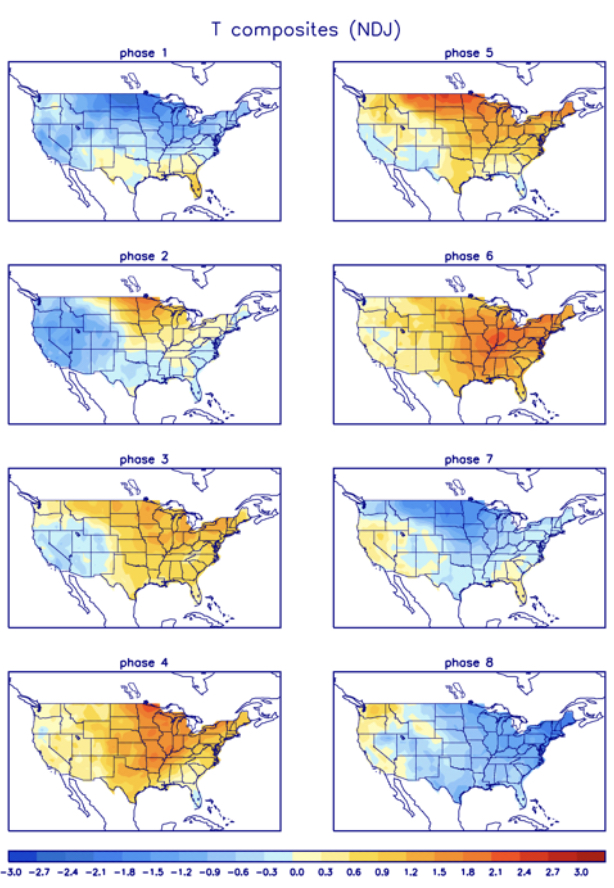
The “wildcard” in this entire December outcome has to do with the MJO. If (still a big if) we can get things to amplify, then a whip around the historically December cold phases (7, 8, and 1) appear in order.
If the MJO doesn’t get in the game, the pattern, at best, will be one of continued transition (colder and warmer than normal periods) and that’s what the majority of ensemble guidance currently shows. Without a favorable MJO, it’s tough to see how meaningful, more sustained arctic air can get into the mix, locally.
As far as storm systems of note, we’re in an incredibly quiet period and that looks to continue through the upcoming 5-6 days. We’ll keep eyes to our north where weak systems will zip by in the fast flow aloft, but most, if not all, of these should remain to our north and east. It’s not until early next weekend (looks like Friday or early Saturday as of now) when our next system of more significance is slated to impact the area.
War Eagle and happy Iron Bowl Saturday! 😀