We continue to finalize our winter forecast, which will be posted, as always, here later this month.
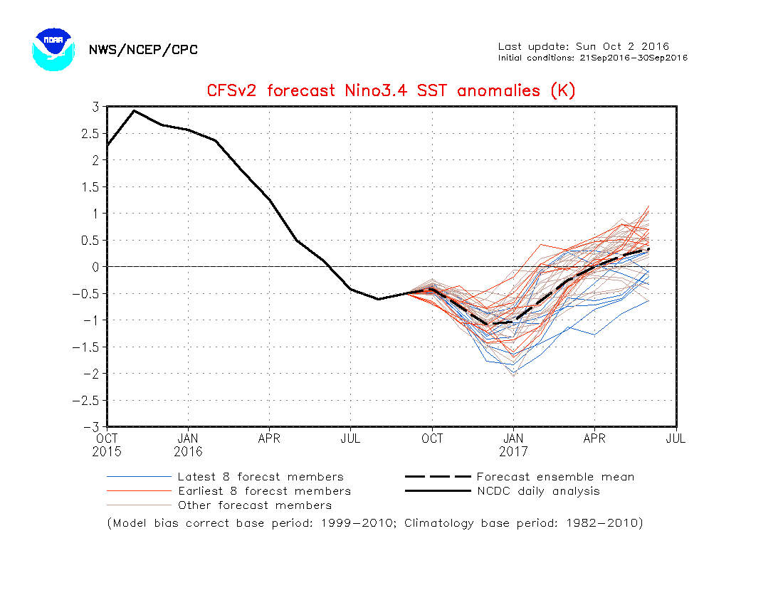
As little as only a few months ago, data suggested a major La Nina for the upcoming winter season. That data has since backed off significantly. In fact, some runs suggest we’re back into a weak-ish El Nino state by spring. At the very least, we are confident on avoiding a strong La Nina this winter and lean more in the direction of a weak Nina, at best, to neutral signal. The CFSv2 is interesting, as always, with the spread in region 3.4.
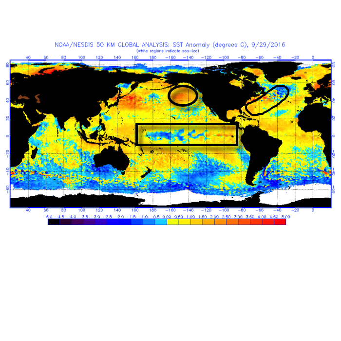
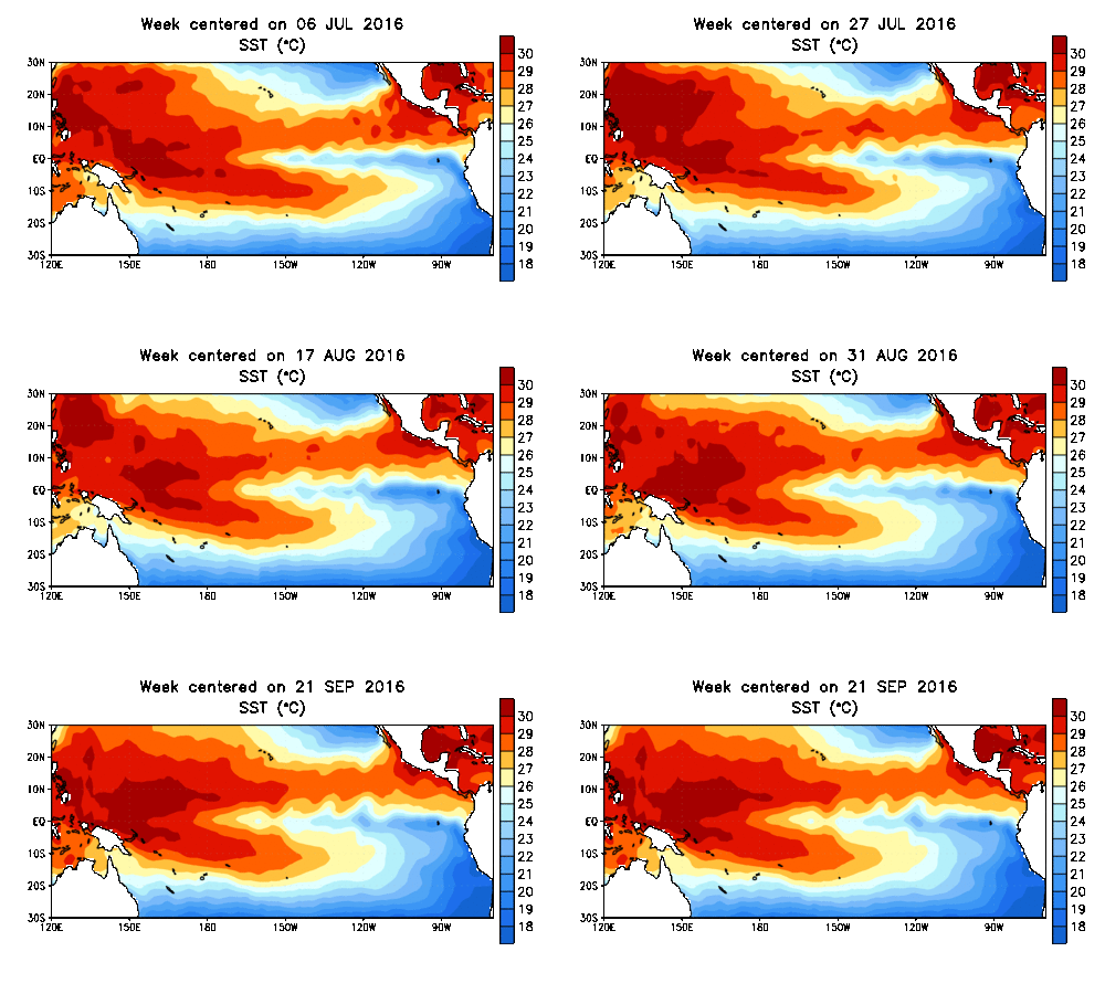 In addition to the central PAC anomalies, we also are keying in on some other items of interest in the overall SST configuration:
I. Warmth in the GOA (Gulf of Alaska)
Argues for central cold this winter, spreading east with time.
II. Warmth off the eastern seaboard
Will likely serve to limit the ability for the cold to spread east early on in the season
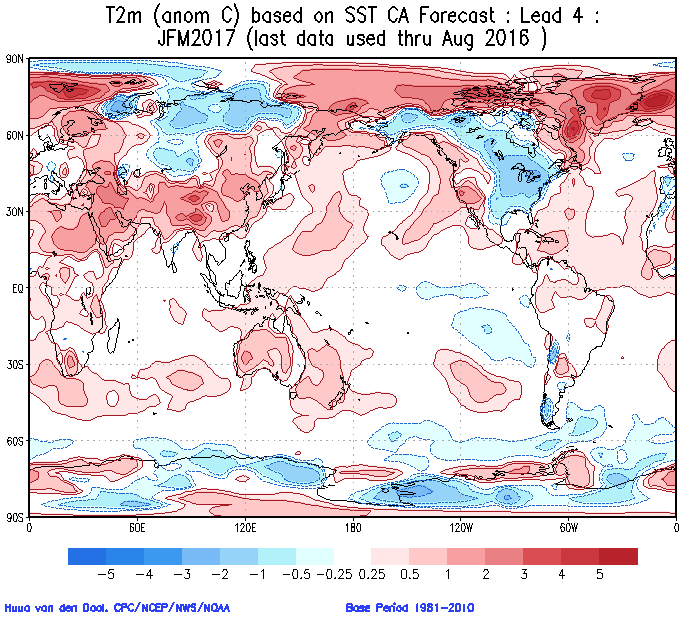
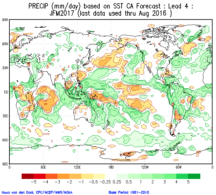
 The SST CA model is quickly becoming one of our more trusted seasonal forecast models. We note how it becomes increasingly bullish on a central and eastern trough as winter wears on (by the way, this is likely to go deep into spring this year, too).
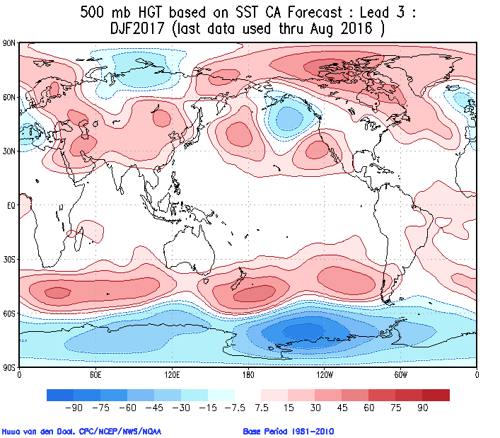
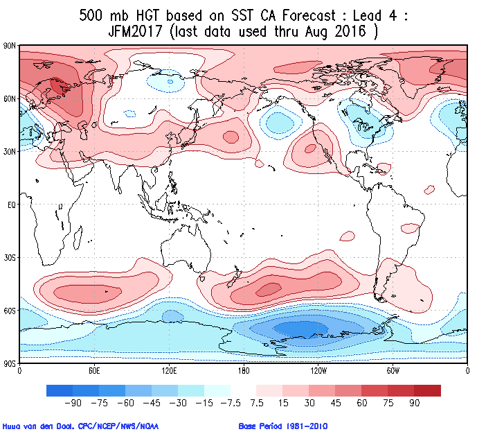 Cold overwhelms the pattern and when you combine it with the active storm track (noted by the green hues, suggesting above normal precipitation through our neck of the woods), confidence is continuing to grow for an above normal snow season.
 The SST configuration on the JAMSTEC would suggest a cold, stormy set-up, locally. That said, while it sees the above average precipitation, it’s awfully warm at the surface.
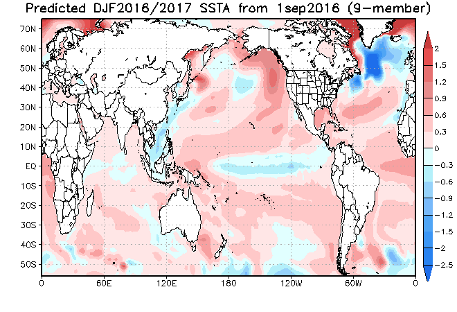
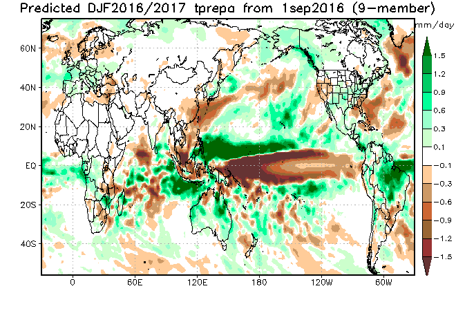
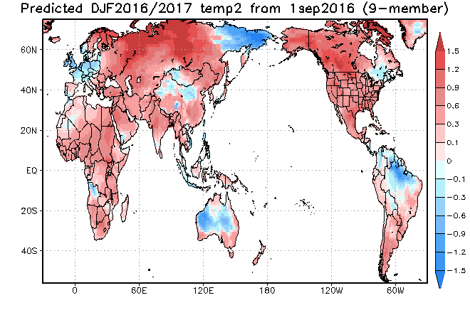 The NMME (to no surprise…) would suggest a very warm, wet winter.
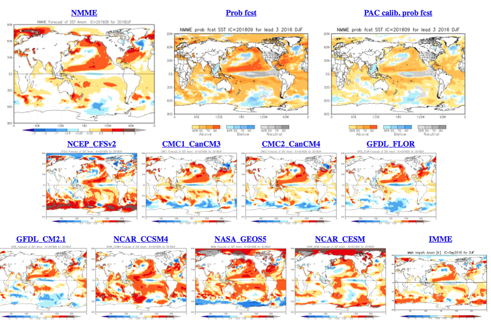
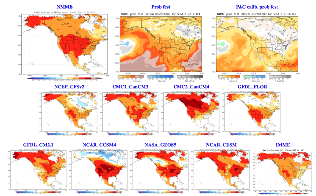
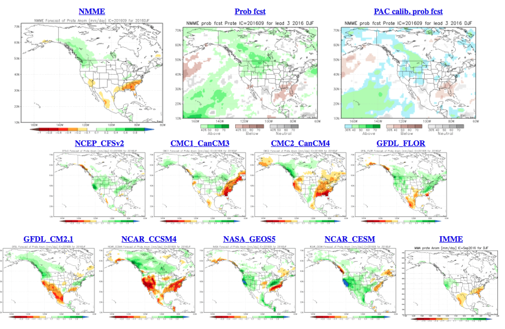 As a reminder, our complete and final annual winter outlook will be posted here during the second half of October. That will include additional model data, along with several other points behind our reasoning for our winter forecast. As we always do, we’ll put “pen to paper” when it comes to our winter forecast, including our expected temperature and snowfall anomalies. Given the data above, including the warm JAMSTEC and NMME, it’s going to be very, very hard to see a warm winter here. In fact, our idea is for the exact opposite, given the SST configuration, and lines up more closely with the SST CA idea at this point. We’re also in the camp of a very, very active storm track through the Ohio Valley. “Big-hitter” potential is present from a winter storm perspective, especially given that we are likely to see resistance from the SE ridge.
Much more later this month…
 Highlights:
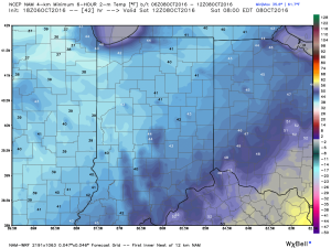
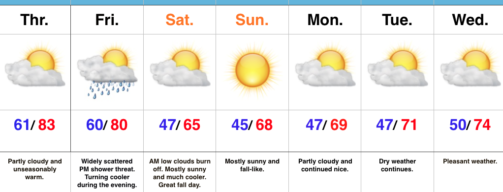
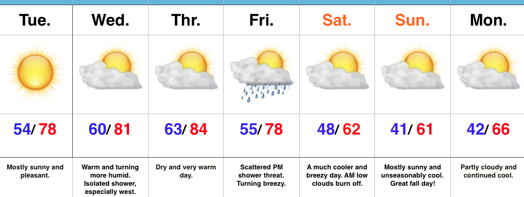
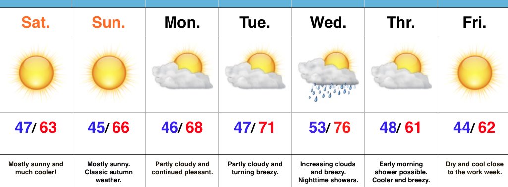
 2.) A cold front will pass through our neck of the woods as we put a wrap on the work week. While moisture is limited with the front, a much cooler air mass will greet us out the door Saturday morning. A light shower is possible Friday afternoon or evening, but this won’t be a big deal and most high school football games will remain dry. Temperatures Saturday morning will be in the 40s with lingering low clouds and areas of fog possible. We should shake the morning low cloudiness and allow for sunshine most of the day. Temperatures will remain crisp; generally in the lower to middle 60s for highs.