VIDEO: Windy Warm-Up Arrives This Weekend; Complex Pattern Next Week…
You must be logged in to view this content. Click Here to become a member of IndyWX.com for full access. Already a member of IndyWx.com All-Access? Log-in here.
You must be logged in to view this content. Click Here to become a member of IndyWX.com for full access. Already a member of IndyWx.com All-Access? Log-in here.
You must be logged in to view this content. Click Here to become a member of IndyWX.com for full access. Already a member of IndyWx.com All-Access? Log-in here.
 Highlights:
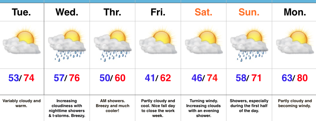
Nice Today Before Wednesday Night Storms…Mid and high level cloudiness will continue to scoot through the Ohio Valley today. While we noted a few sprinkles during the predawn hours, the air remains dry and we should be rain-free today with increasing PM sunshine.
Wednesday will turn increasingly breezy as the day progresses and a cold front will help kick up scattered showers and thunderstorms Wednesday night into the early morning hours Thursday. Behind the front, the coolest air so far this season will press southeast and set us up for a chilly close to the week.
The cool air won’t stay around long as we flip our air flow back to the south over the weekend. Showers are a good bet Sunday followed by a gusty south wind and a summer-like high in the lower 80s Monday.
A couple of notes: It’s beginning to be that time of year again when we have to get used to the wind. As the jet continues to mature, storm systems will become more frequent as we go deeper into fall. Strong winds are a given and the increasingly busy nature of the pattern is a signal of changes brewing. While we’re still a couple weeks away from a wholesale pattern change, don’t be surprised if we undergo a rather dramatic flip in the pattern as October gives way to November. This sure doesn’t look like last year in any way, and, in fact, it’s easy to argue it’s the exact opposite when it comes to early season cold and potentially wintry weather…
Upcoming 7-Day Precipitation Forecast:
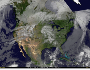
Mid and high level clouds are streaming overhead this evening and will help set up a brilliant sunset across central IN.
 Tuesday will remain rain-free across the region, along with pleasant temperatures and humidity levels (mid 70s after a low in the lower 50s).
Moisture will continue to be transported northward Wednesday, courtesy of a gusty SW breeze at times. As the approaching cold front interacts with the moisture return, scattered showers will “blossom” across the area Wednesday night into the wee morning hours Thursday.
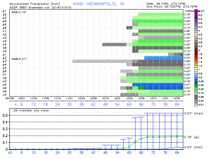
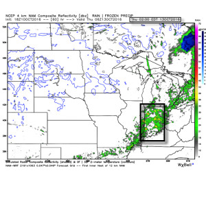 Rainfall amounts don’t look particularly impressive; generally 0.10″-0.25″ during the Wednesday night-Thursday morning time frame.
 The cool air flowing in behind the front is impressive though. In fact, highs both Thursday and Friday will likely only reach the lower 60s (if that).
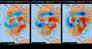
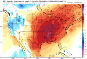
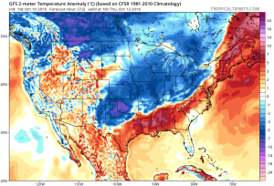 Despite the chilly air that will be with us to wrap up the work week, ensemble data is in excellent agreement on a significant warmer than average regime developing under a big eastern ridge in the 6-10 day. This will likely promote highs into the lower 80s next week for a few days. Impressive, no doubt, considering we’ll be rumbling through the second half of October by that point.
 Highlights:
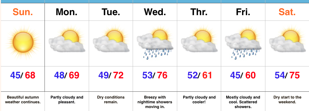
Classic Autumn Weather…Today will be just about as nice of a mid-October day that we could ask for around these parts. High pressure will supply mostly sunny skies and pleasantly cool air.
Dry weather will remain through early in the work week, along with slowly moderating temperatures as our air flow shifts to a SW direction. This will allow enough moisture return for a cold front to help spark showers Wednesday evening.
As that front sweeps through the region, reinforcing cool air will ooze back into the state. A weak disturbance will scoot south of our region Friday, but will likely be close enough to create a mostly cloudy close to the work week, along with scattered showers. Moderating temperatures return next weekend.
Upcoming 7-Day Precipitation Forecast: