Category: Unseasonably Warm
Posts will be a bit off schedule this week as I’m enjoying the beautiful beaches along the Florida Gulf Coast. That said, they will come. The weekend rain was a…
You must be logged in to view this content. Click Here to become a member of IndyWX.com for full access. Already a member of IndyWx.com All-Access? Log-in here.
Permanent link to this article: https://indywx.com/monday-morning-extended-summer/
 Highlights:
- Dry conditions return
- Moderating temperatures through the week
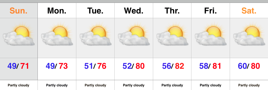
There’s no reason to waste a bunch of pixels on the forecast ahead. High pressure is building in behind the cold front that moved through here Saturday morning. As a result expect dry skies and mostly sunny conditions into next weekend. The cooler, fall-like, air of the weekend will begin to moderate back to summer-like levels into the latter portion of the upcoming work week.
Upcoming 7-Day Rainfall Forecast: 0.00
Permanent link to this article: https://indywx.com/back-to-a-dry-pattern/
It’s a wet and stormy morning across central IN as a cold front moves through the region. That said, rain will be east of the city by mid to late…
You must be logged in to view this content. Click Here to become a member of IndyWX.com for full access. Already a member of IndyWx.com All-Access? Log-in here.
Permanent link to this article: https://indywx.com/wet-stormy-start-gives-way-to-a-beautiful-fall-afternoon/
-
Filed under 7-Day Outlook, Autumn, Forecast Discussion, Forecast Models, Rain, Severe Weather, Summer, T-storms, Unseasonably Cool Weather, Unseasonably Warm
-
September 18, 2015
September to date has been drier and warmer than average across the region- right as planned thus far, overall. This morning featured a more aggressive push of showers…
You must be logged in to view this content. Click Here to become a member of IndyWX.com for full access. Already a member of IndyWx.com All-Access? Log-in here.
Permanent link to this article: https://indywx.com/a-look-where-weve-been-and-where-were-going/
Another sunny day: This morning’s satellite shows that we’re going to be looking at another mostly sunny and pleasant day across the region. Humidity remains lows for now so it’ll…
You must be logged in to view this content. Click Here to become a member of IndyWX.com for full access. Already a member of IndyWx.com All-Access? Log-in here.
Permanent link to this article: https://indywx.com/thursday-weather-notebook-3/

