The January “thaw” has taken hold the past 7-10 days.
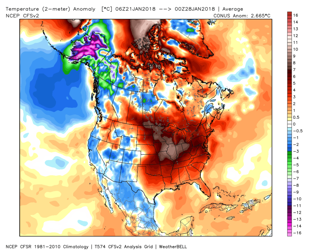 Despite the milder air over the past week, January, as a whole, is still running 4° below average at Indianapolis- a byproduct of just how frigid the first half of the month was.
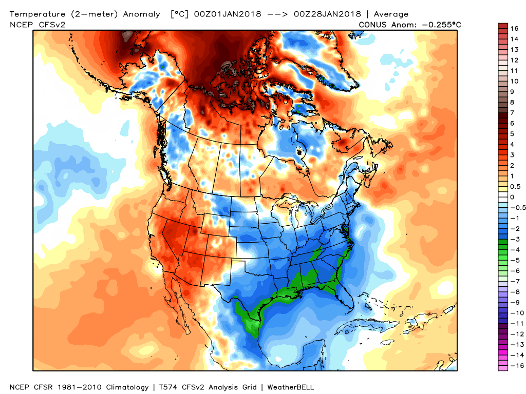 While the January thaw has been nice, times are changing and winter sure seems to be reloading for a very active second half.
Initially, we think it’s the storminess that will be most impressive as a “fight” develops between resistance from southern ridging and a new mean trough pushing southeast. The end result should be multiple snow and ice makers from the southern Plains into the Ohio Valley and northeast over the upcoming couple of weeks.
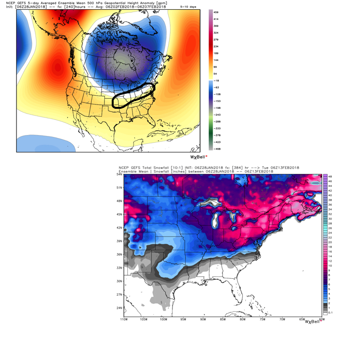 Once we get a snowpack laid down, arctic highs oozing southeast will likely lead to bitterly cold air. Recall our expectation for this pattern to yield at least (1) night of double-digit below zero lows, but it’s more towards mid-month that we think the severe cold takes hold.
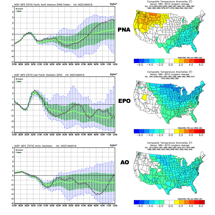
Teleconnections are lining up and in overall agreement of cold, wintry times returning.
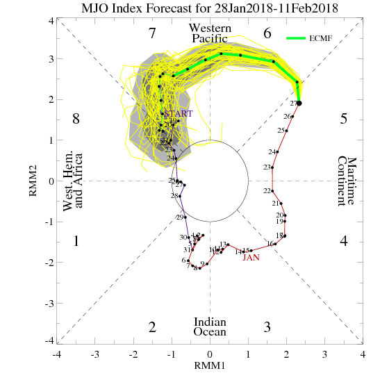
 The Madden-Julian Oscillation (MJO) is forecast to rotate into the colder phase 8 as we rumble from early to mid February. Given the amplitude of the MJO, it should continue to rumble right through the cold phases of 1,2, and 3.
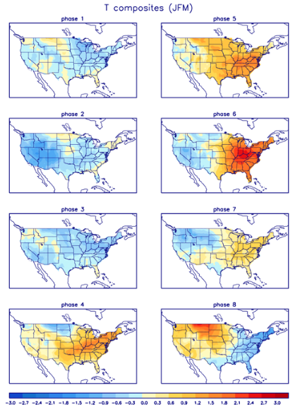 All of these moving pieces that lead up to extended periods of cold, wintry conditions are part of a bigger outcome low solar, easterly QBO winters deal up. What we should experience with this setup is a 6-7 week period of wintry conditions, including times of severe cold. It appears to be a snowier version of what we went through late-December through mid-January. Hang in there, spring will come…eventually.
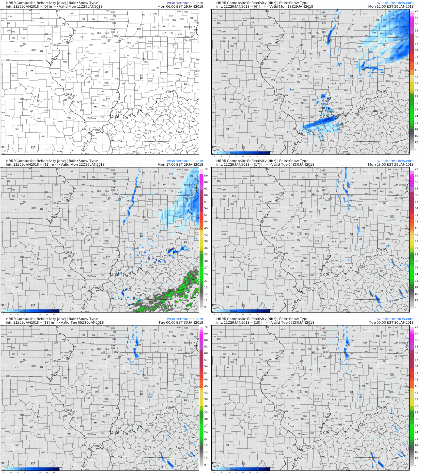 Cold high pressure will settle overhead Tuesday and Wednesday and supply a return of dry times, complete with sunshine. We’ll turn breezy in advance of our next storm system Wednesday.
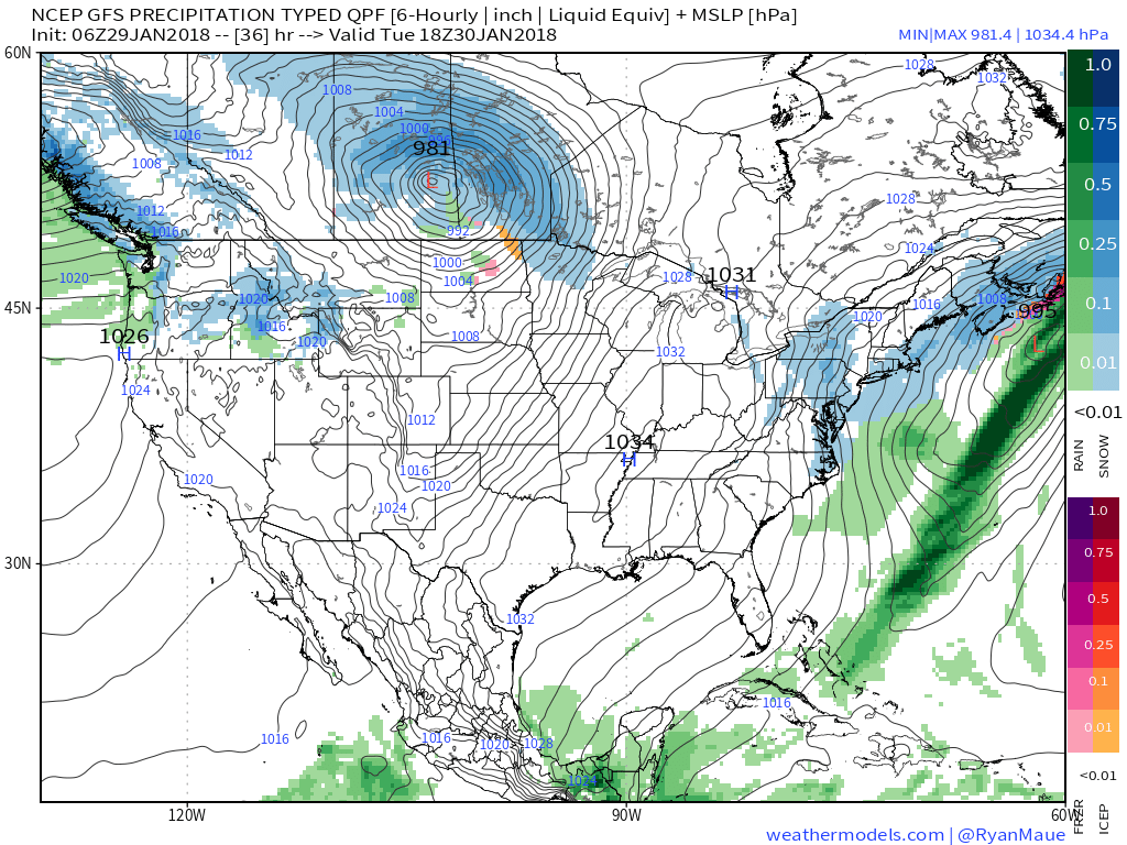 That next system will come in the form of a cold front that will settle south across the state Thursday. Light rain will overspread the region early in the day before mixing with and ending as light snow. This still doesn’t appear to be a significant event for our region at this time.
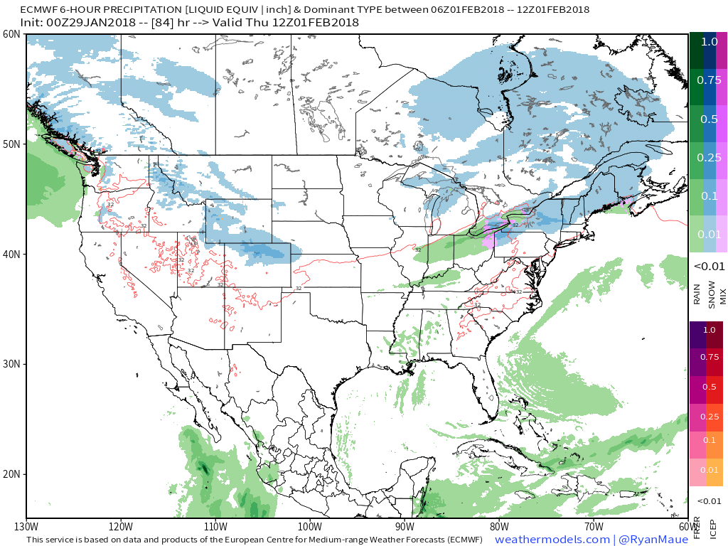 What may be a bigger deal is the event that looms this weekend. Clouds will increase during the day Saturday and a light mix of rain and snow should develop late Saturday night into Sunday morning before colder air wins out changing all precipitation over to snow.
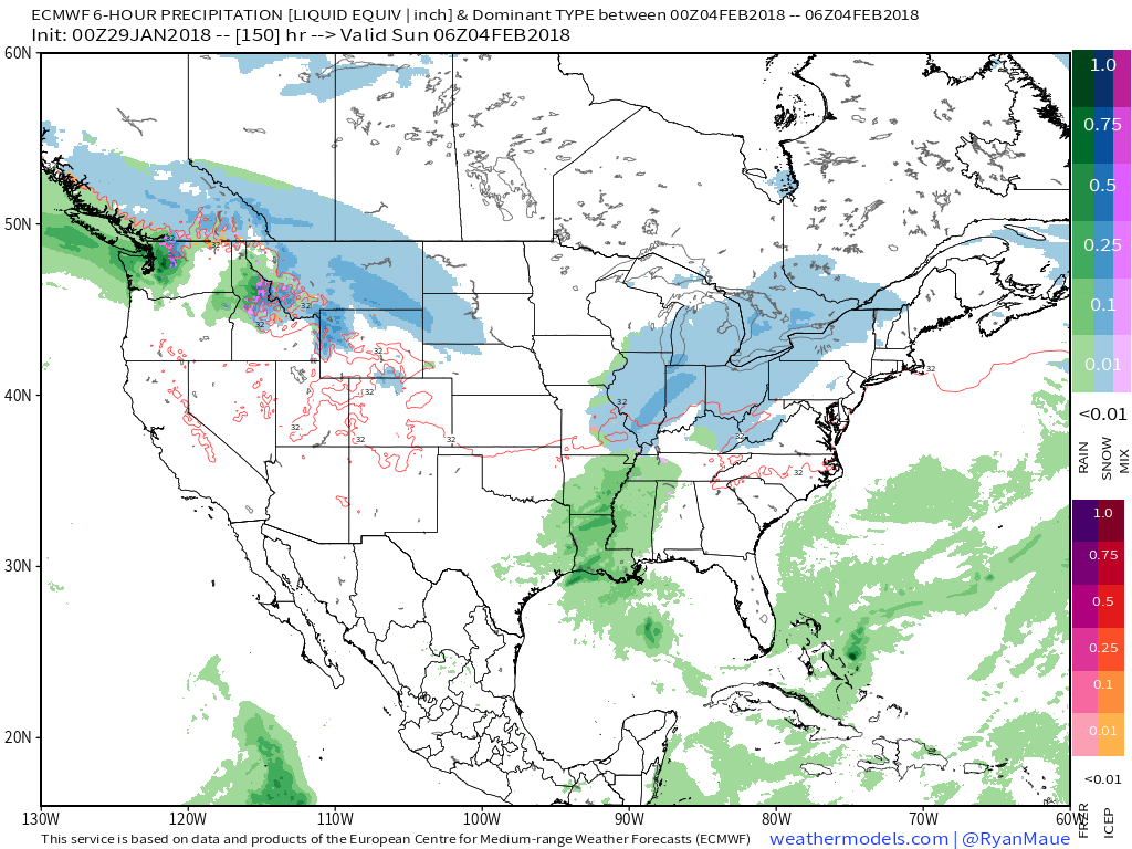 We’re getting into a pattern where the northern stream of the jet will dominate over the next 7-10 days (at least). Models will likely struggle handling individual systems and we’ll have to remain on our toes for the potential of last minute shifts with systems in such a pattern.