Category: Unseasonably Cool Weather
 Highlights:
- Increasing clouds
- Shower chances go up tonight
- Much cooler air coming
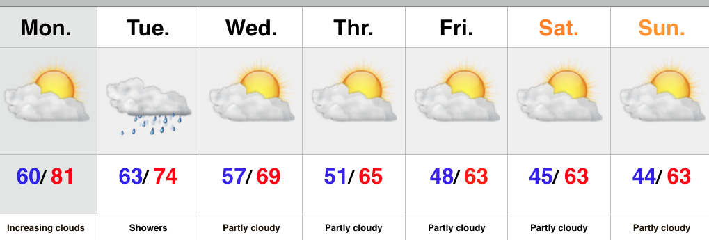
The work week has gotten off to a pleasant and dry start with sunshine across central IN. That said, a quick look at the satellite shows clouds and moisture streaming north. Expect increasingly cloudy skies as we progress through the second half of the day with showers developing tonight. The region will be in a “squeeze play” of sorts Tuesday as a cold front from the northwest and tropical moisture from the Gulf of Mexico collide. The end result will be locally heavy rainfall downstate with numerous showers extending north into central Indiana, as well.
The cold front will sweep through the region Tuesday night and help usher in a much cooler air mass for the rest of the week, continuing into the weekend. Sweaters and jackets will be needed this weekend.
Upcoming 7-Day Central Indiana Rainfall Forecast: 0.10″ – 0.30″
Permanent link to this article: https://indywx.com/warm-start-to-the-week-but-cool-changes-coming/
We’re en route back from a phenomenal family vacation along the world’s most beautiful beaches along the Florida panhandle. This was my view for the past week. Too bad…
You must be logged in to view this content. Click Here to become a member of IndyWX.com for full access. Already a member of IndyWx.com All-Access? Log-in here.
Permanent link to this article: https://indywx.com/post-from-the-road/
Meteorological fall began September 1st, but astronomical fall begins tomorrow. When we look back at summer, we note that it was a cool, wet summer with bookend dry periods. June…
You must be logged in to view this content. Click Here to become a member of IndyWX.com for full access. Already a member of IndyWx.com All-Access? Log-in here.
Permanent link to this article: https://indywx.com/looking-back-at-summer-and-ahead/
 Highlights:
- Dry conditions return
- Moderating temperatures through the week
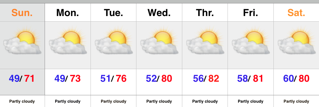
There’s no reason to waste a bunch of pixels on the forecast ahead. High pressure is building in behind the cold front that moved through here Saturday morning. As a result expect dry skies and mostly sunny conditions into next weekend. The cooler, fall-like, air of the weekend will begin to moderate back to summer-like levels into the latter portion of the upcoming work week.
Upcoming 7-Day Rainfall Forecast: 0.00
Permanent link to this article: https://indywx.com/back-to-a-dry-pattern/
It’s a wet and stormy morning across central IN as a cold front moves through the region. That said, rain will be east of the city by mid to late…
You must be logged in to view this content. Click Here to become a member of IndyWX.com for full access. Already a member of IndyWx.com All-Access? Log-in here.
Permanent link to this article: https://indywx.com/wet-stormy-start-gives-way-to-a-beautiful-fall-afternoon/


