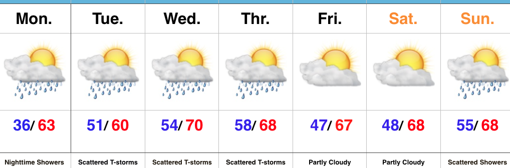
Pleasant Weekend; Summer-like Feel Next Week…
 Highlights:
- Drier trend develops
- Warming up
- Summer-like feel next week
This Is More Like It…High pressure will build into the region over the weekend. With the exception of a weak disturbance that may kick up a couple showers across northeastern portions of the state Saturday, the balance of the upcoming 7-day period will be rain-free. This extended dry spell is certainly well deserved and should continue into early next week. Get out there and make the most of it!
A southwesterly air flow will help transport a warmer and increasingly muggy air mass into the region next week. While we’ll need to keep an eye on this increasingly moist and unstable air mass for storm chances, we’re siding with a more “optimistic” approach to the forecast period and hold storm chances off until Thursday. Regardless of storm chances, next week will certainly take on a more summer-like feel…to the delight of many!
Upcoming 7-Day Precipitation Forecast:
- Snowfall: 0.00″
- Rainfall: 0.50″ – 0.75″
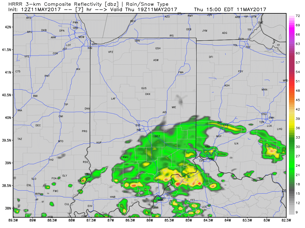
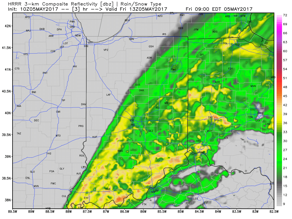
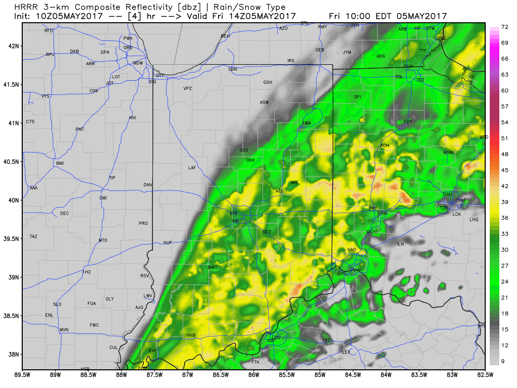
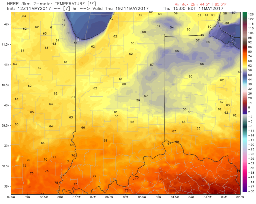 A new batch of showers will ride east and impact areas mainly along and south of I-70 as we move into late morning and early afternoon. While some embedded thunder is possible, severe weather isn’t expected today.
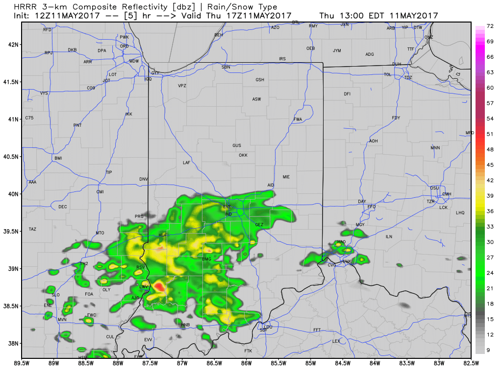
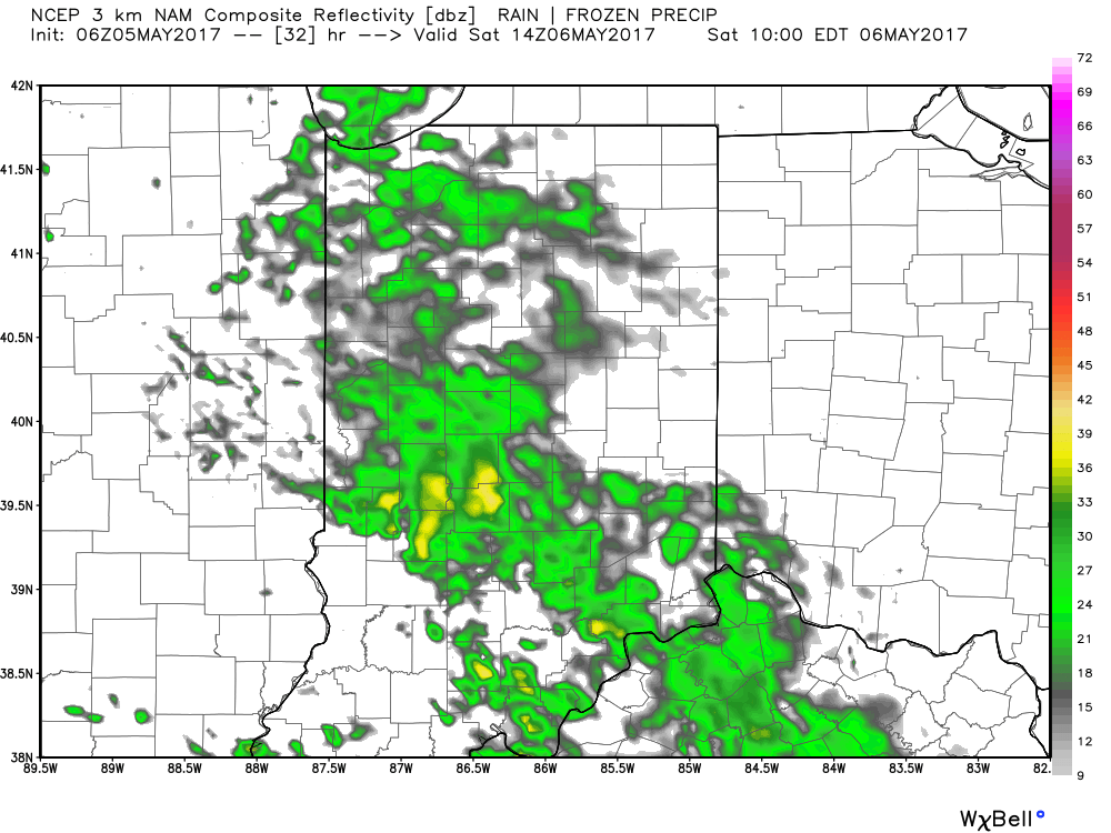
 Drier and cooler air wins out for all tonight and paves way for a gorgeous weekend ahead. High pressure will support plentiful sunshine and comfortable conditions. More on the weekend and next week’s weather later today in an updated 7-day!
 Highlights:
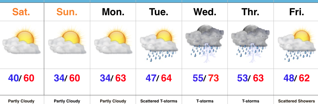 Highlights:
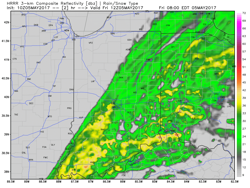
 Additional rainfall of 1″-1.5″ is likely from Indianapolis and points south and east with this band of rain before drier weather finally works in here this afternoon and evening. Otherwise, expect continued windy, cold, and raw conditions today as temperatures remain in the 40s this afternoon, including wind chills in the 30s.
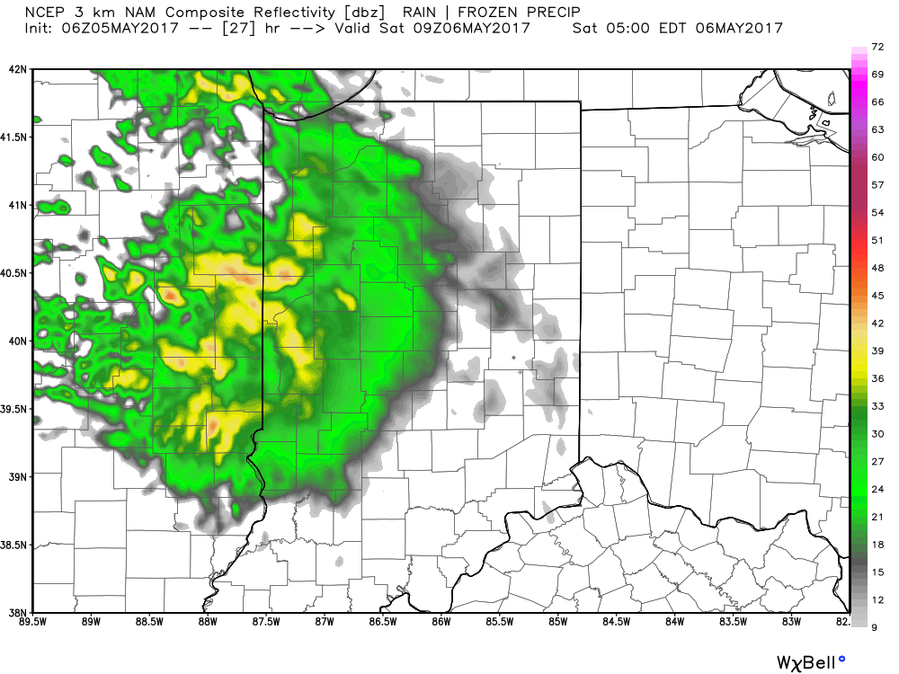
 We’ll finally get rid of the rain and introduce a drier regime Saturday afternoon into Sunday, including a sunny close to the weekend. With the drier air, overnight lows will fall to frosty levels Sunday and Monday mornings (lower to middle 30s).