Heavy Rain And Storms Thursday; Phenomenal Weekend Ahead…
Highlights:

  • Turning more humid this afternoon
  • Heavy rain Thursday
  • Cooler and drier weekend ahead

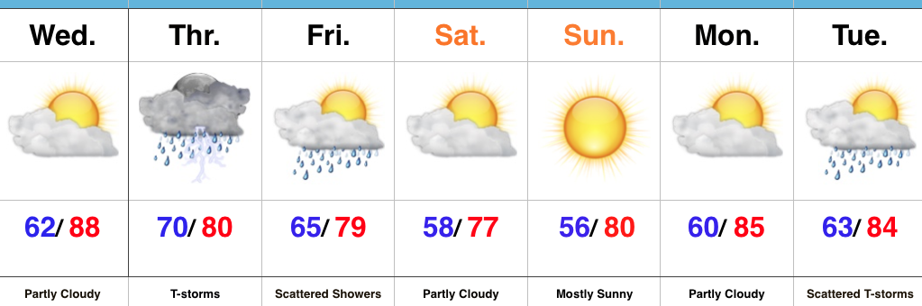
Heavy Rain Tomorrow…Wednesday is getting off to a pleasant and beautiful start across the Hoosier state.  Sunshine will be with us throughout the day, but our pleasant air mass that we’re awaking to will grow increasingly moist this afternoon and evening.  Our next storm system approaches late tonight and will help push widespread rain and thunderstorms across the state early Thursday morning.  With such high water content in our air mass, expect periods of heavy rain across the region.  Localized flooding will result.

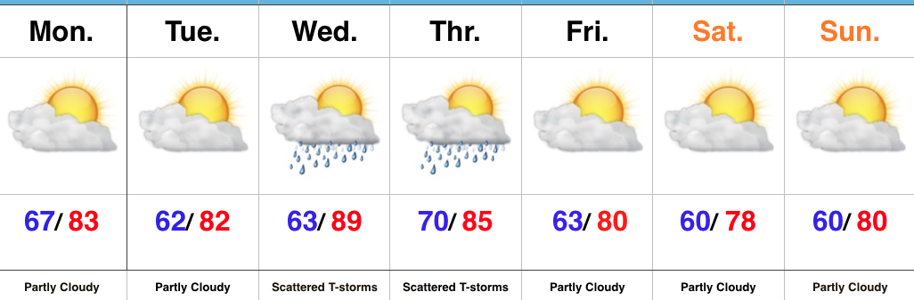
The trade off to the wet and stormy Thursday will be an incredible weekend.  Despite a few lingering showers Friday, we’ll notice a dramatic drop in humidity Friday night and this will set the stage for a refreshing last weekend of July.  In fact, temperatures will grow cool enough both Saturday and Sunday mornings to perhaps trigger a feel of early autumn for some.  Plentiful sunshine can be expected along with unseasonably low dew points with a northeasterly flow in place.

Temperatures and moisture levels will slowly increase as we get into early next week.  With the increasing humidity, expect increasing chances of showers and thunderstorms towards the middle of next week.

Upcoming 7-Day Precipitation Forecast:

  • Snowfall: 0.00″
  • Rainfall: 2.00″ – 3.00″

Now This Is More Like It…

Highlights:

  • Less humid air builds in
  • Mid-week storms
  • Refreshing weekend

Pleasant Open To The Work Week…High pressure will build overhead today and result in a dry open to the work week.  A surface front moved south through the region late last night and north winds will help drier air continue to build in as we move through the day.  By this evening, we’ll really feel the more refreshing brand of air.

We’ll remain rain-free through Tuesday before our next cold front approaches late Wednesday into Thursday.  Most of Wednesday will remain dry, as well, but we’ll mention chances of a late night thunderstorm arriving from the northwest.  Better overall coverage of showers and thunderstorms can be expected Thursday.

Timing is our friend this go around as the front passes Thursday evening, allowing a much drier and cooler air mass to build in.  Considering this is the last weekend of July, it’ll feel very, very pleasant.

Upcoming 7-Day Precipitation Forecast:

  • Snowfall: 0.00″
  • Rainfall: 0.50″ – 1.00″

Afternoon And Evening Rumbles…

Highlights:

  • T-storms arrive this afternoon
  • Heating up this week
  • Stormy periods late-week

Pleasant Start; Stormy Finish…After we got rid of the low level clouds and fog Saturday, it turned out to be a gorgeous day!  The balance of our Sunday will also be very pleasant, but a frontal boundary will push through the state this evening and will be sufficient enough to kick up a line of showers and thunderstorms that will impact central IN this afternoon and evening.  One or two of the storms could reach severe levels (large hail and damaging wind).

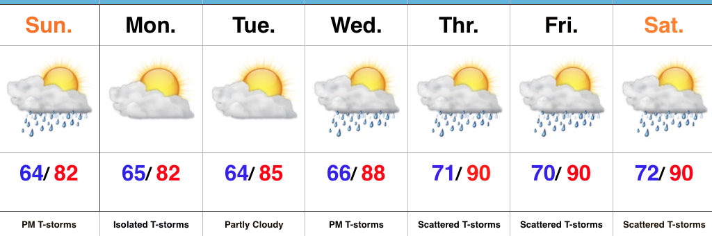
As we look forward, the big weather story this week will be the increasingly hot and muggy feel by late-week.  Factor in that highs will approach 90° the second half of the week, along with dew points exceeding 70° and the stage will be set for a truly “oppressive” feel.  Prepare to sweat.

Along with the increasingly heat and humidity, we’ll also note an increase in overall coverage of showers and thunderstorms through the late-week stretch.  Individual disturbances will create periods of more widespread storms and with such a moisture rich air mass in place, expect periods of locally heavy rainfall.

Upcoming 7-Day Precipitation Forecast:

  • Snowfall: 0.00″
  • Rainfall: 1.50″ – 2.50″

“Rinse & Repeat” Pattern…

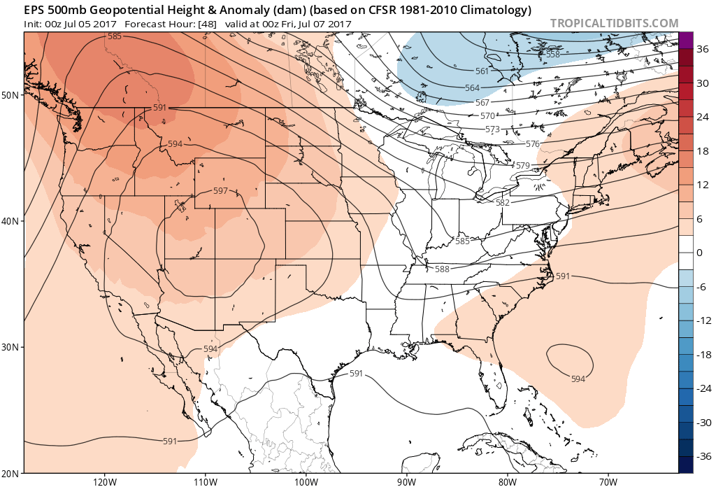
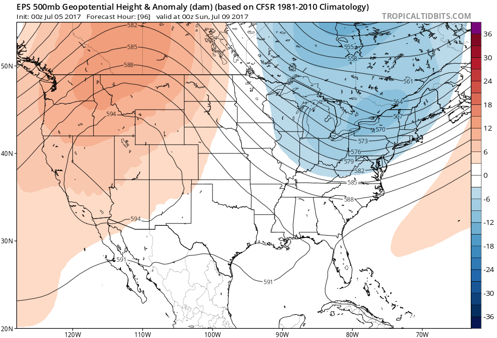
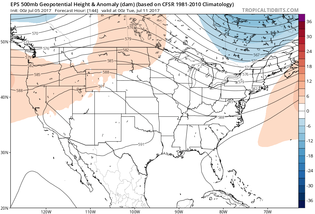
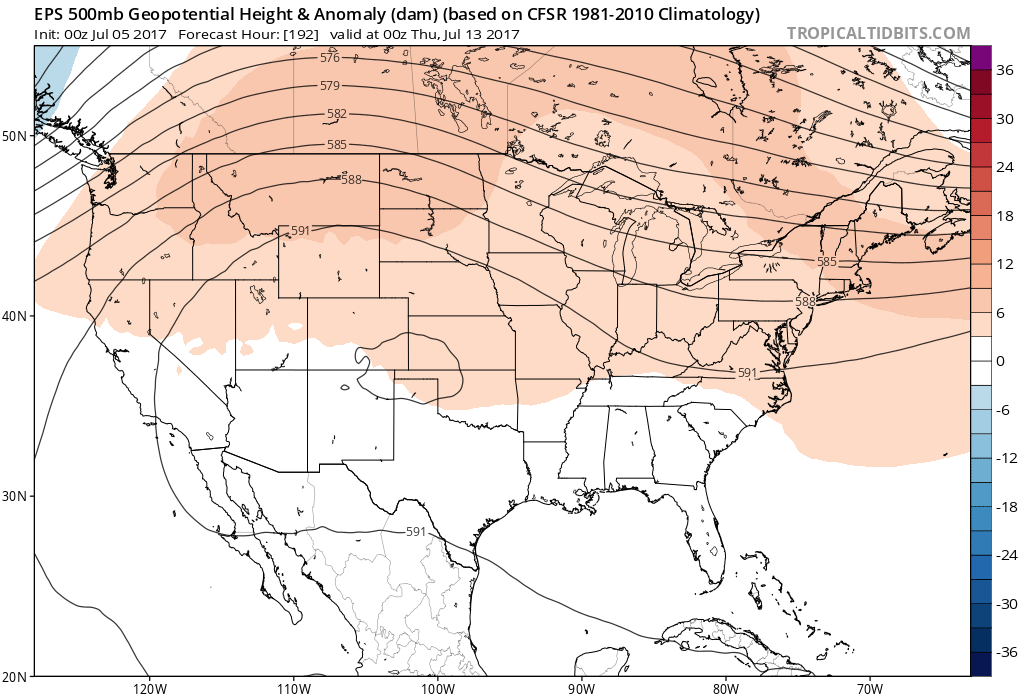
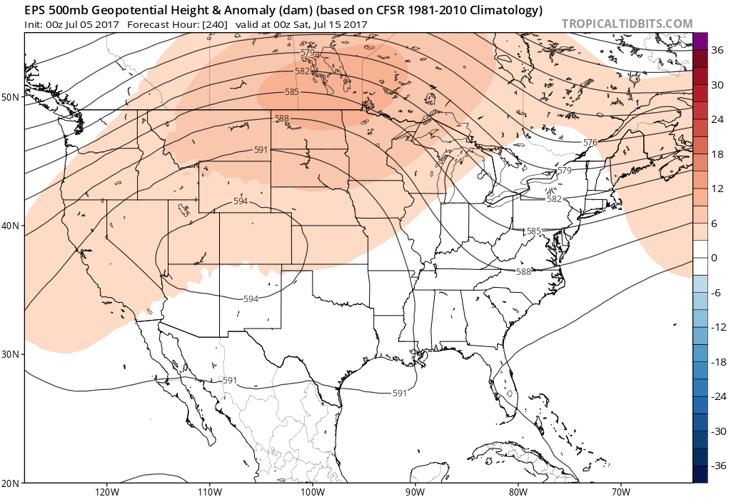
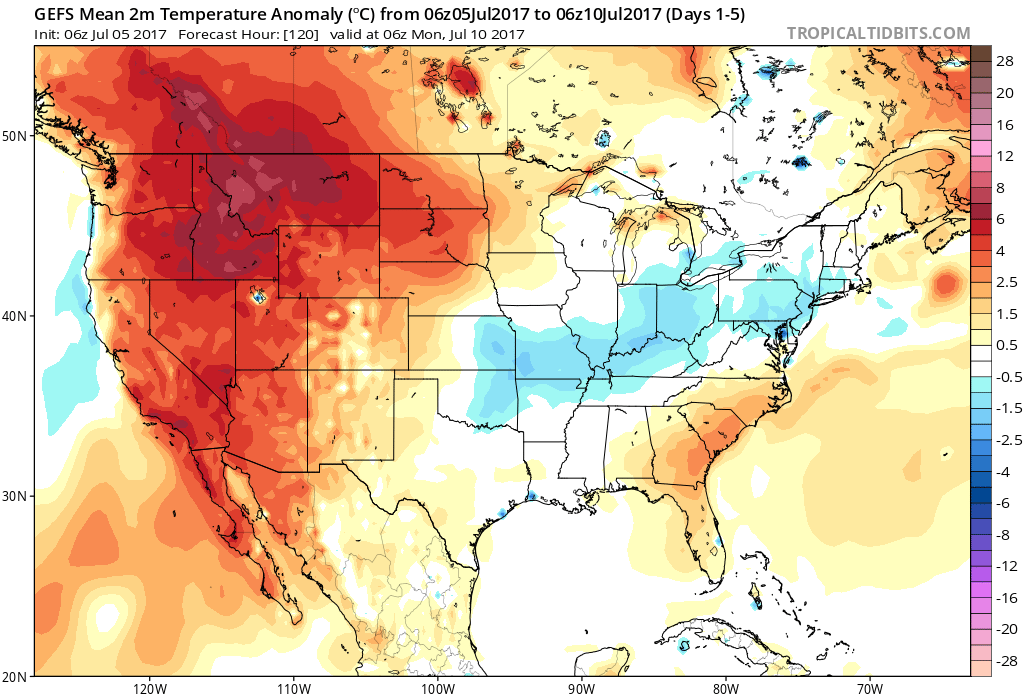
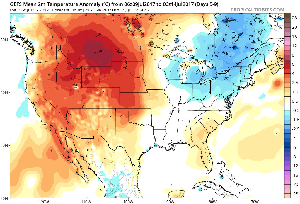
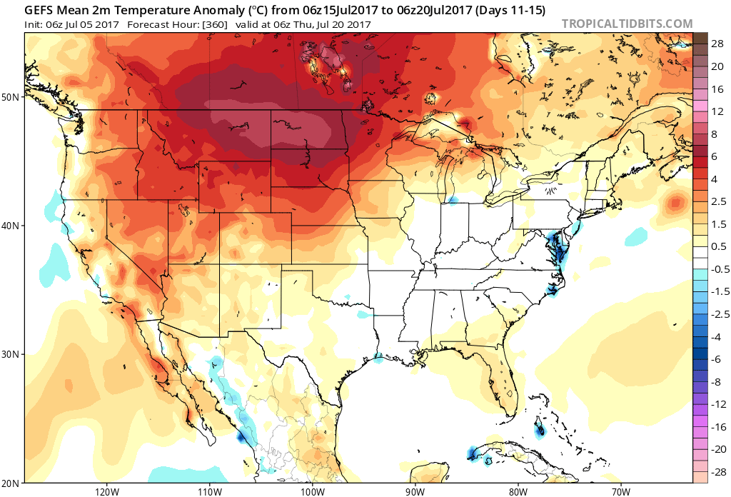
As we look deeper into mid and late July, the one item that continues to stand out in our weather pattern is a lack of any serious heat, relative to average. It’s obvious that the “hot dome” really wants to set up shop over the Rocky Mountain region and while brief “spurts” of warmer air will try to eject out towards our region, the balance of the medium and longer range looks to be dominated by a northwest flow aloft and seasonal to slightly below average conditions. 


At least through mid-July, this will keep the west and Rocky Mountain region well above average and promote seasonal to cooler than average conditions, overall, for our region.