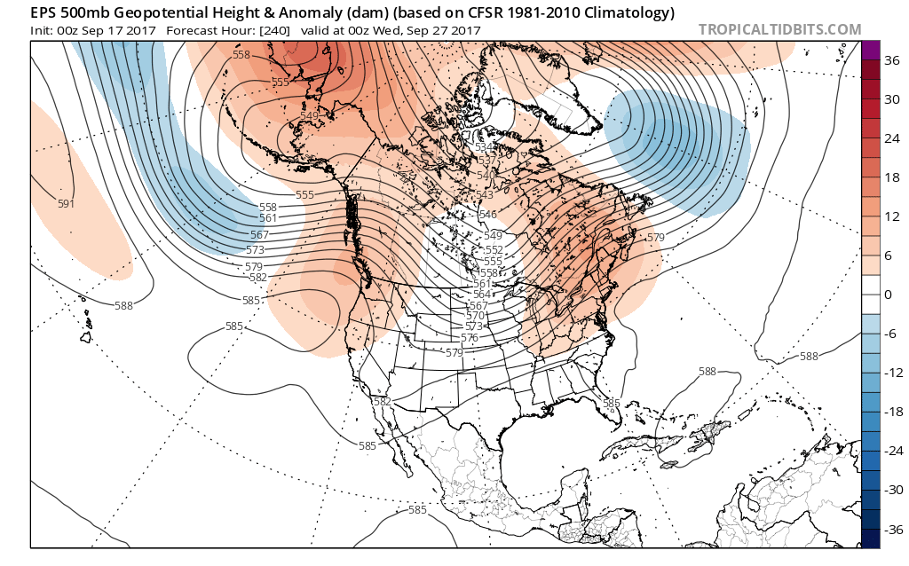
VIDEO: Transitional Pattern Over The Upcoming 10 Days…
You must be logged in to view this content. Click Here to become a member of IndyWX.com for full access. Already a member of IndyWx.com All-Access? Log-in here.
You must be logged in to view this content. Click Here to become a member of IndyWX.com for full access. Already a member of IndyWx.com All-Access? Log-in here.
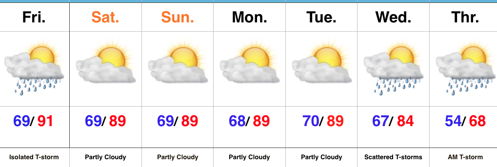 Highlights:
A Little Something For Everyone…If you’re a fan of summer, this forecast has it! If you’re a fan of fall, this forecast has that, too! Summer-like heat will dominate through the short-term with only a slight chance of an isolated thunderstorm today. Most will remain dry and that dry theme will carry us into the new work week ahead. Unseasonably hot (upper 80s to near 90 is downright hot) conditions will also continue as we open up the new week.
That said, a long advertised cold front will push towards the region by midweek and this will provide enough lift to create widely scattered thunderstorms Wednesday into Thursday morning. Significant and widespread rains aren’t, unfortunately, anticipated. The bigger deal will be the much cooler air that will spill into the region Thursday and set the stage for an unseasonably cool open to October.
Upcoming 7-Day Precipitation Forecast:
There are no changes to our ongoing forecast of “bonus” summer-like conditions into early next week. Highs will continue to zoom into the upper 80s and overnight lows will remain well above average (mid-to-upper 60s). (Keep in mind, averages now feature highs in the mid-70s and lows in the mid-50s).
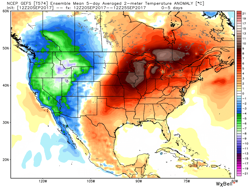 However, a cold front will approach the middle part of next week and while this won’t be an efficient rain producer, it will serve to deliver a return of fall-like air as we close September and open October. From a precipitation stand point, rainfall amounts look “anemic” at best over the upcoming 7-10 days.
At this distance, scattered showers and thunderstorms are possible with the FROPA, but many will remain rain-free and even those that do pick up a shower or storm shouldn’t expect significant rains. What will be a much bigger deal will be the return of an authentic fall feel by next Friday, continuing into early October.
Quick video update for you coming live from Santa Rosa Beach, FL!
You must be logged in to view this content. Click Here to become a member of IndyWX.com for full access. Already a member of IndyWx.com All-Access? Log-in here.
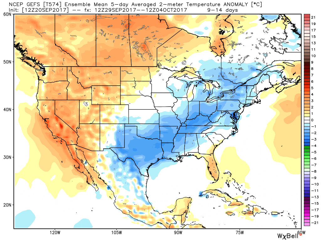
So far this month, unseasonably cool conditions have set up shop across the eastern portion of the country (IND is running more than 4° below normal through the 16th) while the west has experienced a much warmer than average pattern.
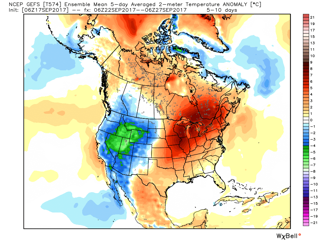
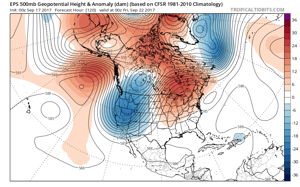
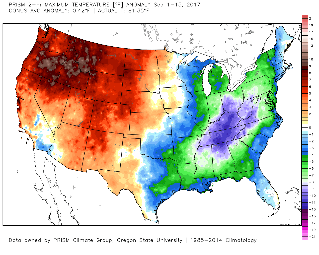 That will flip around in big time fashion this week as a highly amplified pattern takes hold. The mean trough position will shift into the west and lead to an early taste of winter, including mountain snow. Meanwhile, our region will make up for lost time in the summer department, including highs generally in the mid to upper 80s (around 10° above average).
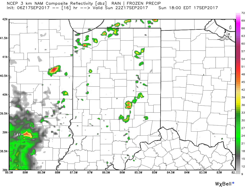
 Daily chances of widely scattered afternoon and evening thunderstorms will be with us beginning today through the majority of the upcoming week. Everyone won’t get wet, but there will be a couple of localized heavy downpours on area radars at times. As dry as we’ve been, we’ll take what we can get.
 Eventually, the pattern will “relax” (at least briefly) out towards Day 10. This will feature a more seasonable regime returning to the region, along with better chances of more widespread rains as a cold front approaches. We’ll also have to keep a close eye on additional tropical threats to the southeast region…