The Last Month Of Meteorological Summer Is Upon Us…
You must be logged in to view this content. Click Here to become a member of IndyWX.com for full access. Already a member of IndyWx.com All-Access? Log-in here.
You must be logged in to view this content. Click Here to become a member of IndyWX.com for full access. Already a member of IndyWx.com All-Access? Log-in here.
It’s a nice start to the day, though patchy dense fog is impacting some communities this morning. Sunshine will burn through the fog over the next hour, or two.
 That said, things will change as we progress into the prime heating hours of the afternoon and evening. Upper level energy will rotate east out of the Plains (this morning) and across Indiana this afternoon and evening.
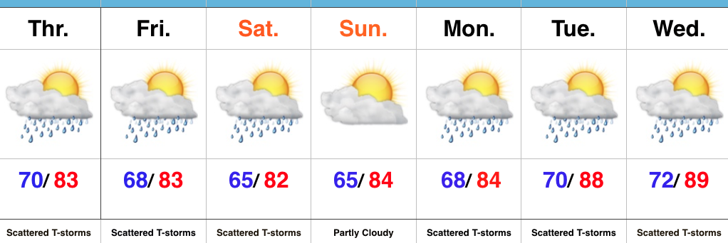
 This will help ignite thunderstorm development during the afternoon and evening. While a storm could impact any given neighborhood this evening, best concentration of storms should lie north of the I-70 corridor. Locally heavy rain will be a good bet with the stronger storms. Localized rainfall amounts in excess of 2″ will be possible.
 Additional scattered thunderstorm activity will continue Saturday, but there will be many more dry hours than wet/ stormy.
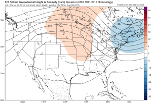
Looking ahead, a shot of heat will come out next week (lower 90 potential), but this will be transient. By the 8-10 day period, we’re back into an active NW flow type look. You know the drill by now. That means potential storm complexes and the worst of the heat to our west, relative to averages.
 Highlights:
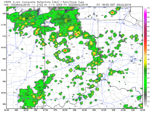
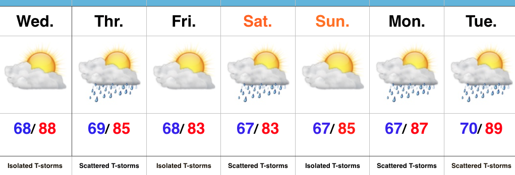
Stormy At Times…Widespread thunderstorms have resulted in as much as 4″-5″ of rain across southeastern IN during the early morning hours. Flash flooding has resulted (including in and around the Cincy area, as well). Closer to the home front, upper air energy will combine with a weak surface wave of low pressure to result in an enhanced storm chance this afternoon and evening across central IN. Some locally heavy rain will accompany the stronger storms that develop, along with vivid lightning.
Scattered storm chances will remain Friday into Saturday, but there will also be plenty of dry hours, as well. Drier air should keep most of the state rain-free Sunday before an unsettled regime returns for early and middle parts of next week.
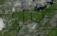
Upcoming 7-Day Precipitation Forecast:
 Highlights:
More Sunshine Today…Areas of heavy rain resulted in localized flooding across south-central IN yesterday. While we can’t go with a completely dry forecast today, it will be an overall drier day when compared to Tuesday. An isolated thunderstorm is possible, but most should remain dry.
Upper level energy and increased moisture will lead to a more widespread coverage of showers and thunderstorms Thursday. With precipitable water values approaching 2″ in spots Thursday, localized hefty downpours will again be possible.
We’ll continue scattered storm chances this weekend, particularly Saturday, as renewed upper level energy moves overhead. After a slightly cooler stretch of weather, compared to normal, we’ll begin to heat things back up next week.
Upcoming 7-Day Precipitation Forecast:
You must be logged in to view this content. Click Here to become a member of IndyWX.com for full access. Already a member of IndyWx.com All-Access? Log-in here.