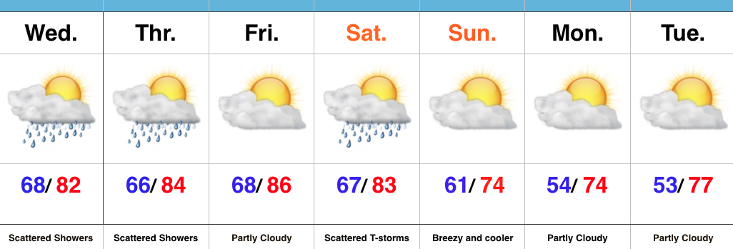
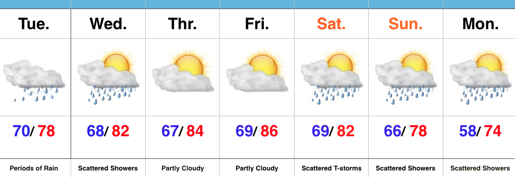
Scattered Storms; Turning Much Cooler…
 Highlights:
- AM fog burns off today
- Scattered storms
- Much cooler air coming
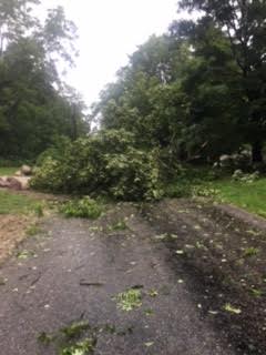
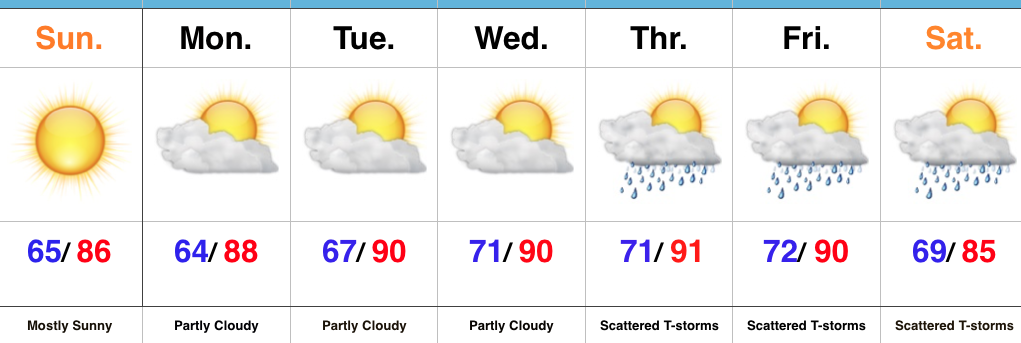
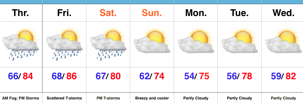
Afternoon And Evening Thunder…Morning fog (some dense) will eventually burn off and give way to a muggy day. As afternoon heating takes place, scattered evening thunderstorms are a good bet, especially north of Indianapolis. We’ll repeat this to wrap up the work week Friday.
A cold front will take aim at the region Saturday evening and scattered showers and thunderstorms will accompany this boundary as it moves through. A few storms could reach strong to severe levels Saturday PM as the front moves through.
Winds will shift to the NW and usher in a much cooler and drier brand of air for the second half of the weekend, continuing into the early portion of next week. Many will likely be craving fall by early next week coming off multiple mornings with lows in the 50s.
Upcoming 7-Day Precipitation Forecast:
- Snowfall: 0.00″
- Rainfall: 0.50″-1.00″