
The updated Sea Surface Temperature Constructed Analog model is in for the winter. In short, it suggests a slow start to winter gains momentum and turns much colder as mid and late winter arrive. It’s also a stormy look, locally, and would imply big-hitter potential in the Ohio Valley.
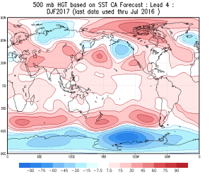
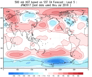
500mb pattern
*Note how the trough becomes more established over the central and east during the January through March period.


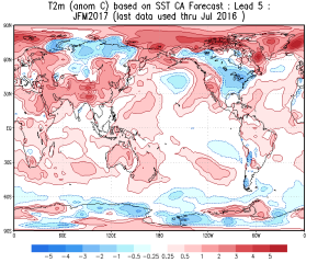
Temperature anomalies


The consistency is remarkable on the bullish cold signal for the central and east for the January-March time frame. We note high agreement, month-over-month, on the J-M time frame being significantly cold.
Precipitation anomalies
*No doubt a stormy signal through the Ohio Valley.

 Time is ticking…winter will be here before we know it! Our official annual winter outlook will be out in October.
 Precipitation DJF
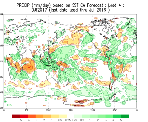 Temperature anomalies DJF and JFM
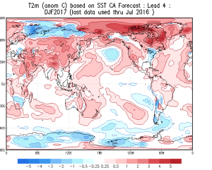
 Hmmmmm… 🙂