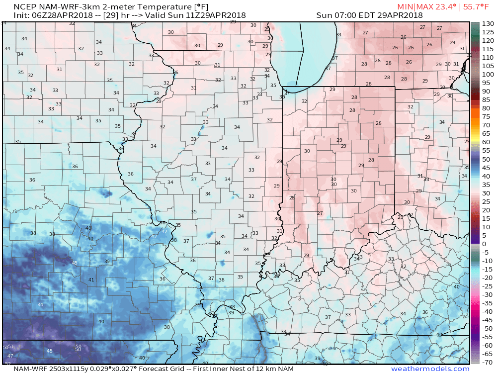
I. A cold front blew through the state last night and we’ll deal with a gusty northerly breeze throughout the day. At times, periods of low clouds will be with us, especially into the early afternoon hours. As skies clear and winds diminish tonight, a hard freeze is likely for most of central Indiana, including the potential of setting a new record low in Indianapolis (record low for Sunday is 31°).
 II. High pressure will build in for the second half of the weekend and remain in control of our weather through the first half of the work week. Dry conditions will remain along with a significant warming trend.
 III. We’ll actually go above normal (for a change) through the early and middle parts of next week, including highs around 80° by Tuesday!
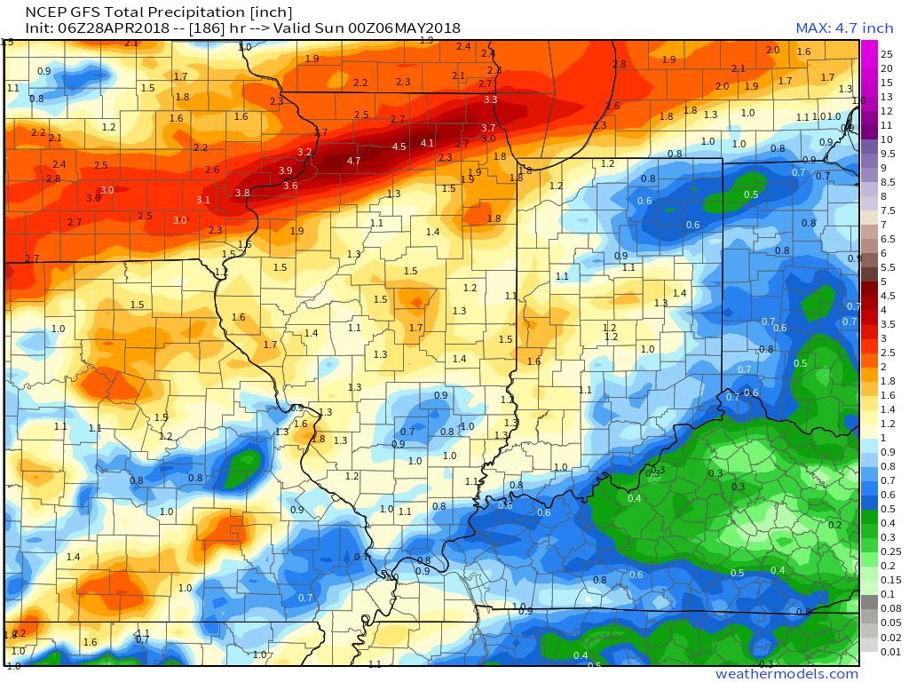
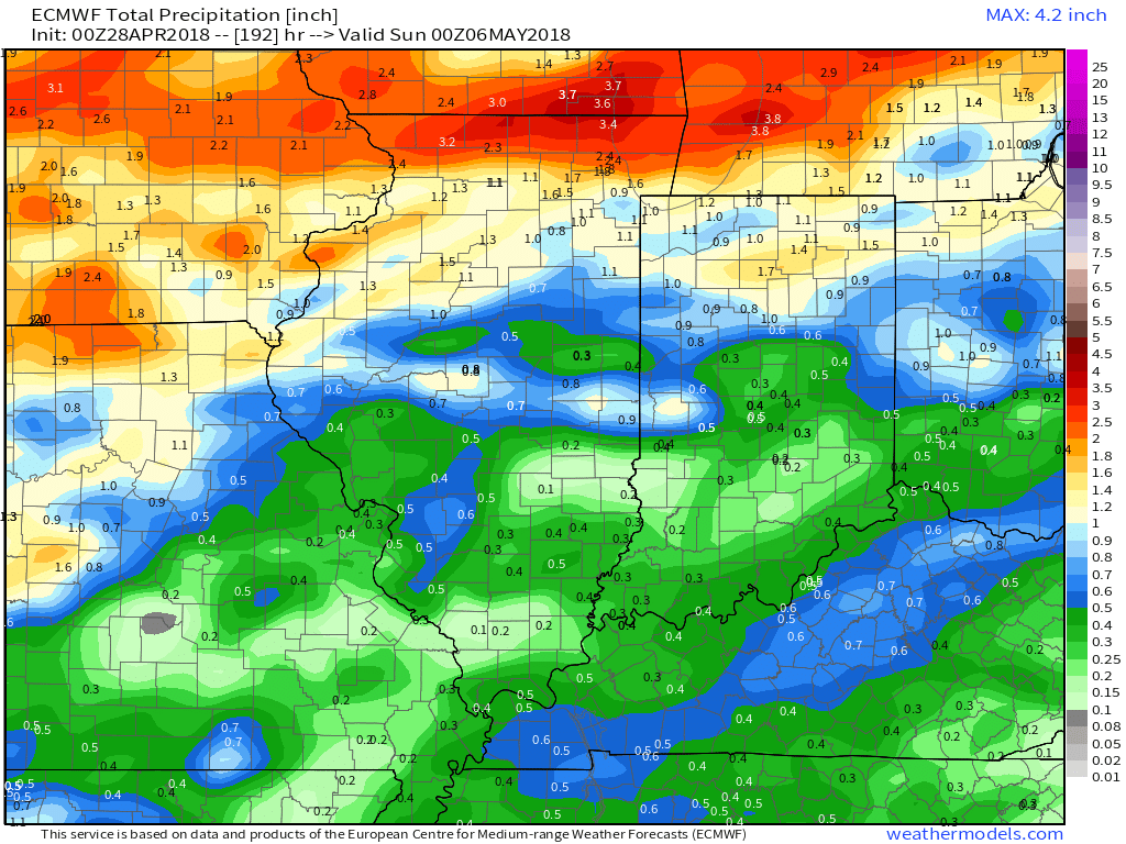
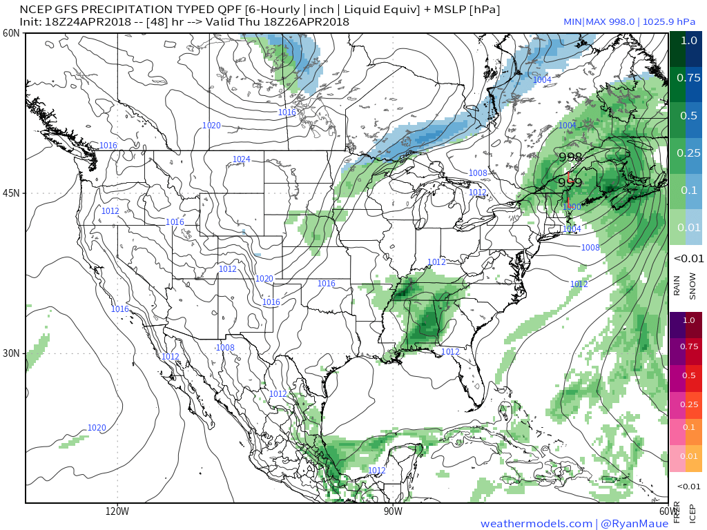
 IV. Unsettled weather returns for the second half of the work week. Models differ on rainfall totals, but we’ll include mention of 7-day totals in the 0.75″ to 1.25″ range- most of which falls Thursday and Friday.
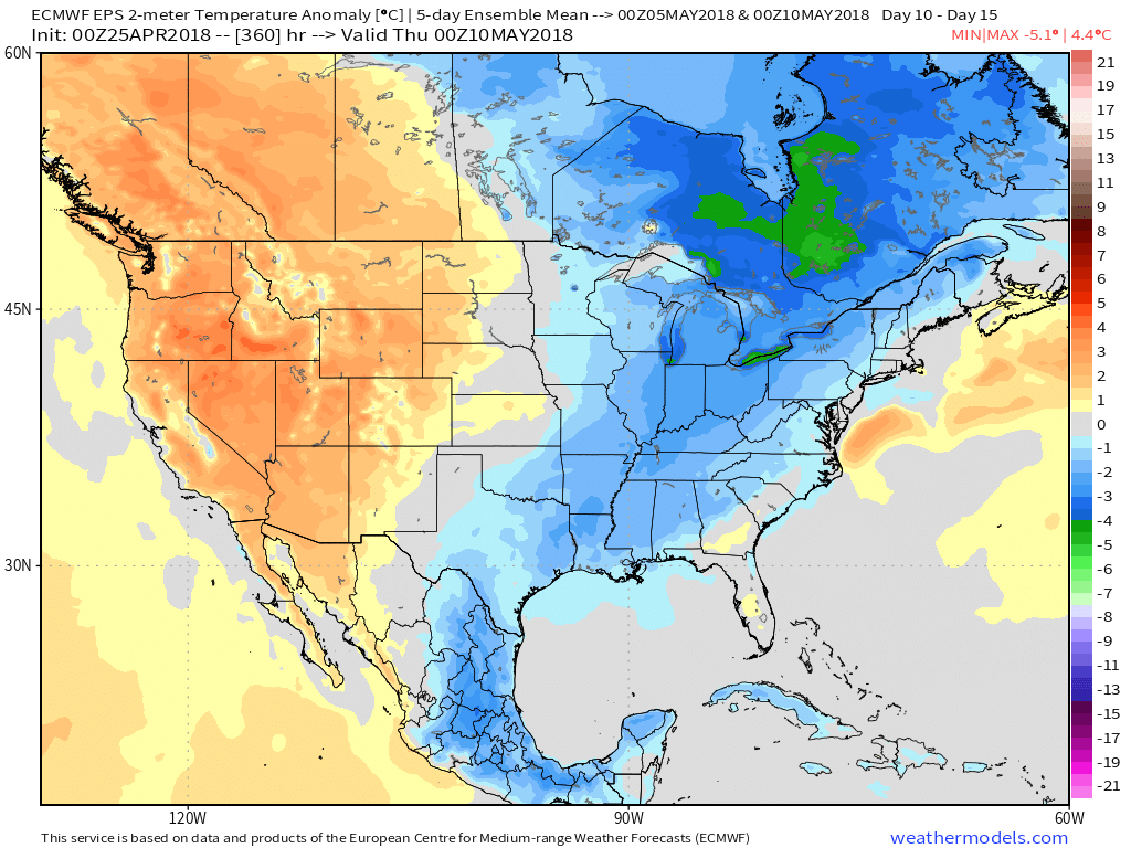
 V. Cooler than normal temperatures will return for Week 2 so be sure to enjoy the warmth while we have it next week.

 Temperatures will remain cooler than average, but that late-April sun will feel mighty nice, especially after a couple days of “showery” overcast and 50s.
 High pressure will quickly build in thereafter and lead to the best weather weekend so far this spring. Saturday and Sunday should feature plentiful sunshine both days. Morning lows will be chilly (upper 30s to lower 40s for most), but daytime highs will zoom into the 60s both days.
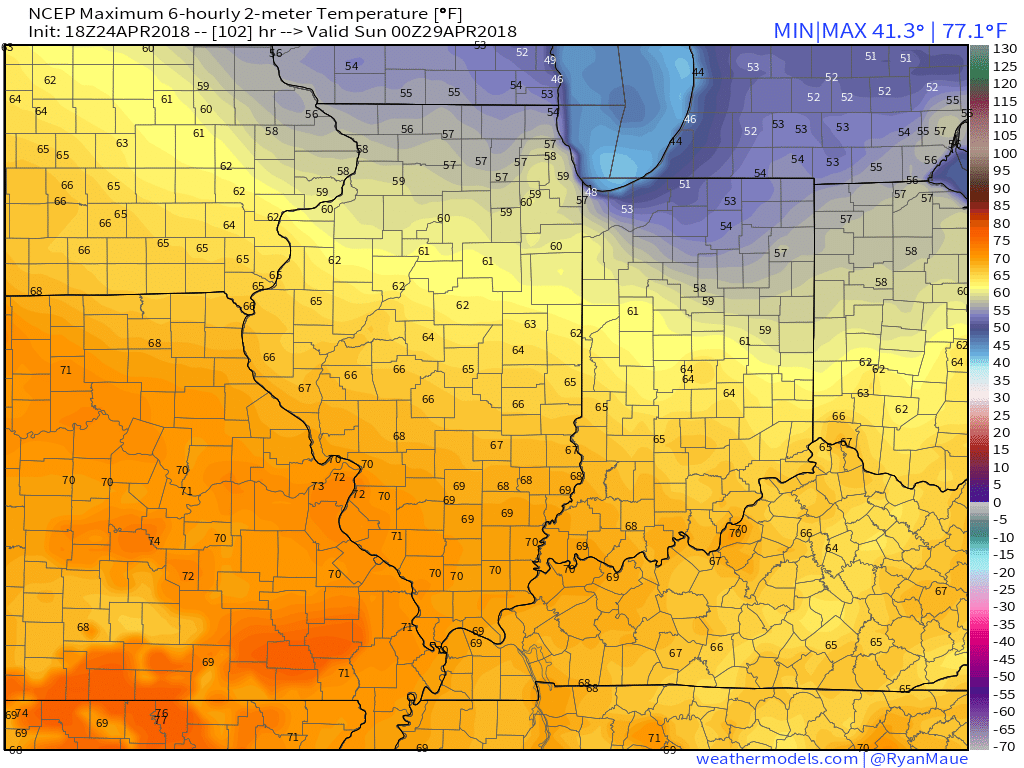 As we look ahead, warmth will continue to build as we open May. Lower 80s seem to be a good bet as we move into next week, but before we get into sustained warmth, another “setback” or two seems to be a good bet. We note the EPS showing this nicely as cooler anomalies return by Week 2.
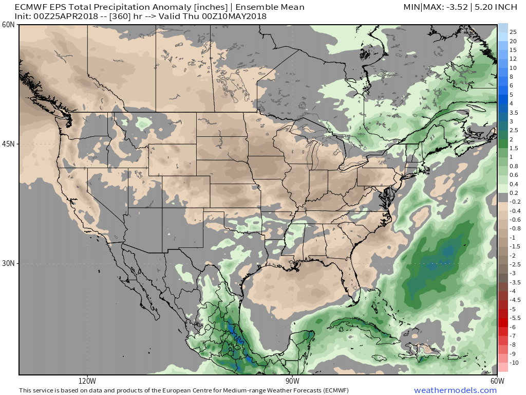
 It remains a drier than overall pattern over the upcoming couple weeks. The next storm of any significance is slated for an arrival late next week (Thursday time frame).