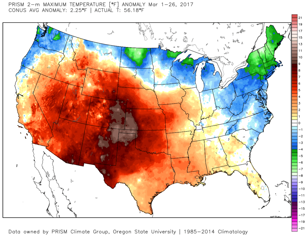
Month-to-date, Indianapolis is running near seasonal norms from a temperature standpoint (0.50° above normal). Chill has dominated the northern tier and eastern third of the country.
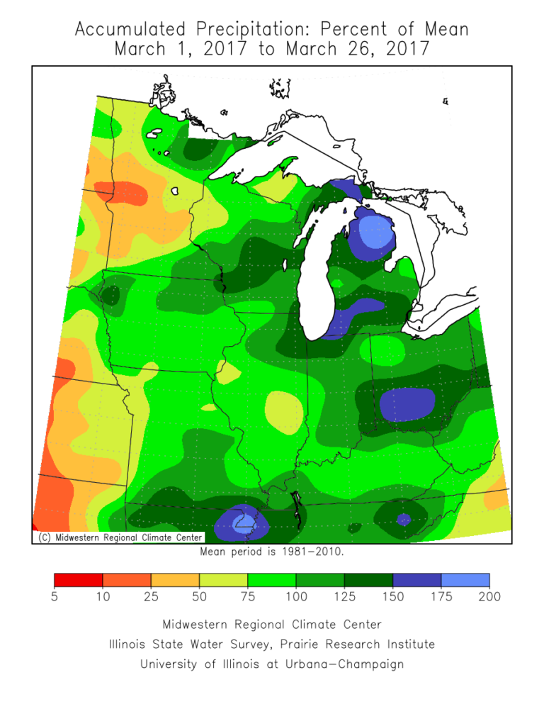
 Precipitation is running above normal, locally, to the tune of nearly 1″ month-to-date. Heaviest rains have fallen across southeastern Indiana over the past (30) days.
 A look at precipitation anomalies across the mid west, month-to-date:
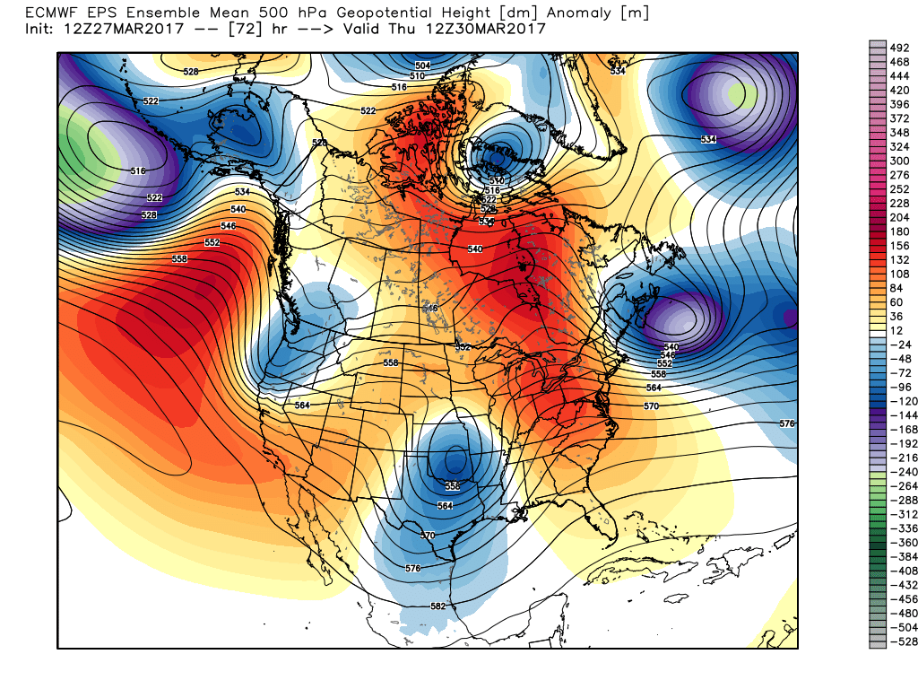
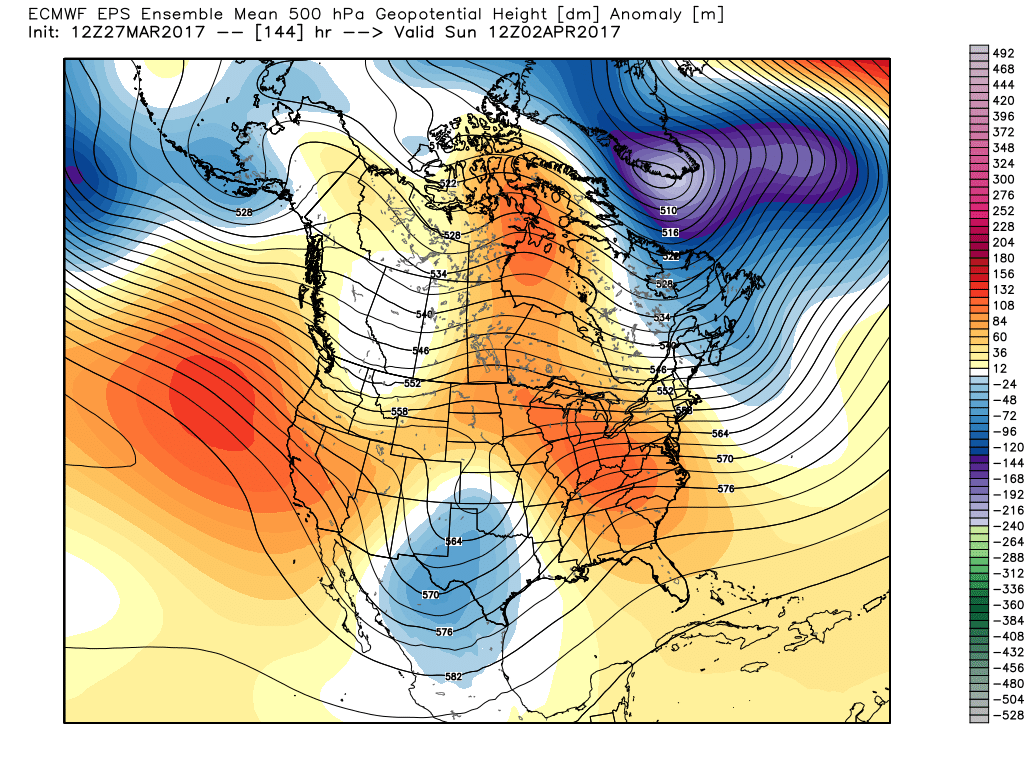
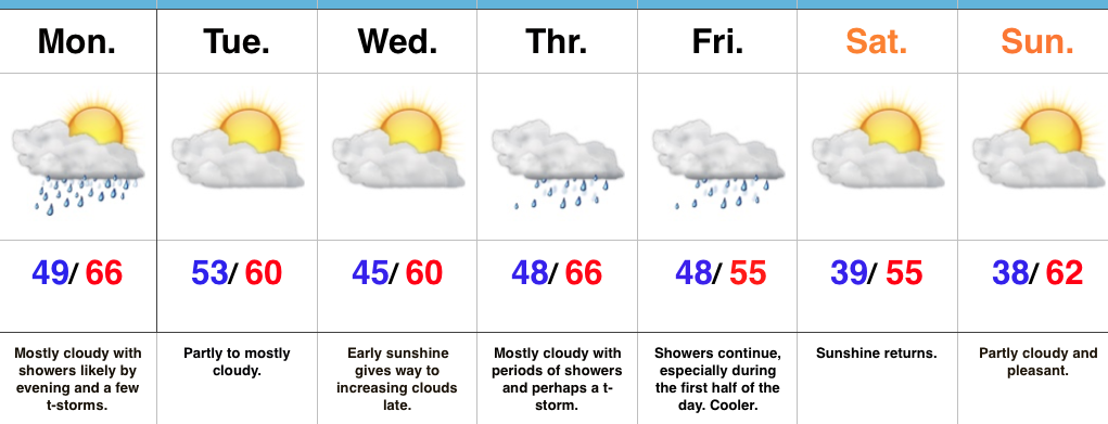
 As we progress through the upcoming (10) days, a transient weather pattern will persist. This will keep forecasters busy, but it should also be stressed it’s not all a “doom and gloom” type pattern, either. There will be plenty of dry time over the upcoming period, including drier conditions building in tomorrow (Tuesday) into a good chunk of Wednesday.
By Wednesday night/ Thursday morning, shower chances will begin to increase and that will set the stage for a wet close to the work week as numerous showers and embedded thunder move across the region Thursday into Friday. This is courtesy of a storm system “bowling” through to our south. This won’t be a severe weather maker for our neck of the woods, but will serve to create a rather damp and gloomy regime during the aforementioned period.
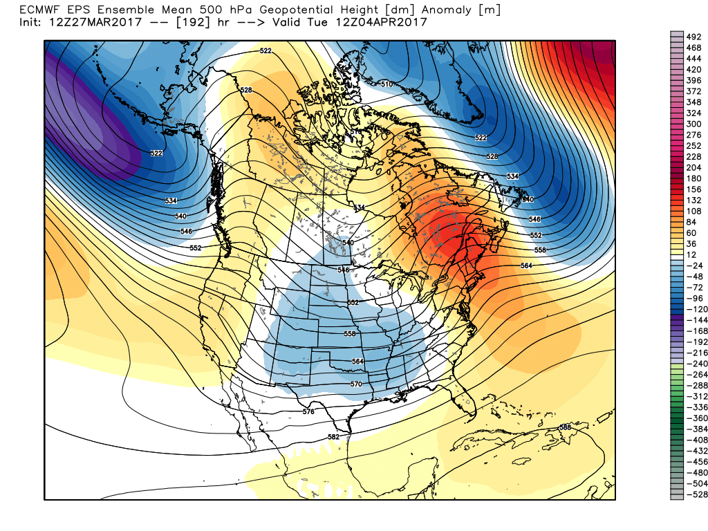
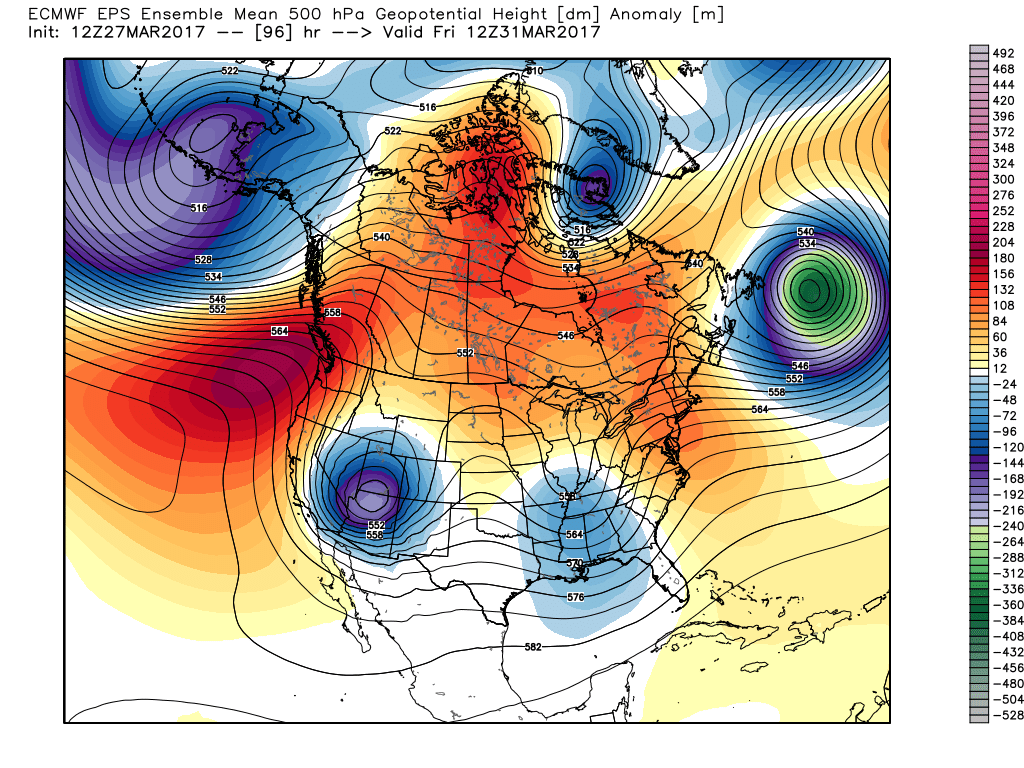 However, timing is our friend this go around as upper ridging develops over the upcoming weekend. Not only will we dry out, but we’ll also enjoy increasing sunshine as the weekend progresses.
 That said, looking further down the pipe line, another (potentially more significant) storm system looms during the 8-10 day period. This would fall in the April 3rd-4th time frame. From this distance, models are bullish on hefty rainfall totals with this storm system and we’ll keep a close eye on things as time draws closer.
 Speaking of April, our overall thoughts for the fourth month of the year (where does time go?) would imply a warmer than average month and active (wetter than average). Relative to average, we feel we still may have some chill to traverse early month, but there’s also some indication we could bust into an early summer-like feel mid and late month. With the mean trough position west and ridging east, we’ll have to also be mindful for the potential of an active severe weather month- especially mid and late month. Overall, the CanSIPS idea below is one we would agree with from a mean 500mb perspective.

 Highlights:
 Highlights:
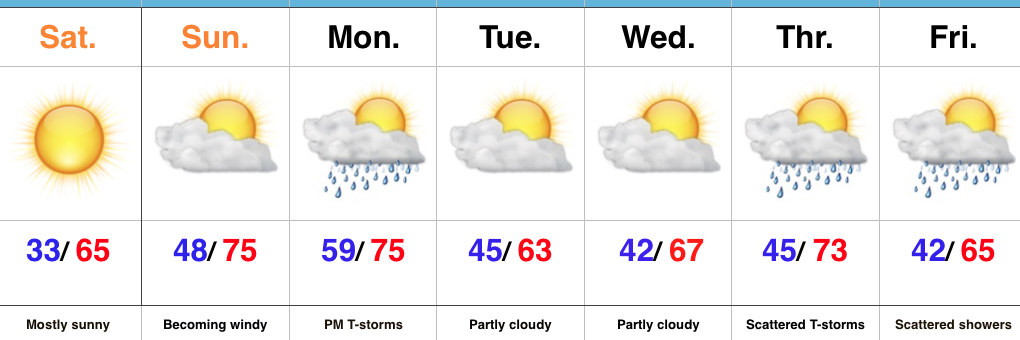
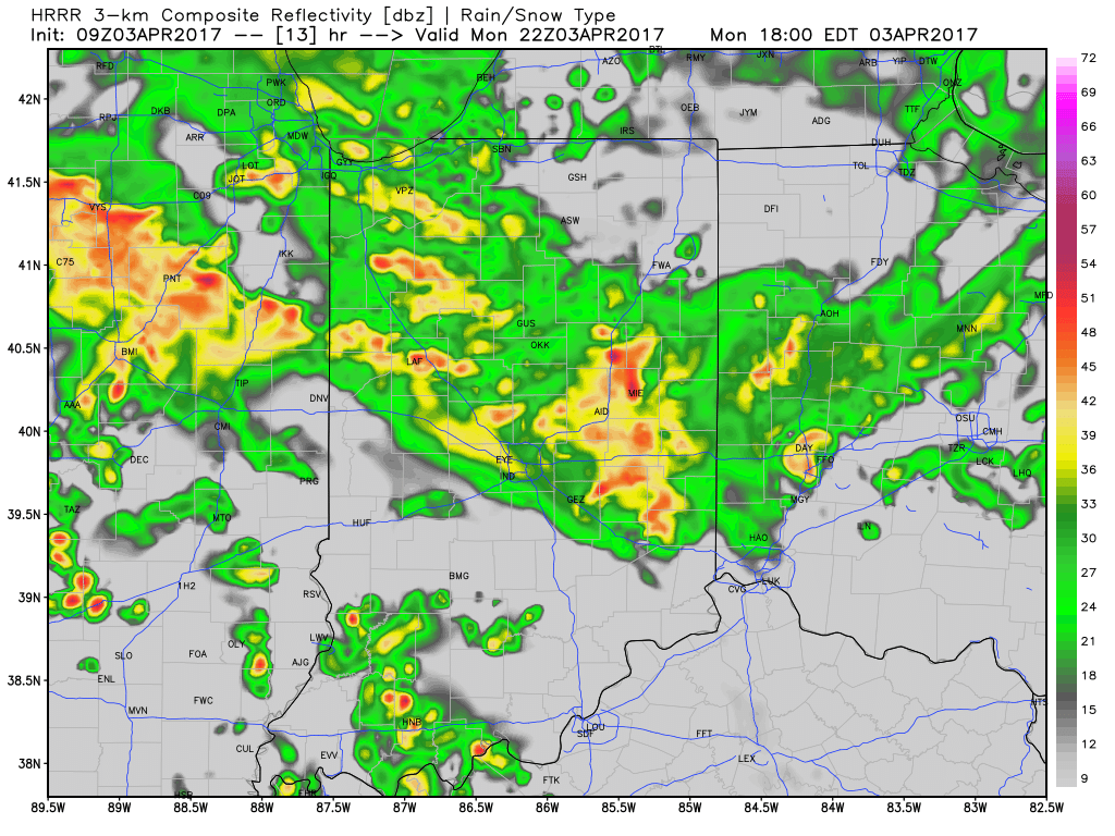 2.) We’ll get a breather on Tuesday, but our next storm system will move in quickly and begin impacting central Indiana during the day Wednesday. A couple strong to severe thunderstorms are possible Wednesday and will require our attention over the next day, or so. We’ll have more details with our updated 7-day later today.
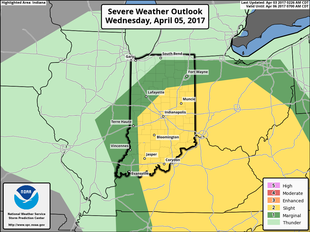 3.) We’ll get into the colder side of the storm to close the work week and thoughts will shift from storms to snow. Wind-whipped snow showers will be a good bet in the unseasonably cold air Thursday into Friday morning.
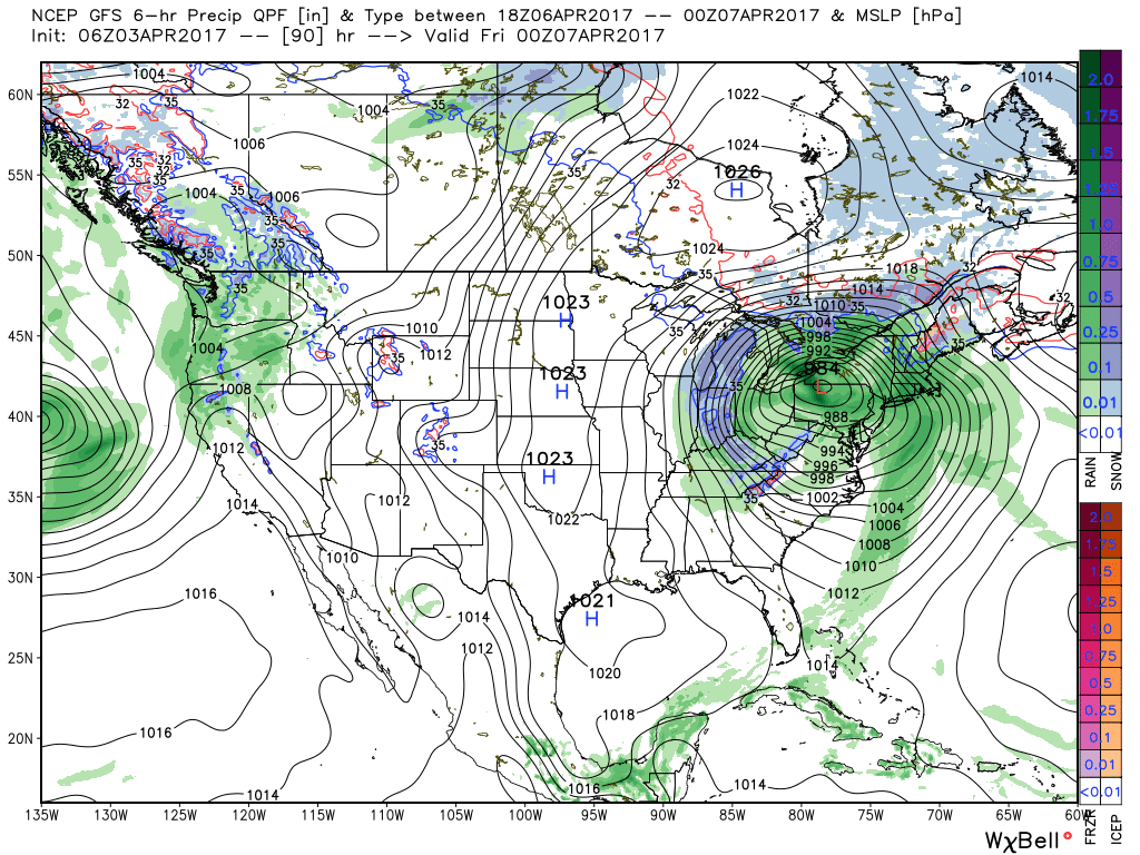 4.) Timing will once again be our friend as we push into the weekend. Weak high pressure will arrive on the scene and help ensure dry conditions. After a cold start Saturday, a moderating trend will develop.
 Highlights: