You must be logged in to view this content. Click Here to become a member of IndyWX.com for full access. Already a member of IndyWx.com All-Access? Log-in here.

May 03
You must be logged in to view this content. Click Here to become a member of IndyWX.com for full access. Already a member of IndyWx.com All-Access? Log-in here.
Permanent link to this article: https://indywx.com/video-wrapping-up-the-work-week-and-looking-ahead/
May 02
Storms are ongoing across northern portions of the state this evening and these will continue into the wee morning hours, as illustrated by the latest high resolution forecast radar products.
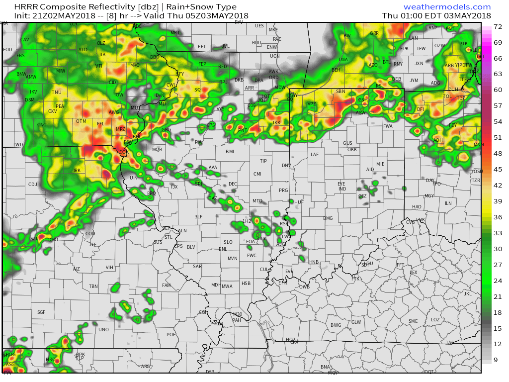
Forecast radar at 1a Thursday.
As we progress into the predawn hours, we’ll notice increasing coverage of shower and thunderstorm activity across central Indiana. It sure appears as if the Thursday morning commute will feature noisy storms, including locally heavy rain.
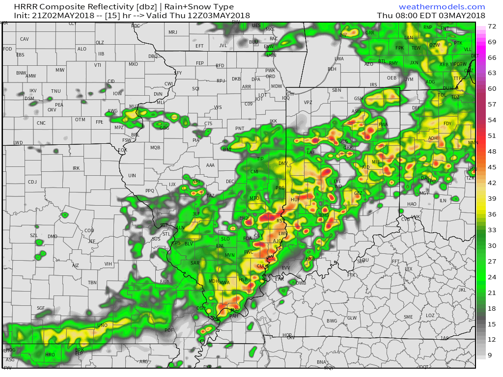
Forecast radar at 8a Thursday.
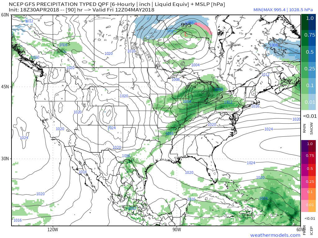
After the morning round of storms scoots off to the east, drier times are forecast to arrive through the early afternoon, but storms should quickly redevelop during the evening hours, continuing in scattered fashion into the first half of Friday.
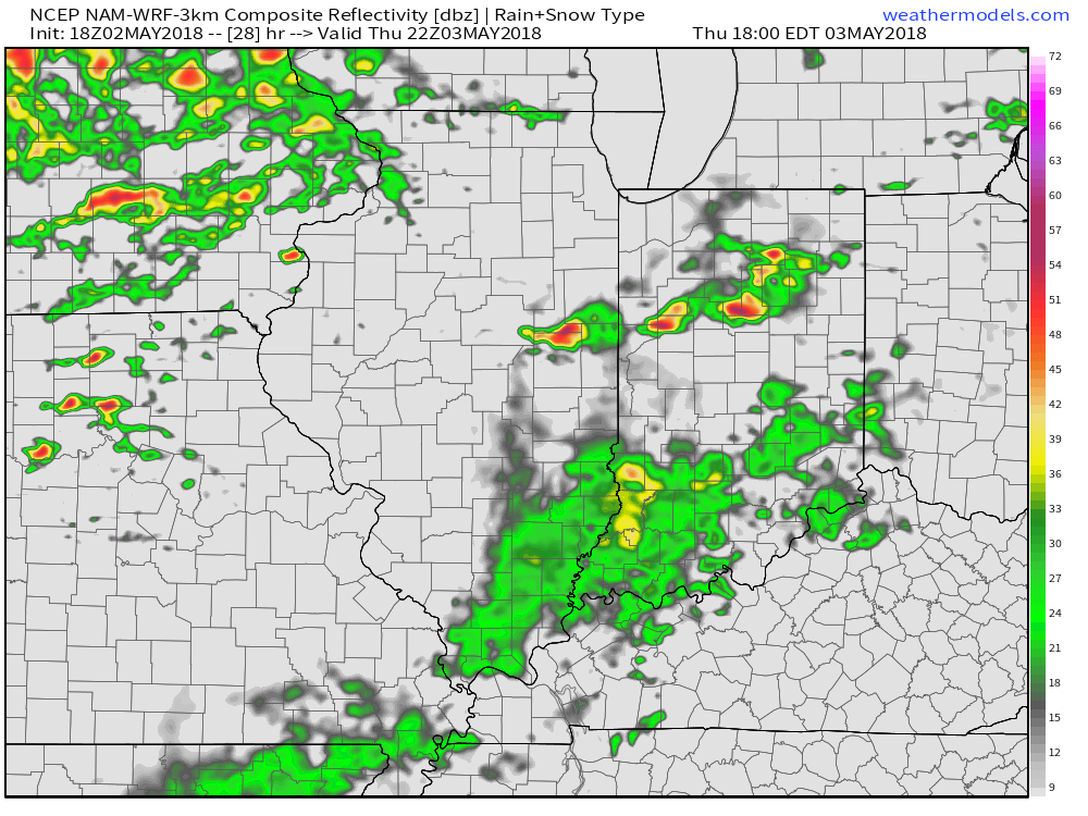
Forecast radar at 6p Thursday.
Finally, as the front passes Friday afternoon, a line of strong storms may impact southern Indiana prior to sunset Friday. Here across central Indiana, we’ll notice a drier brand of air working in from northwest to southeast through the evening hours.
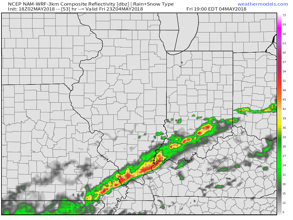
Forecast radar at 7p Friday.
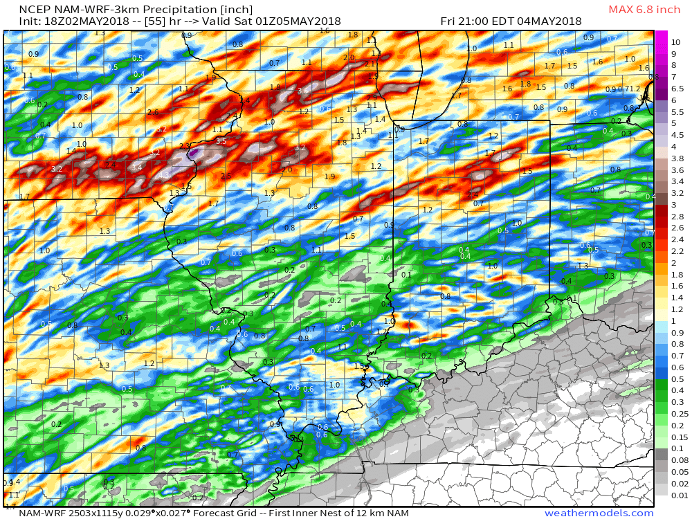
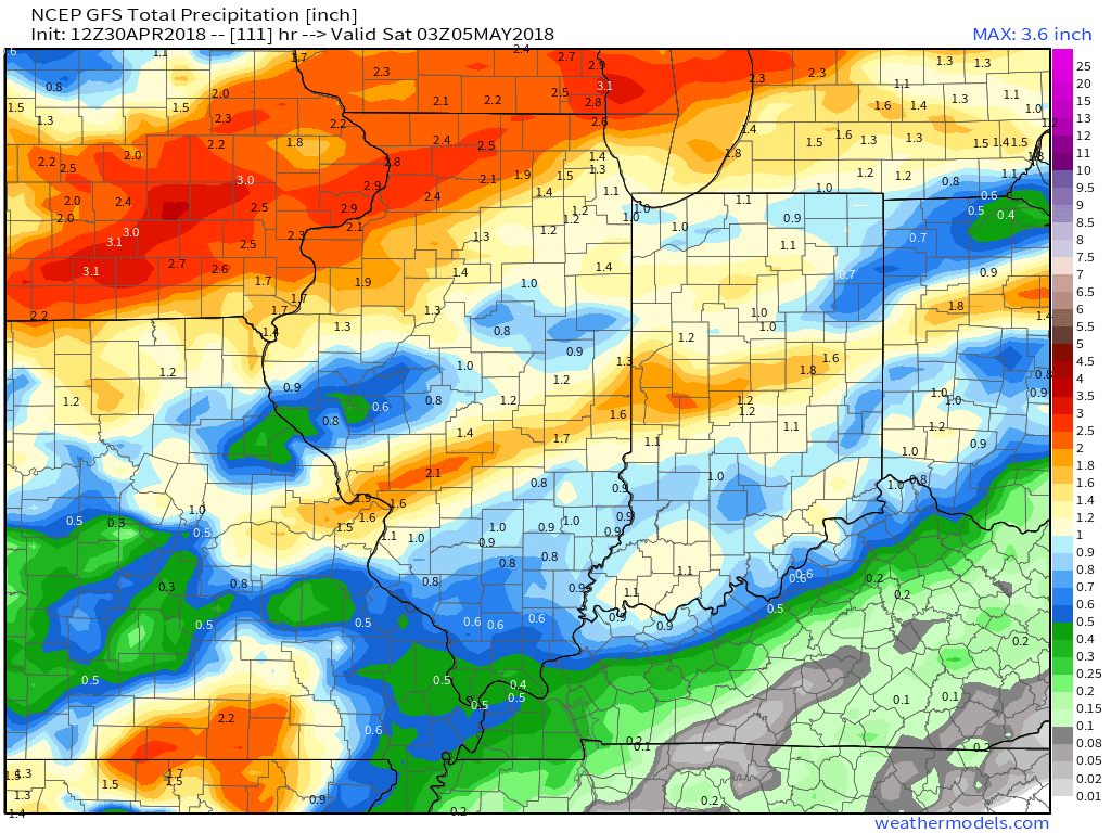
Thoughts haven’t changed with respect to rainfall totals: 0.50″ to 1″ with locally heavier amounts, especially across northern portions of the state.
 High pressure returns Saturday and will help set up a fantastic weather day. We’ll enjoy an increasingly sunny sky and pleasant temperatures topping out in the middle 70s Saturday afternoon. It’ll be a perfect day for those Cinco de Mayo and Derby festivities!
Permanent link to this article: https://indywx.com/tracking-storms-to-close-the-work-week-before-a-fantastic-saturday/
May 01
For the first time this spring, you’ll really notice the muggy nature to the air by Wednesday afternoon, as dew points climb from the pleasant 50s (Wednesday morning) to near…
You must be logged in to view this content. Click Here to become a member of IndyWX.com for full access. Already a member of IndyWx.com All-Access? Log-in here.
Permanent link to this article: https://indywx.com/video-summer-like-feel-wednesday-helps-fuel-storm-chances-longer-range-thoughts/
Apr 30
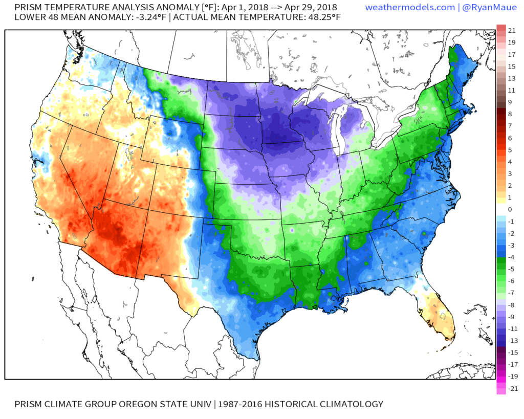
After a month-to-date temperature anomaly map that looks like this:
 …and a year-to-date that looks like this:
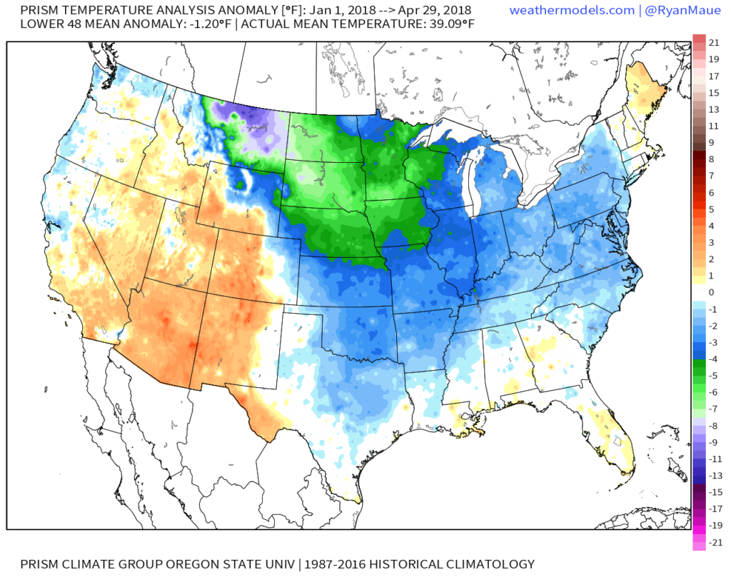 …sustained warmth is music to the ears of many Hoosiers! Thankfully, the balance of the upcoming (10) days will feature warmer than average conditions, as illustrated by the latest European ensemble data.
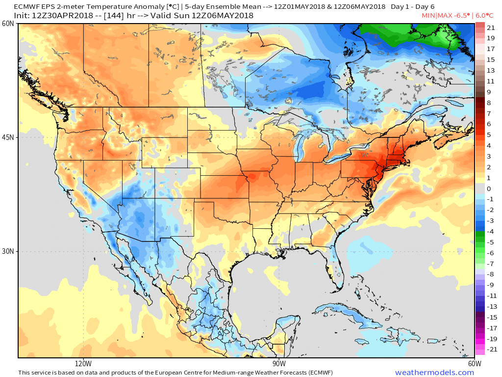
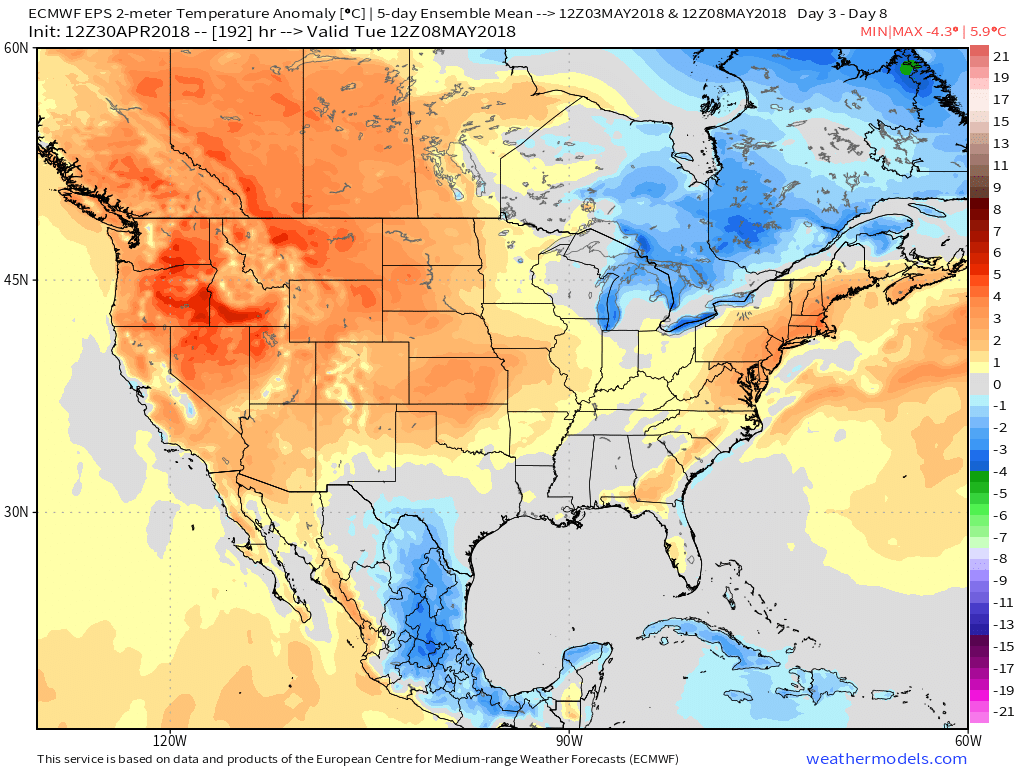 This will include multiple days with high temperatures rising into the 80s over the upcoming 10-day stretch (Tuesday and Wednesday and again next Monday through Wednesday).
As for storm chances, dry times will continue to dominate Tuesday with plentiful sunshine. Clouds will begin to increase Wednesday and we can’t rule out an afternoon shower, but most should still remain dry. Thursday and Friday will offer up the best chances of getting wet, including embedded thunder.
 As for rainfall totals, it still appears widespread amounts will check-in in the half inch to one inch range, but a few locally heavier amounts can be expected.
 Models continue to dry us out in time for the weekend and all of those important Cinco de Mayo/ Derby plans. An increasingly sunny sky will be with us along with highs in the middle 70s Saturday afternoon! Can you say “perfection?”
Looking ahead, I’m not sold we won’t have to deal with showers Sunday as a disturbance moves nearby (low confidence forecast from this distance). More widespread showers and thunderstorms will arrive on the scene late next week…
We also note the majority of longer range guidance trending warmer for May. We’ll have some updated thoughts on that later this week!
Permanent link to this article: https://indywx.com/warmth-dominates-timing-out-storm-chances-over-the-upcoming-10-day-period/
Apr 29
You must be logged in to view this content. Click Here to become a member of IndyWX.com for full access. Already a member of IndyWx.com All-Access? Log-in here.
Permanent link to this article: https://indywx.com/video-warming-trend-highlights-the-upcoming-week-unsettled-times-return-midweek/