Pleasant Start; Nighttime Showers…
 Highlights:
- Sunshine gives way to showers
- Colder mid-week
- Warmth returns
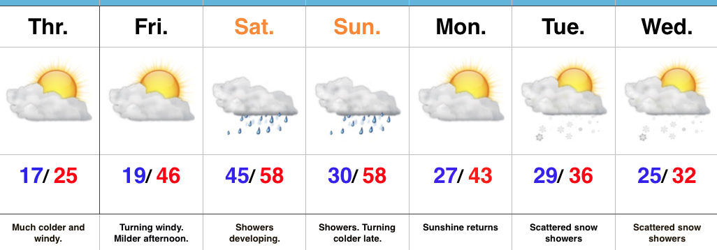
Showers Arrive Tonight…The weekend is off to a pleasant start, but clouds will increase this afternoon and light showers will follow by evening, continuing into early Sunday morning. Rainfall amounts won’t be impressive, with most around one-quarter inch. It’ll be an unseasonably mild weekend, with highs today pushing close to 60° and early highs Sunday around 50° before cooler air spills in for the second half of the weekend.
The majority of the upcoming work week will be precipitation-free. A dry cold front will pass Tuesday evening and this could result in a couple of snow flurries or light snow showers. As of now, the better coverage of snow showers appears to be to our east for our friends in Ohio. We’ll turn colder Wednesday and Thursday, but have no fear as moderating temperatures will quickly return as we roll into next weekend. In fact, the period just beyond the current 7-day looks downright spring-like, including highs that may push close to 70° early in Week 2.
Upcoming 7-Day Precipitation Forecast:
- Snowfall: 0.00″
- Rainfall: 0.25″ – 0.50″
 Winds will turn strong and gusty out of the southwest this afternoon, noted by the tightly packed isobars (lines of equal pressure) along with considerable mid and high level clouds.
 Clouds will lower and thicken Saturday and we may also have to deal with periods of fog, as well. Showers and drizzle will lift into town as the day progresses, especially by afternoon and evening.
 We don’t expect heavy rain this weekend. In fact, model data continues to really back off on expected totals. The general consensus is between 0.15″ and 0.25″ across central Indiana.
 After a mild Saturday, cooler (but not cold) air will ooze into the Ohio Valley Sunday.
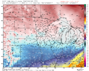 Resurgent cold air will blow into town during the middle and latter portions of the upcoming work week. Highs will return to the 30s with overnight lows in the lower 20s. We’ll likely add scattered snow showers into the mix as well.
 Timing:
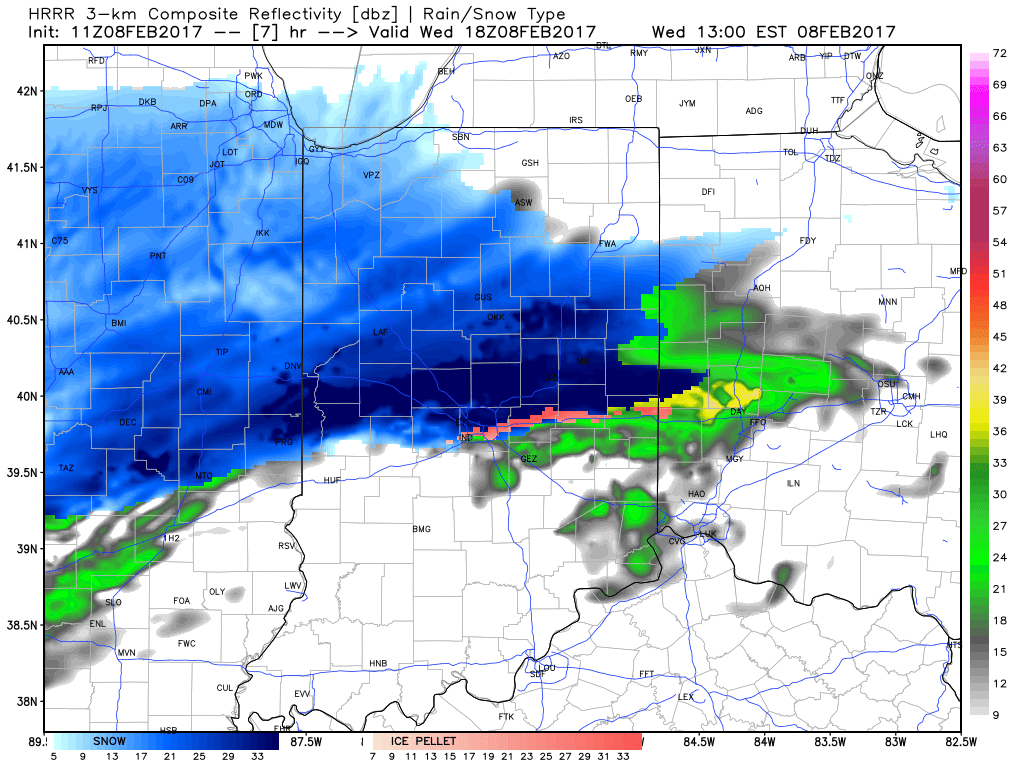


 Timing:
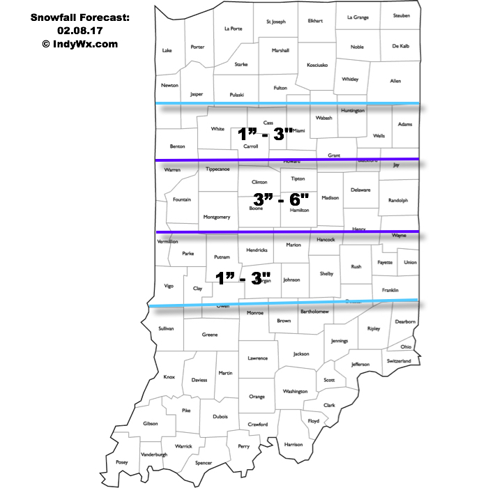
 It’s not until we push into Wednesday afternoon and evening that more widespread snow will move through central Indiana, including Indianapolis.
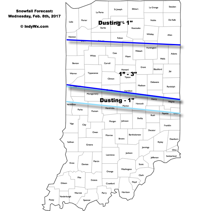
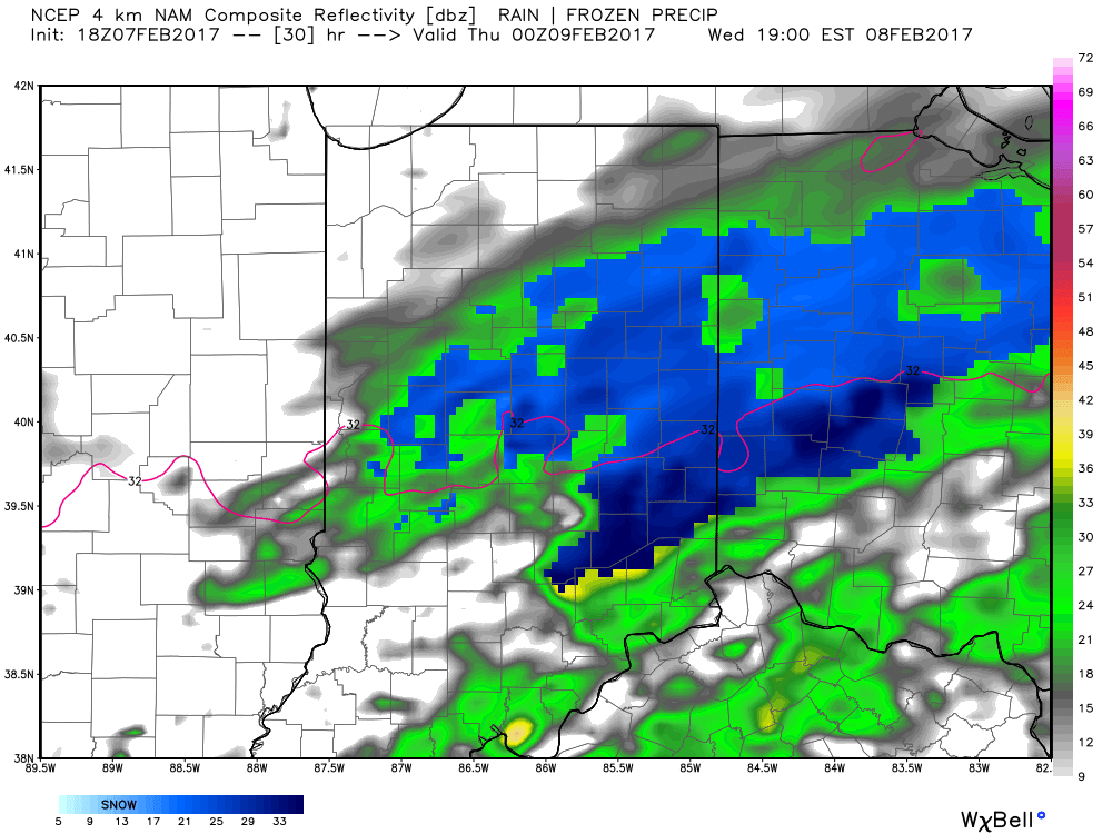 Periods of moderate to locally heavy snow can be expected through central and north-central parts of the state Wednesday evening, especially between the hours of 3p-7p. This will be a wet snow and though the snowfall intensity should be impressive at times, it’ll have a hard time accumulating from what it otherwise could be if the ground was cold. With that said, we do anticipate snowfall rates to overcome initially marginally cold air and “warm” surface temperatures. Our forecast calls for a dusting to 1″ for the city, itself, increasing to 1″-3″ north of the city- encompassing most of north-central Indiana. Roadways will likely become slushy with wet snow accumulation Wednesday evening.