Bitter Feel Today…
 Highlights:
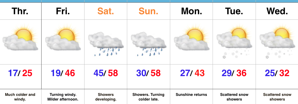
- Frigid Thursday
- Milder, but wet this weekend
- Turning colder next week
Bundle Up…Temperatures are running much colder than this time 24 hours ago with most waking up to the teens. Throw in a strong and gusty NW wind and the ‘chill factor has fallen to as low as zero for many neighborhoods this morning. Thankfully, sunshine should be with us this afternoon.
Our wind flow will shift around to the southwest and usher in a milder brand of air by Friday afternoon. Eventually, that flow will also be an increasingly moist one, as well, and showers will develop Saturday, continuing into Sunday. We expect the cold front to slip through the state Sunday night and allow colder air to return.
Questions abound early-mid next week. Whether or not we can get a piece of energy to dig in and create wintry “fun and games” is yet to be determined. Modeling is going back and forth on that idea, versus, multiple, weaker waves capable of producing scattered snow showers in the colder air mass. We’ll continue to monitor things.
Upcoming 7-Day Precipitation Forecast:
- Snowfall: Dusting – 1″
- Rainfall: 0.25″ – 0.75″
 Timing:


 Timing:
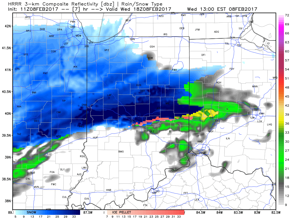
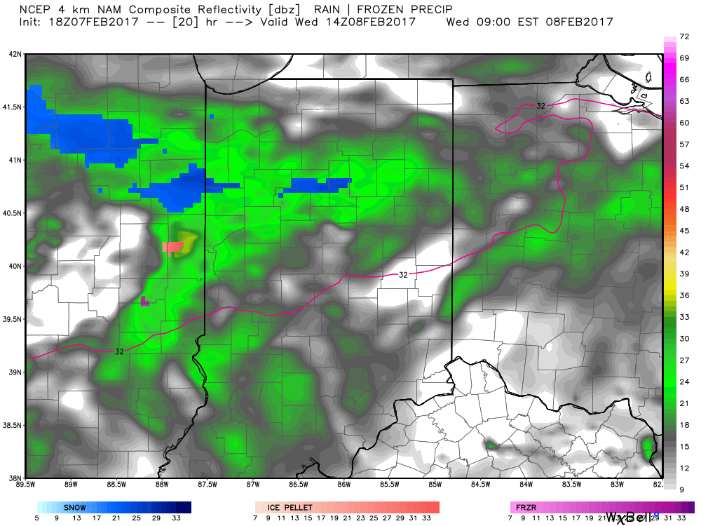 It’s not until we push into Wednesday afternoon and evening that more widespread snow will move through central Indiana, including Indianapolis.
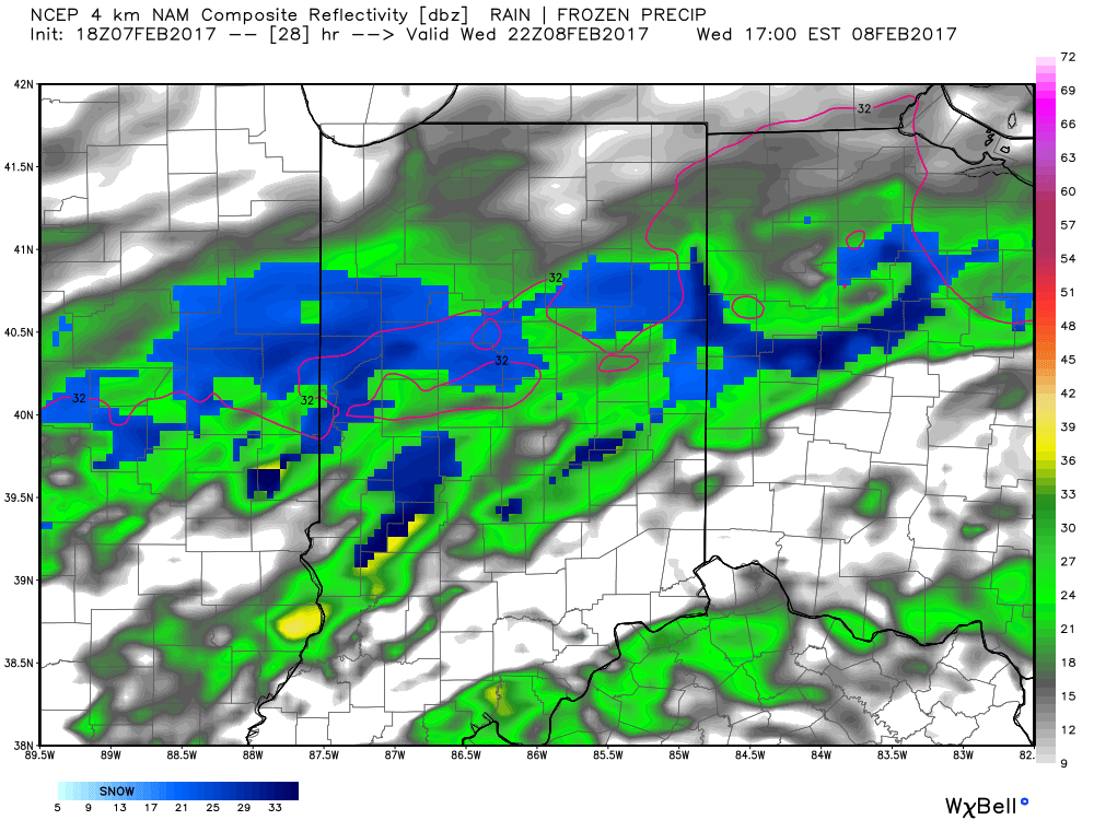
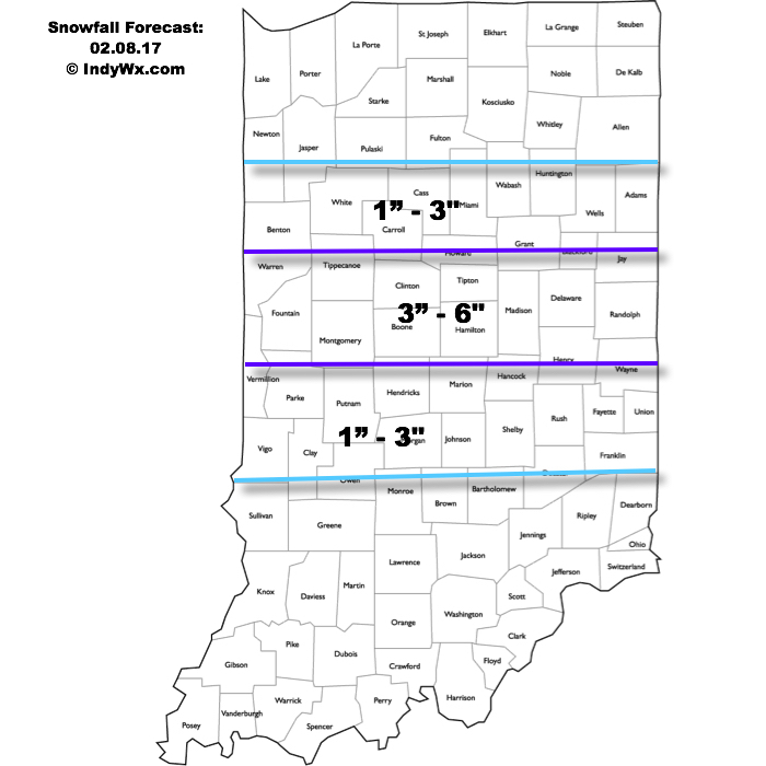
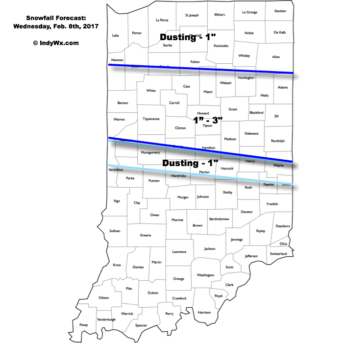
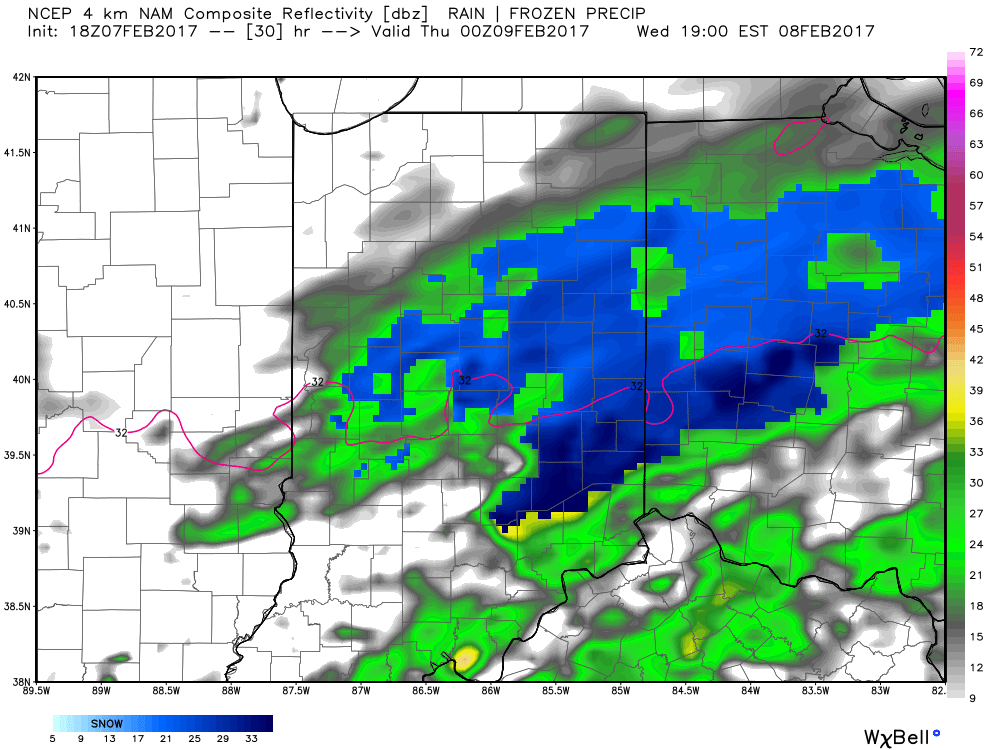 Periods of moderate to locally heavy snow can be expected through central and north-central parts of the state Wednesday evening, especially between the hours of 3p-7p. This will be a wet snow and though the snowfall intensity should be impressive at times, it’ll have a hard time accumulating from what it otherwise could be if the ground was cold. With that said, we do anticipate snowfall rates to overcome initially marginally cold air and “warm” surface temperatures. Our forecast calls for a dusting to 1″ for the city, itself, increasing to 1″-3″ north of the city- encompassing most of north-central Indiana. Roadways will likely become slushy with wet snow accumulation Wednesday evening.