Winter 2018-2019 Notes…
As the calendar turns from July to August, we really begin to increase the amount of research into the upcoming winter season. While still a couple months out from publishing our official Winter Outlook, we did want to touch base on a couple of items.
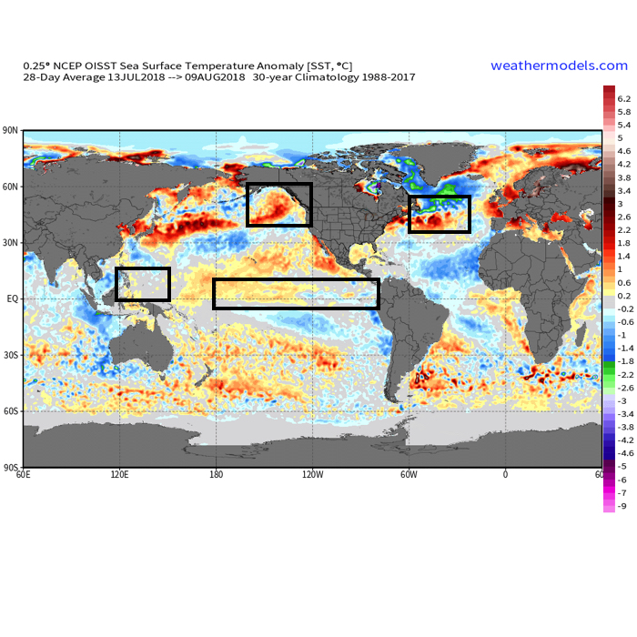 The early “baseline” of our ideas focuses on the likelihood of El Nino returning for the upcoming winter season. As we’ve stated many times in the past, each Nino event is different from one another and other ingredients (highlighted above) can play a significant role in ultimately determining the eventual outcome.
- Weak Modoki (central-based) Nino is expected this winter
- SST configuration in the NPAC (north Pacific) is perhaps the most “intriguing” item at the moment
- Low solar/ QBO
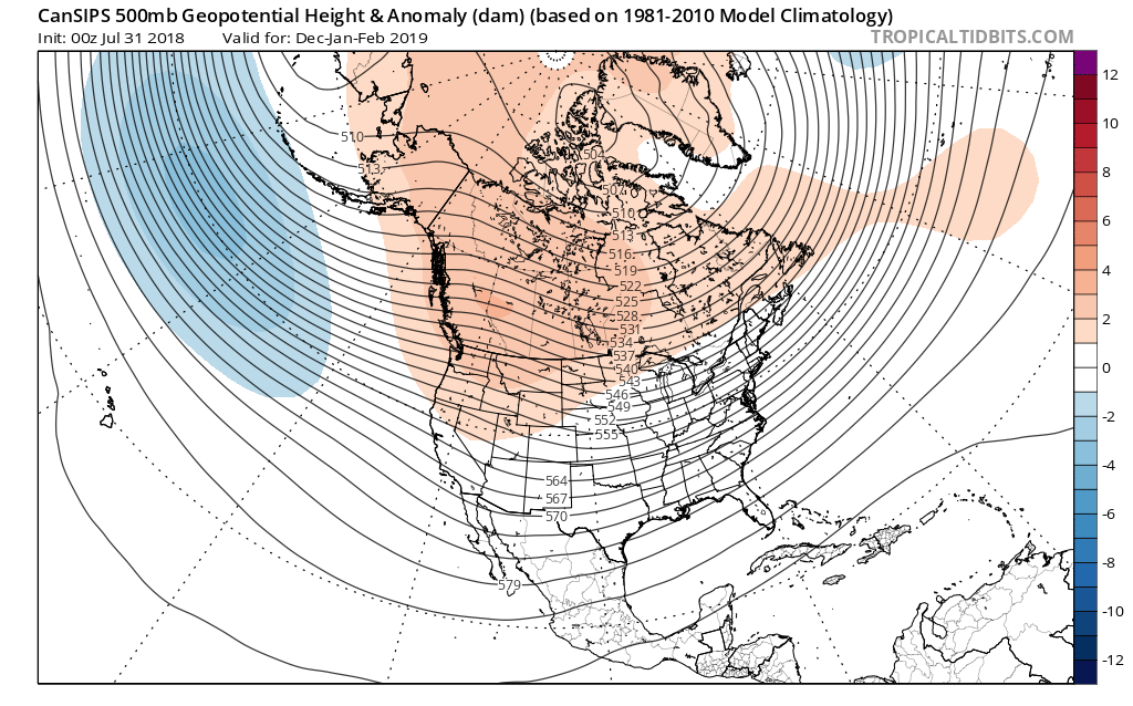
Somewhat of a surprise is that the majority of longer range, seasonal data is aligning for a cold, stormy eastern winter. Included in the cold, stormy camp are the JAMSTEC, European, and CanSIPS. A few snap shots are included below…

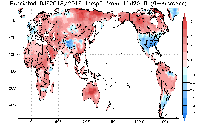
The CFSv2 is siding with a warmer winter, but it appears as if the model is struggling with the coming Nino and “over-hyping” things. Accordingly, the model results in a blow torch winter. Again, remember, we’re leaning towards a weak, central-based event.

 That sea surface temperature configuration in the northern Pacific argues for western Canada ridging and downstream troughiness such as the JAMSTEC, European, and CanSIPS would imply.
Just wanted to touch base briefly on our early thinking before we release our official 2018-2019 IndyWx.com Winter Outlook in October.
 II. We’ll turn cooler to close the week, but with an increasingly sunny time of things, we forecast a very pleasant open to the weekend. High pressure will remain in control of our weather into early next week. Really the only item of interest will be a gusty easterly breeze at times Sunday into Monday. We’ll watch a storm system get shunted south and stay dry here. Overnight lows will remain chilly through the weekend.
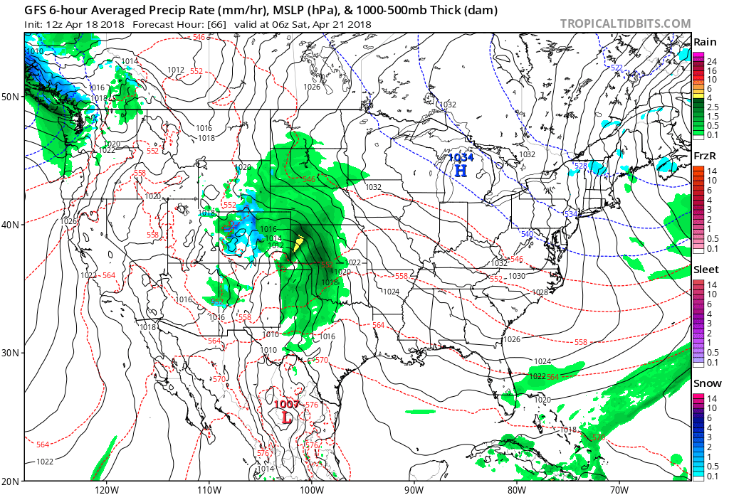 III. The next opportunity for meaningful precipitation should arrive the middle of next week (Tuesday-Wednesday) time frame, and even this doesn’t look like a big deal. From this distance, it seems like 0.10″ to 0.25″ will come from that system.
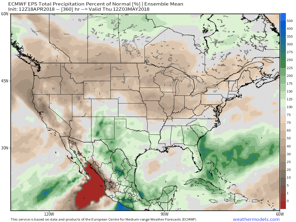
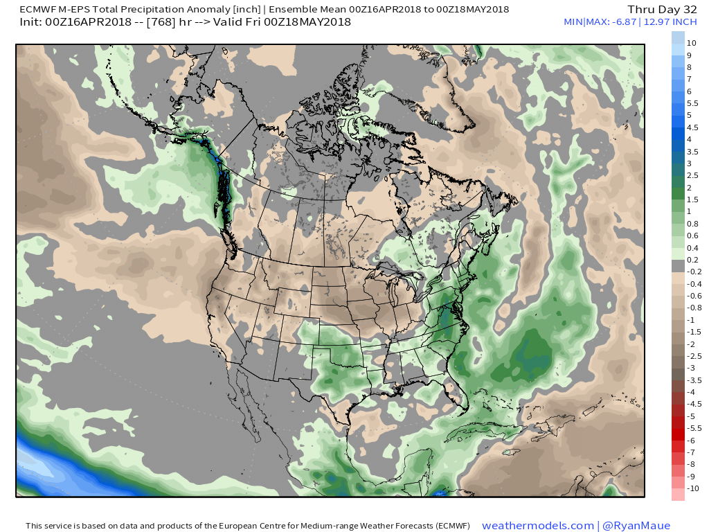
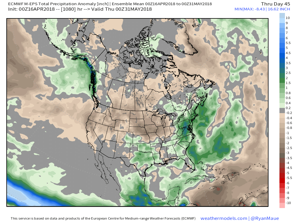
 IV. As we look ahead, the relative cold looks to relax as we put a wrap on April and open May. Additionally, we also note the EPS painting much of the northern tier into the Ohio Valley with a drier than normal signal. Sure looks like conditions are finally improving for #Plant18 to get underway in earnest…
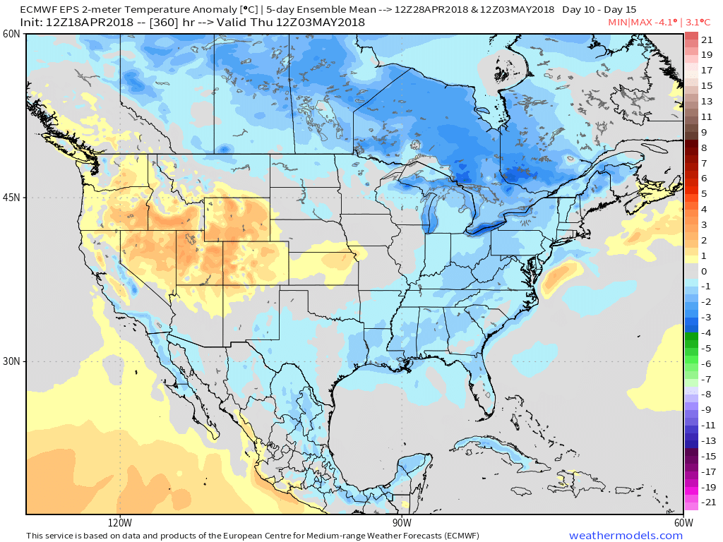
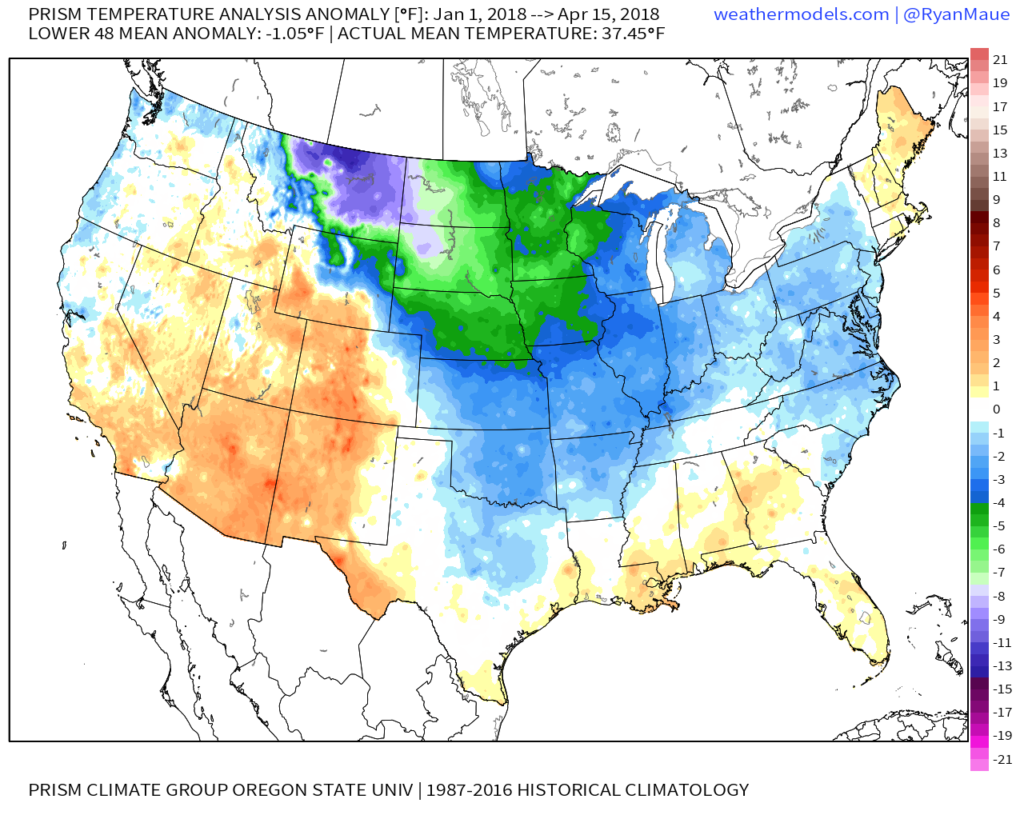 More specific to Indianapolis, here’s the monthly temperature breakdown so far for 2018:

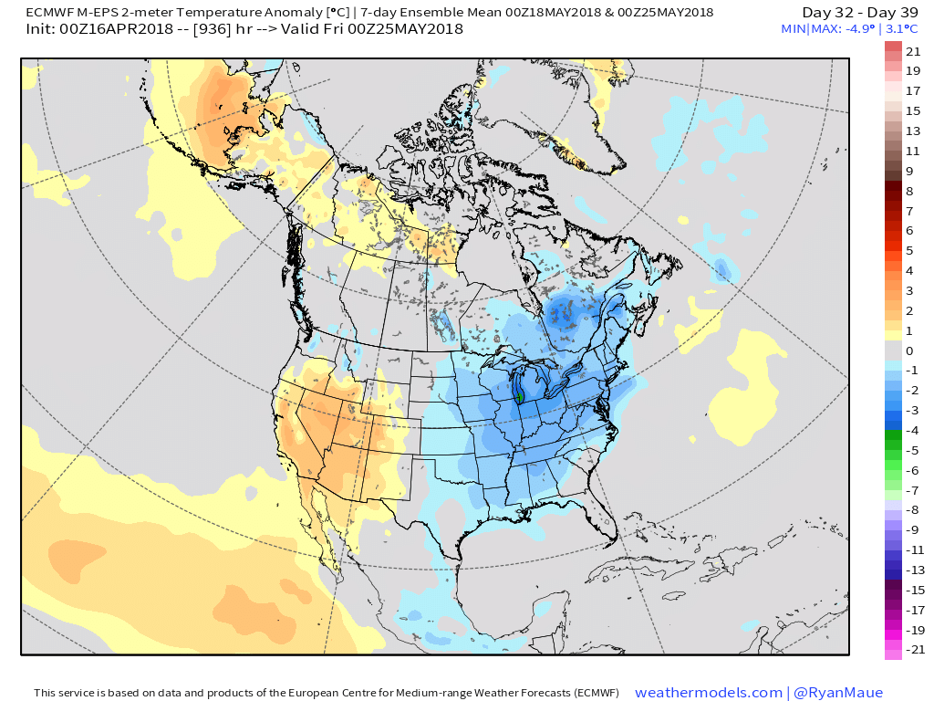 While we have conflicting temperature ideas, both suggest a drier than average month emerging:
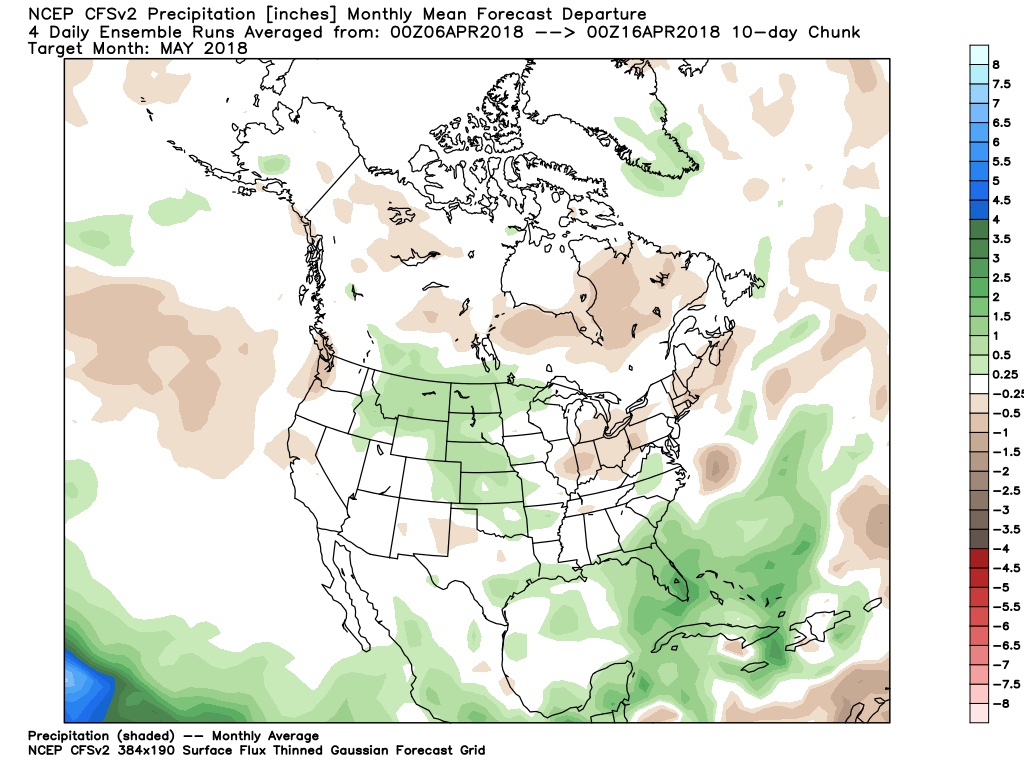
 At the end of the day, our call on May’s forecast from mid-April would be for an early cooler than average start before flipping towards more of a seasonable to slightly warmer than normal regime. Our idea all along this spring has been that when this pattern flips, the potential is present to jump right to a summery feel. In the face of the new European Weeklies, we still feel this warmer idea mid and late May is on the table. We’re in agreement with the data of a drier than average month.