A hot and humid Independence Day awaits with minimal storm coverage this afternoon. While an isolated storm is possible, overall storm coverage will be significantly less than Tuesday afternoon. The big story will be heat indices approaching 100° to 105° this afternoon. If you have plans outdoors today, hopefully it’s by a pool!
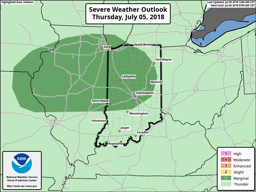
As we move into Thursday, a cold front will approach from the north. Ahead of this boundary, the potential is present for a gusty round of storms Thursday afternoon and evening.
 The Storm Prediction Center currently has a ‘Marginal’ risk of severe weather for portions of the state. It wouldn’t surprise us if a portion of this risk area is upgraded to a ‘Slight’ risk with future updates. The primary concerns? Stronger storms may include damaging winds and large hail.
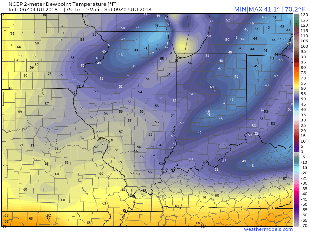
 Storm coverage will diminish during the day Friday with a drier air mass taking hold by evening. We’ll really notice a reduction in humidity Friday night and that more refreshing feel will remain intact through the weekend. Dew points may even fall into the 40s by Saturday morning! Many central Indiana neighborhoods can expect to settle into the mid and upper 50s for overnight lows Saturday and Sunday mornings.
 Dry weather will be with us as high pressure remains in control of the period this weekend into early next week.
Longer term, a transition period should take place around the middle of July that should ultimately help set up a cooler close to the month and open to August- relative to normal and certainly to where we’ve been lately.

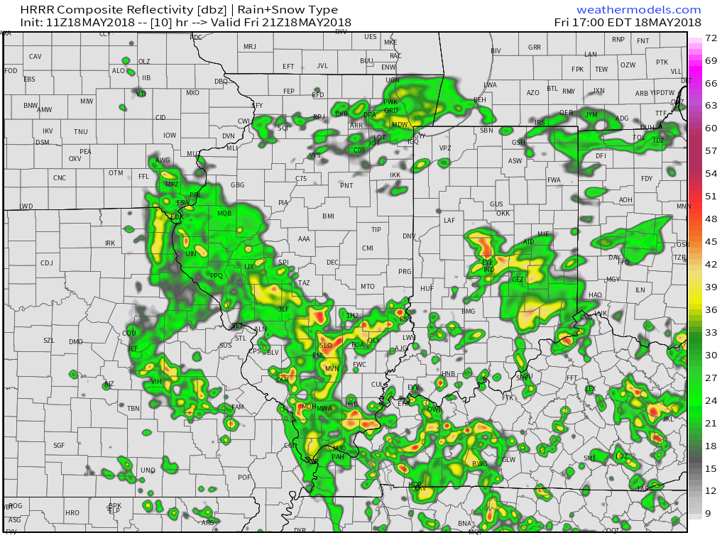
 Upper level energy will push east this afternoon and combine with an unstable air mass, along with unseasonably hot and humid air (highs today will reach the lower 90s across the southern half of the state with dew points around 70°), resulting in explosive thunderstorm development this evening. Storms will rumble east during the nighttime hours before exiting off to the east and diminishing during the early morning hours.
 We target the time frame of 6p to midnight for greatest storm coverage and the possibility of severe weather. While the greatest threat of severe is just south of the city, itself, I think all of central IN is in play for the possibility of strong to severe thunderstorms tonight. In addition to locally heavy rain, stronger storms could pose a damaging straight line wind threat along with large hail.
 Otherwise, look for considerable cloudiness and highs topping out in the lower 70s today.
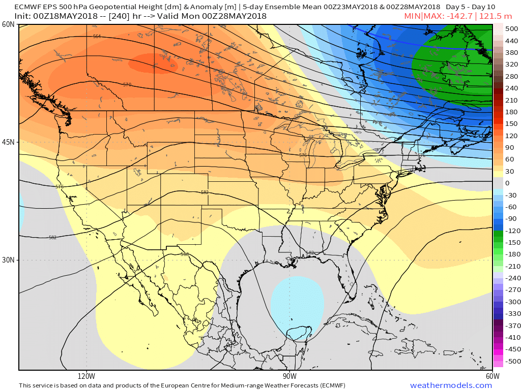
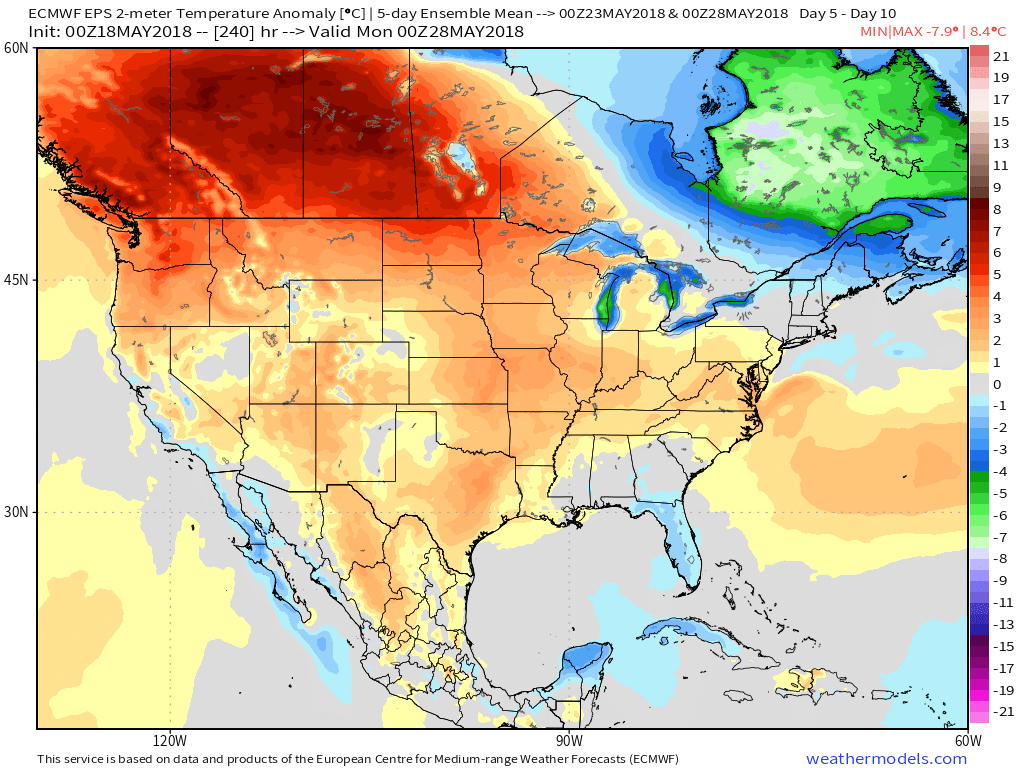
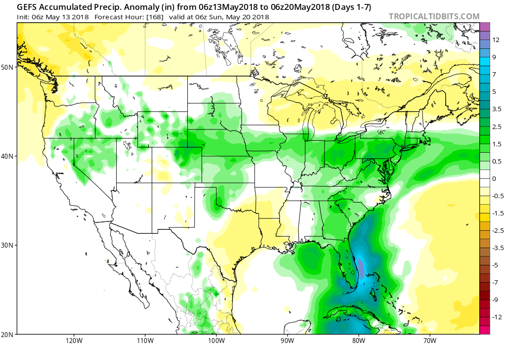
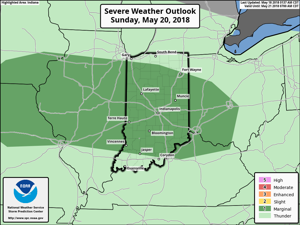 As we look ahead to the end of May, there really aren’t any significant changes to the overall warmer than normal theme we’ve enjoyed so far this month. Longer range guidance off of the European ensemble continues to support broad scale upper ridging across the Mid West and Ohio Valley and a corresponding warmer than average regime. From a precipitation perspective, the next couple of weeks do look more active compared to the dry start to the month. Case in point, the balance of the upcoming week will be dominated by a stalled frontal boundary. While we’ll have to fine tune exactly where the front stalls, daily chances of showers and thunderstorms (scattered fashion) can be expected.