Updated 02.14.21 @ 10p
You must be logged in to view this content. Click Here to become a member of IndyWX.com for full access. Already a member of IndyWx.com All-Access? Log-in here.

Feb 14
Updated 02.14.21 @ 10p
You must be logged in to view this content. Click Here to become a member of IndyWX.com for full access. Already a member of IndyWx.com All-Access? Log-in here.
Permanent link to this article: https://indywx.com/2021/02/14/video-roadways-become-impassable-tomorrow-evening-from-combo-of-heavy-snow-severe-drifting-another-strong-winter-storm-inbound-midweek/
Nov 25
It’s a wet morning across central Indiana as widespread rain (some of which is moderate to heavy) is falling for most of the region. This is due to a well organized low pressure system and associated frontal boundary currently spinning across the central Plains.
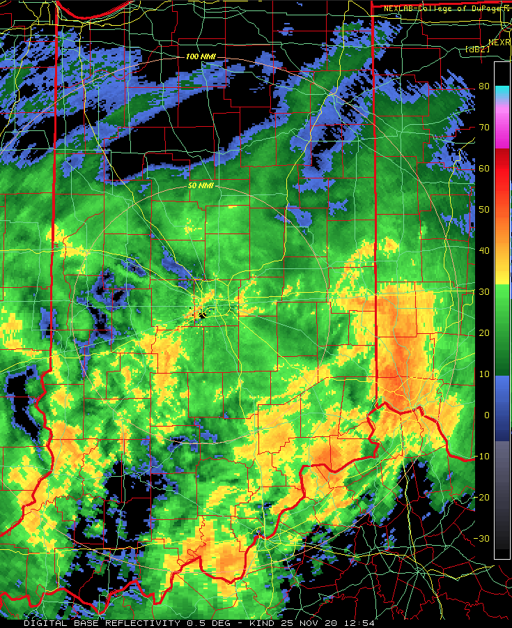

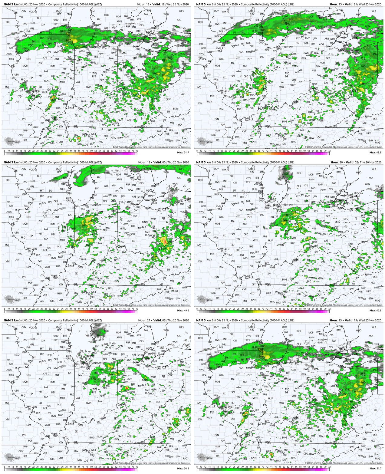
As the widespread shield of rain departs late morning and into the early afternoon hours, we’ll have a “lull” in the activity until late afternoon and early evening. That’s when we anticipate storms to fire as the area of low pressure moves across the state. Should we get into any sort of sunshine later this afternoon (questionable at best), the opportunity for severe weather would increase during the 4p to 9p window (west to east). As it is, a couple of strong-to-severe storms can’t be ruled out given the dynamics in play. The biggest threat would be localized hail and/ or damaging wind gusts with these stronger cells.
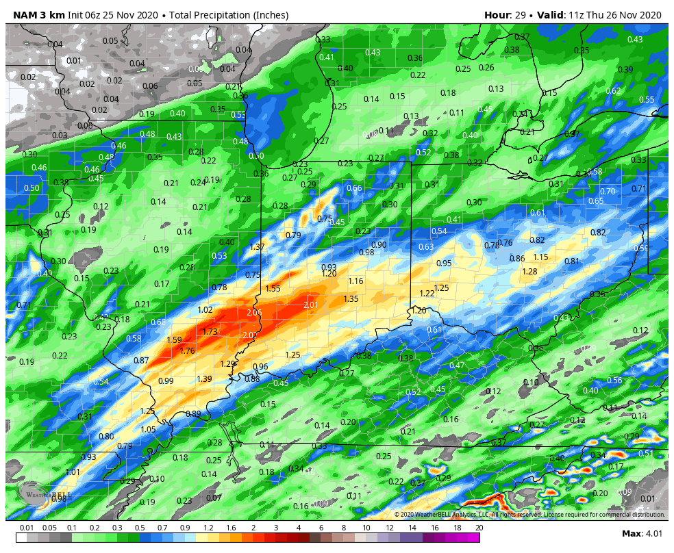
Widespread 1″+ rainfall can be expected (both from this morning’s rain and what’s ahead this evening) with locally heavier amounts- especially south of the I-70 corridor.
Things will quieten down tonight and we still anticipate a much calmer Thanksgiving Day, itself, continuing through Black Friday and Saturday as high pressure settles overhead.
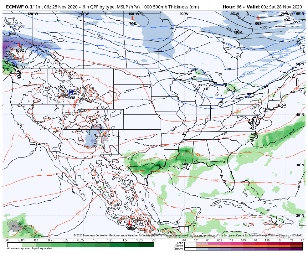
By this time, of course, attention will turn to the “shenanigans” ahead early next week. We have no changes to our thinking a significant event is ahead and continue to favor this initial storm tracking west of the spine of the Appalachians. Operational model will likely continue to offer up a wide range of solutions (sometimes with each model update). The item we’ll be most focused on is the phasing of the 2 streams. The timing of this taking place will play a critical role into who ends up with a sizable snow/ wind event vs. mostly rain with backlash snow. Stay tuned and know, as per usual, we’ll be posting away right through the holiday.

Permanent link to this article: https://indywx.com/2020/11/25/strong-storm-potential-by-evening-more-chatter-about-late-weekend-next-week/
Nov 24
You must be logged in to view this content. Click Here to become a member of IndyWX.com for full access. Already a member of IndyWx.com All-Access? Log-in here.
Permanent link to this article: https://indywx.com/2020/11/24/evening-client-video-update-couple-of-strong-storms-tomorrow-evening-stage-set-for-a-major-winter-event-sunday-monday/
Nov 24
You must be logged in to view this content. Click Here to become a member of IndyWX.com for full access. Already a member of IndyWx.com All-Access? Log-in here.
Permanent link to this article: https://indywx.com/2020/11/24/video-strong-storm-potential-tomorrow-afternoon-in-depth-december-pattern-breakdown/
Nov 10
You must be logged in to view this content. Click Here to become a member of IndyWX.com for full access. Already a member of IndyWx.com All-Access? Log-in here.
Permanent link to this article: https://indywx.com/2020/11/10/video-gusty-storms-arrive-into-central-indiana-this-evening-colder-trends-next-week/
Nov 09
You must be logged in to view this content. Click Here to become a member of IndyWX.com for full access. Already a member of IndyWx.com All-Access? Log-in here.
Permanent link to this article: https://indywx.com/2020/11/09/video-tracking-2-cold-fronts-in-the-week-ahead/
Oct 23
You must be logged in to view this content. Click Here to become a member of IndyWX.com for full access. Already a member of IndyWx.com All-Access? Log-in here.
Permanent link to this article: https://indywx.com/2020/10/23/video-timing-out-when-strong-storms-arrive-today-chilly-close-to-the-month/
Sep 07
You must be logged in to view this content. Click Here to become a member of IndyWX.com for full access. Already a member of IndyWx.com All-Access? Log-in here.
Permanent link to this article: https://indywx.com/2020/09/07/video-discussing-where-strong-storms-may-develop-later-this-afternoon-warm-week-ahead/
Sep 06
You must be logged in to view this content. Click Here to become a member of IndyWX.com for full access. Already a member of IndyWx.com All-Access? Log-in here.
Permanent link to this article: https://indywx.com/2020/09/06/video-stormy-24-hours-ahead-amplified-pattern-this-week/
Aug 29
I. Tracking multiple cold fronts this week.
II. Pattern transitions cooler than normal as we move through the 1st (10) days of September.
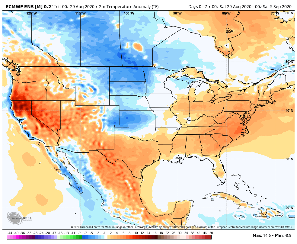

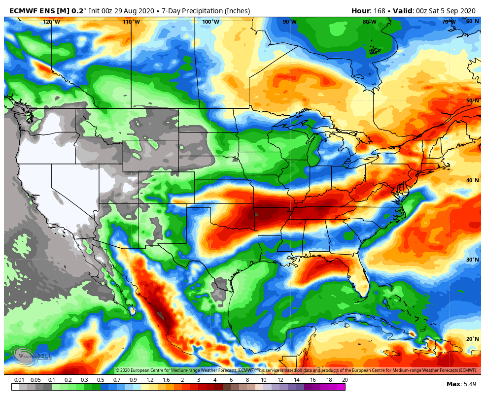
Forecast Period: 08.29.20 through 09.05.20
As we flip the page from meteorological summer to fall, a more active pattern can be expected, locally. Of course we already had one cold front sweep through the region this morning and we’re tracking 3 additional fronts between now and Labor Day. The 2nd front will move through midweek with scattered showers and storms Tuesday afternoon and Wednesday. The 3rd front will arrive Friday with yet another scheduled for a passage Labor Day night. Each front will provide an enhanced chance of showers and embedded thunder, but washouts aren’t anticipated any of the days through the upcoming week. Temperatures will run near seasonal norms before trending much cooler behind the Labor Day front (late September or early October like temperatures).
Permanent link to this article: https://indywx.com/2020/08/29/weekly-agwx-and-severe-weather-outlook-20/