
I. Tracking multiple cold fronts this week.
II. Pattern transitions cooler than normal as we move through the 1st (10) days of September.

Forecast Period: 08.29.20 through 09.05.20
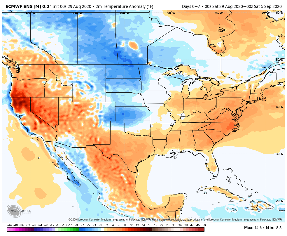
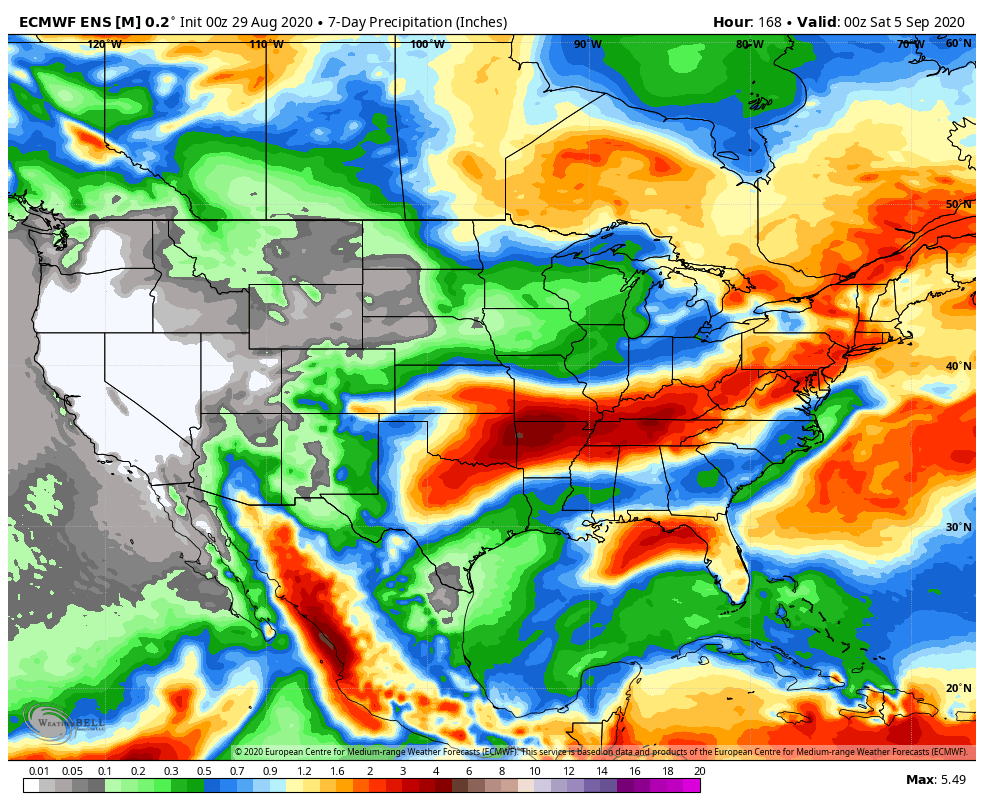
As we flip the page from meteorological summer to fall, a more active pattern can be expected, locally. Of course we already had one cold front sweep through the region this morning and we’re tracking 3 additional fronts between now and Labor Day. The 2nd front will move through midweek with scattered showers and storms Tuesday afternoon and Wednesday. The 3rd front will arrive Friday with yet another scheduled for a passage Labor Day night. Each front will provide an enhanced chance of showers and embedded thunder, but washouts aren’t anticipated any of the days through the upcoming week. Temperatures will run near seasonal norms before trending much cooler behind the Labor Day front (late September or early October like temperatures).