Transition Begins Back To A Prolonged, Sustained Wintry Pattern…
The January “thaw” has taken hold the past 7-10 days.
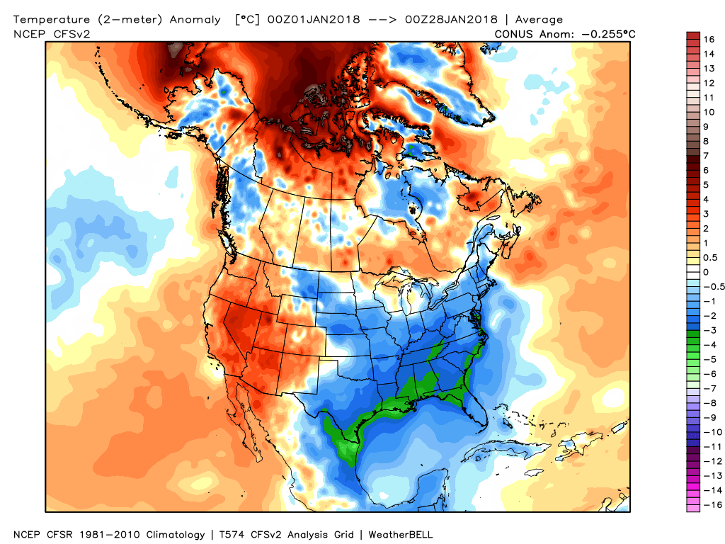
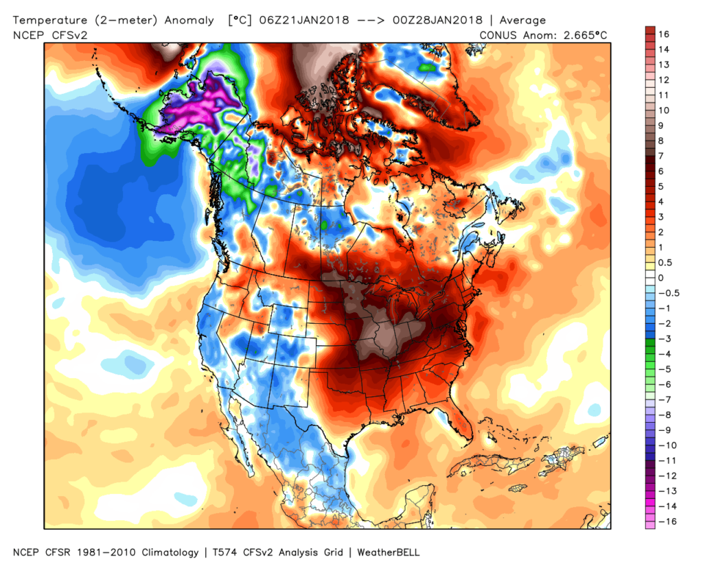 Despite the milder air over the past week, January, as a whole, is still running 4° below average at Indianapolis- a byproduct of just how frigid the first half of the month was.
 While the January thaw has been nice, times are changing and winter sure seems to be reloading for a very active second half.
Initially, we think it’s the storminess that will be most impressive as a “fight” develops between resistance from southern ridging and a new mean trough pushing southeast. The end result should be multiple snow and ice makers from the southern Plains into the Ohio Valley and northeast over the upcoming couple of weeks.
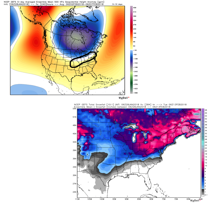 Once we get a snowpack laid down, arctic highs oozing southeast will likely lead to bitterly cold air. Recall our expectation for this pattern to yield at least (1) night of double-digit below zero lows, but it’s more towards mid-month that we think the severe cold takes hold.
Teleconnections are lining up and in overall agreement of cold, wintry times returning.
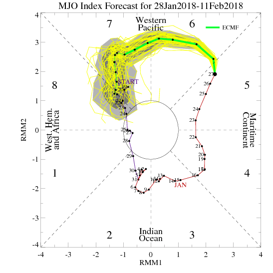
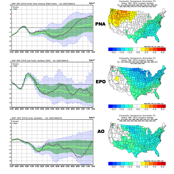 The Madden-Julian Oscillation (MJO) is forecast to rotate into the colder phase 8 as we rumble from early to mid February. Given the amplitude of the MJO, it should continue to rumble right through the cold phases of 1,2, and 3.
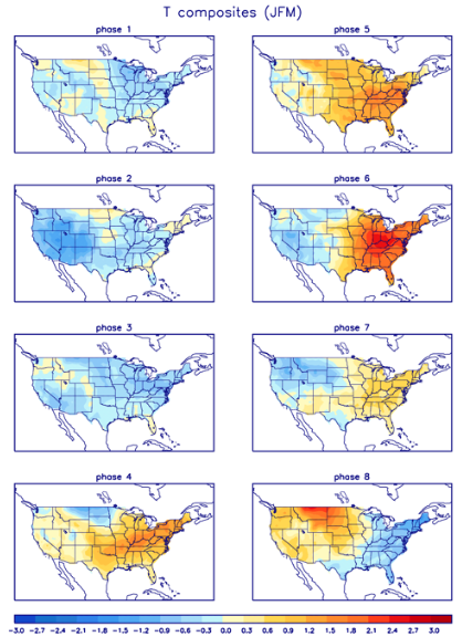 All of these moving pieces that lead up to extended periods of cold, wintry conditions are part of a bigger outcome low solar, easterly QBO winters deal up. What we should experience with this setup is a 6-7 week period of wintry conditions, including times of severe cold. It appears to be a snowier version of what we went through late-December through mid-January. Hang in there, spring will come…eventually.
 Highlights:
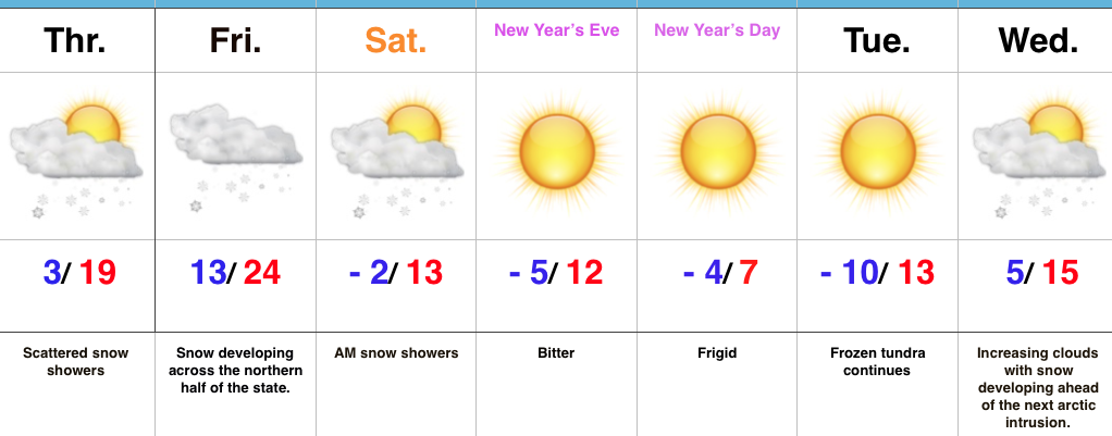 Highlights:
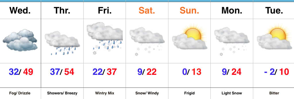
 Despite an active weather week ahead, the open to the new work week will be rather uneventful. Weak high pressure will keep us dry today and Tuesday. Fog and low clouds should give way to an increasingly bright sky by this afternoon (still more clouds than sun today) and partly cloudy skies Tuesday.
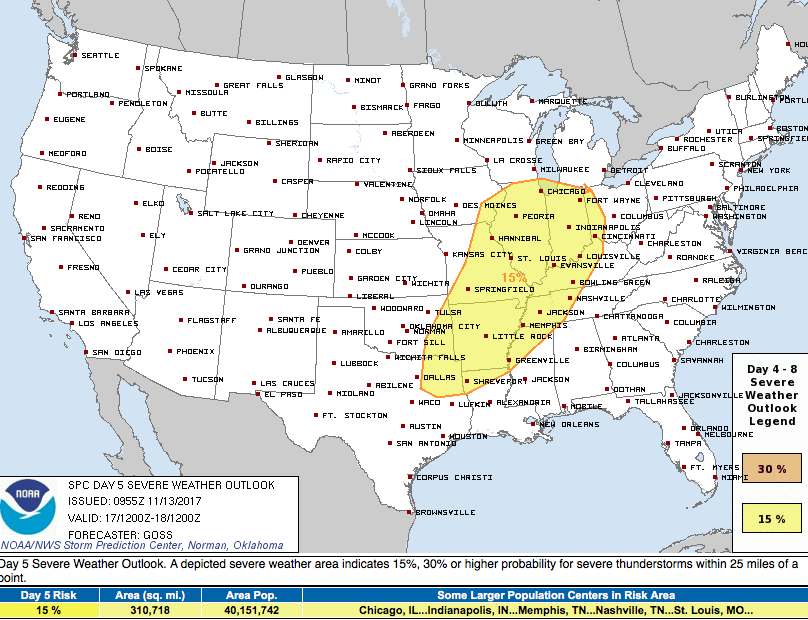
 A stronger storm will impact the region as we close out the work week. Strengthening low pressure will track into the Great Lakes and drag a trailing cold front through our region Friday evening. A briefly milder southwesterly air flow will push temperatures close to 60° Friday afternoon/ evening before the sharply colder push of air blows into town for the weekend. The transition may include strong to severe thunderstorms Friday PM, and the Storm Prediction Center (SPC) has outlined a large portion of the region under a severe risk Friday. It’ll be important to stay tuned to future updates. Even outside of potentially damaging thunderstorm gusts, non-t-storm winds will gust over 40 MPH Friday.
 Once the cold front sweeps through the region, a sharply colder air mass will plunge into the Ohio Valley for the weekend. Overnight data has trended even colder and would suggest falling Saturday temperatures (most of the day will be spent in the 30s) and highs only in the lower to middle 30s Sunday.
 Speaking of cold, Thanksgiving week is looking unseasonably cold, and there’s also the potential of early-season snow (far too early for specifics).