Still Warm, But Much More Active…
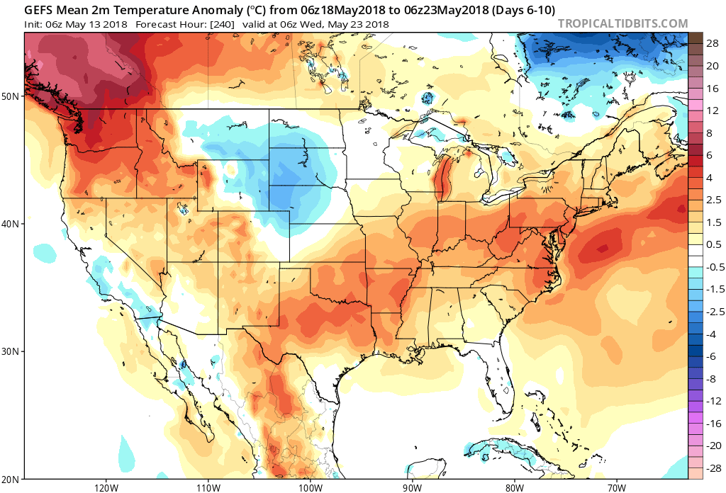
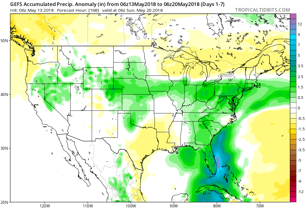
So far, May-to-date has run well above average in the temperature department (+8.5°) and below average from a precipitation perspective. While we’ll continue to run much warmer than normal through the second half of the month, we’ll begin to make up for “lost time” in the rainfall department, and that starts this week.
Daily chances of showers and thunderstorms are included in your latest 7-day and, at times, storm complexes will likely reach strong to severe levels as disturbances ride the periphery of an upper level ridge off to our south. It certainly won’t rain the entire time over the upcoming week and we’ll still enjoy more dry hours than wet and stormy. That said, for a region running around 1.5″ below average, the more active times will be a welcome sight for many. By next Sunday, we expect many area rain gauges to accumulate 1.5″ to 2.5″ of rain with locally heavier amounts.
 Concern is on the increase for the potential of strong to severe thunderstorms to impact central parts of the state Wednesday evening and night. That said, there are questions with how quickly the atmosphere will be able to recover from morning cloudiness and scattered thundershowers.
 Current thinking leans towards a brightening sky through the mid and late afternoon hours which will help destabilize things for potentially a “more significant” event Wednesday evening and night (bracketing the hours of 6p to midnight from west to east).
 Storms are expected to exit off to the east by midnight:
 The primary concern that severe thunderstorms may deal central Indiana lies around damaging straight line winds and large hail, however, it should also be noted current parameters also suggest a couple of storms could spawn a tornado.