VIDEO: Storm Chances Return; Big Heat Looms…
You must be logged in to view this content. Click Here to become a member of IndyWX.com for full access. Already a member of IndyWx.com All-Access? Log-in here.
You must be logged in to view this content. Click Here to become a member of IndyWX.com for full access. Already a member of IndyWx.com All-Access? Log-in here.
You must be logged in to view this content. Click Here to become a member of IndyWX.com for full access. Already a member of IndyWx.com All-Access? Log-in here.
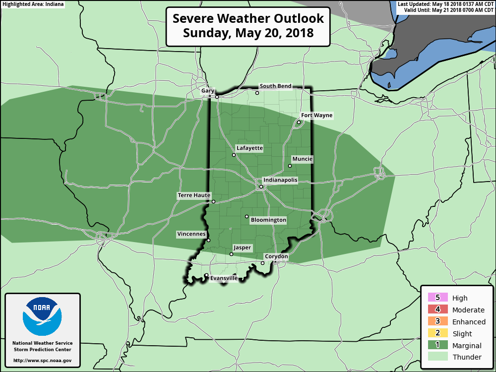
The Storm Prediction Center has placed southwestern Indiana under a Slight risk of severe weather, with extreme southern Indiana now included in an Enhanced risk.
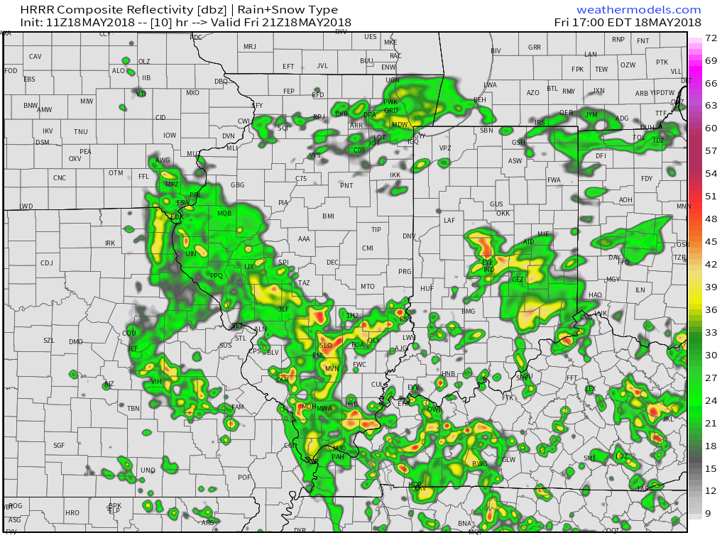
 Upper level energy will push east this afternoon and combine with an unstable air mass, along with unseasonably hot and humid air (highs today will reach the lower 90s across the southern half of the state with dew points around 70°), resulting in explosive thunderstorm development this evening. Storms will rumble east during the nighttime hours before exiting off to the east and diminishing during the early morning hours.
 We target the time frame of 6p to midnight for greatest storm coverage and the possibility of severe weather. While the greatest threat of severe is just south of the city, itself, I think all of central IN is in play for the possibility of strong to severe thunderstorms tonight. In addition to locally heavy rain, stronger storms could pose a damaging straight line wind threat along with large hail.
A couple of storms may still fire Friday afternoon in the warm and humid air mass, but a boundary will pass Friday evening, allowing less humid air to arrive Saturday. On that note, even cooler and less humid air awaits early next week.
You must be logged in to view this content. Click Here to become a member of IndyWX.com for full access. Already a member of IndyWx.com All-Access? Log-in here.
An upper level low pressure system will track northeast today into tonight, and as it does, look for more numerous showers and embedded thunder to develop. Some localized heavier downpours are a good bet this evening across central Indiana.

 Otherwise, look for considerable cloudiness and highs topping out in the lower 70s today.
While we’ll have to contend with a few showers Saturday, overall, the day should be drier compared to today and what lies ahead Sunday. Speaking of Sunday, we’re monitoring the potential of a couple of storms reaching strong to severe levels to close the weekend. The Storm Prediction Center includes central portions of the state in a “marginal” risk of severe with their update Friday morning. It wouldn’t surprise us if a portion of the marginal risk is upgraded to a “slight” risk in future updates. We’ll fine tune storm timing over the next 24 hours.
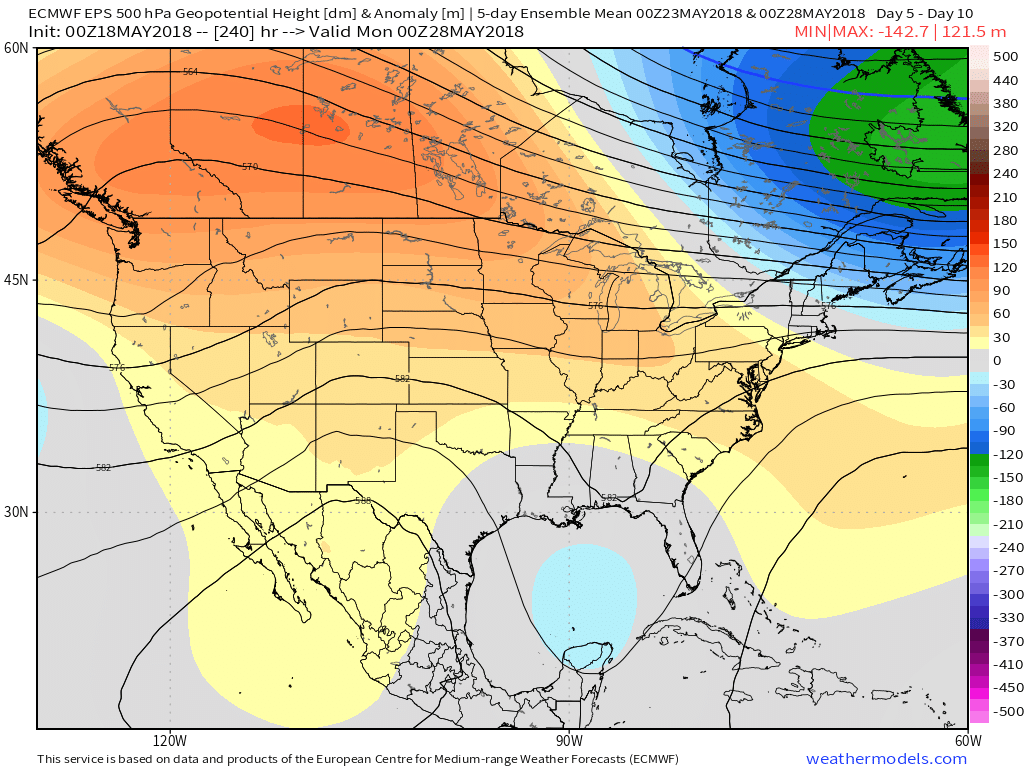
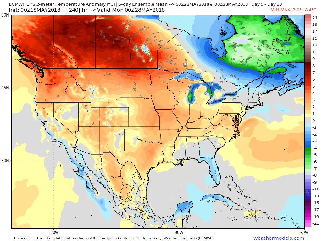
 As we look ahead to the end of May, there really aren’t any significant changes to the overall warmer than normal theme we’ve enjoyed so far this month. Longer range guidance off of the European ensemble continues to support broad scale upper ridging across the Mid West and Ohio Valley and a corresponding warmer than average regime. From a precipitation perspective, the next couple of weeks do look more active compared to the dry start to the month. Case in point, the balance of the upcoming week will be dominated by a stalled frontal boundary. While we’ll have to fine tune exactly where the front stalls, daily chances of showers and thunderstorms (scattered fashion) can be expected.