Unseasonably Warm; Wet Day After Christmas…
 Highlights:
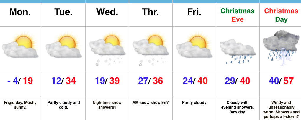
- Unseasonably warm today
- Showers and perhaps a t-storm by lunchtime
- Turning more seasonable later this week
Wet At Times Today…A cold front will push across the state later this afternoon. Ahead of the front, a warm southwesterly air flow will lead to a spring-like feel on this day after Christmas. Coverage of showers will increase by late morning and around lunchtime, including the possibility of an embedded thunderstorm. Once the front sweeps through the region, our winds will flip to the northwest and result in a cooler feel as early as tonight. Tuesday will feature much more seasonable conditions.
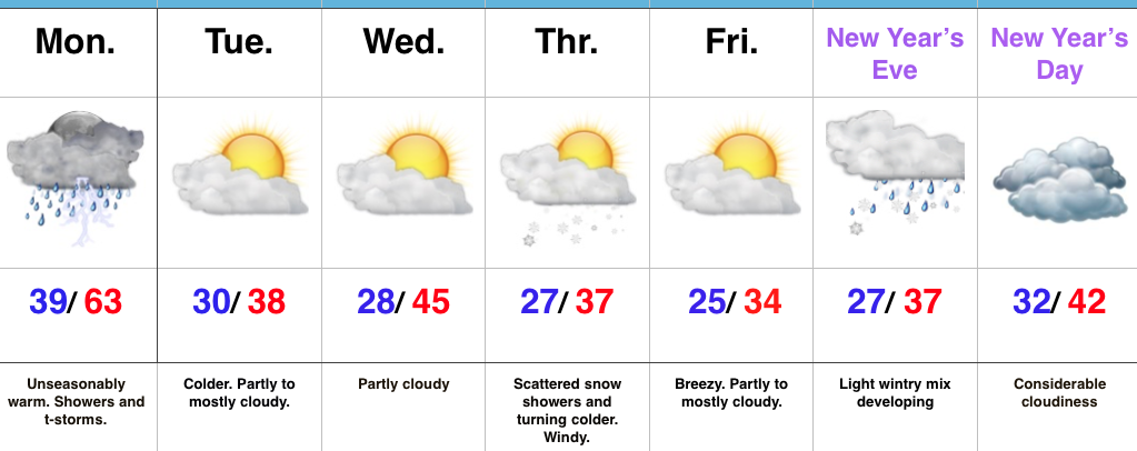
Reinforcing chilly air will blow into town Thursday afternoon and with enough upper level energy around, we’ll mention scattered snow showers in our forecast. Colder weather will be with us to close the week and head into New Year’s weekend.
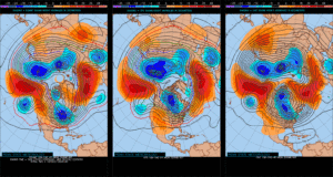
Speaking of New Year’s, we still eye a storm system around New Year’s Eve. Confidence is low in the overall set-up in regards to storm track and timing and fine tuning will be required. For now, we’ll simply go with a developing light wintry mix Saturday and “sure up” the details later this week.
Upcoming 7-Day Precipitation Forecast:
- Snowfall: Dusting
- Rainfall: 0.50″ – 0.75″
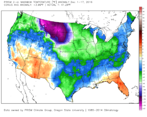
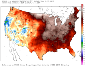
 This is, of course, is in stark contrast to December 2015.
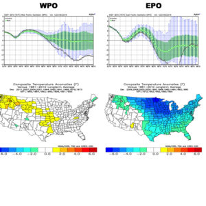
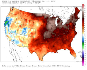 As we move forward, an active pattern awaits between now and the end of the year. This comes after a few days to catch our breath, including moderating temperatures leading up to Christmas.
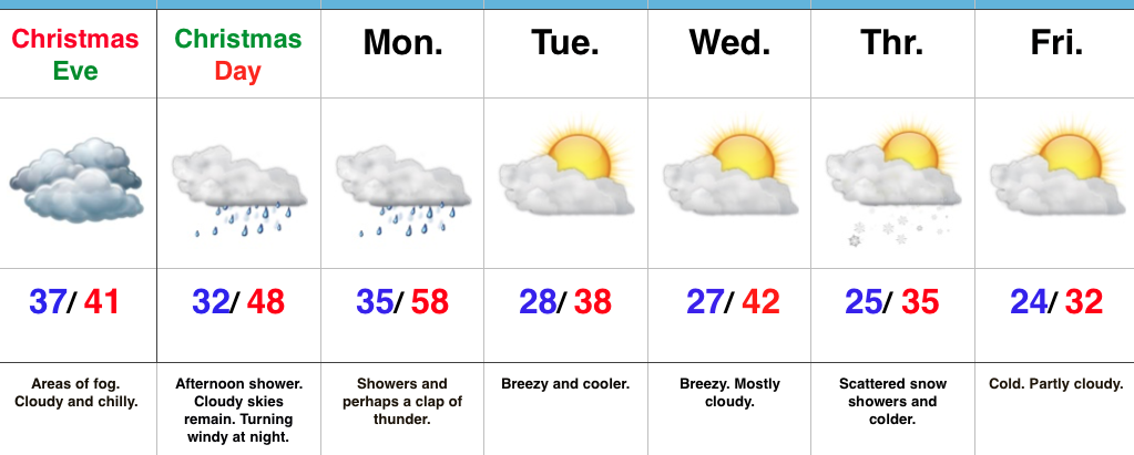
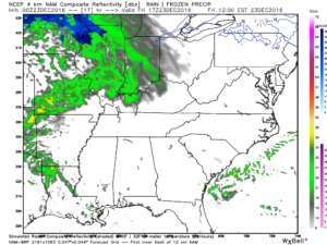 Christmas Eve will feature overcast skies with areas of fog and drizzle, but the majority of the concentrated rain should fall south of the region. Santa’s ride into central IN should be uneventful, weather-wise.
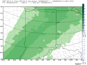 Temperatures will fall through the day Monday and we should run much closer to seasonable temperatures next week. A couple of additional storm systems will have to be monitored for rain and snow prospects the middle of next week and again around New Year’s Eve/ Day. Initially, we’ll be rather mild, but there may be more in the way of cold air readily available to make the storm system around New Years “more interesting” from a wintry perspective.