Snow Intensifies Again Early Afternoon; Turning Much Colder…
 Highlights:
- Snow intensifies for a period this afternoon
- Bitterly cold weekend ahead
- Moderating trend early next week
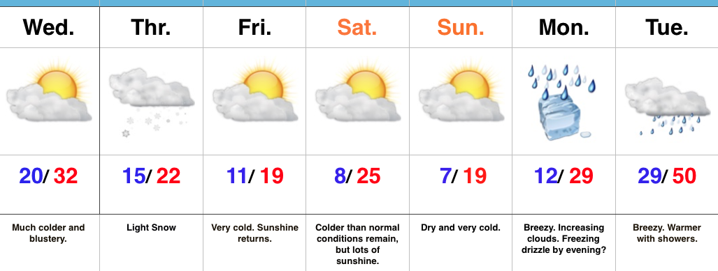
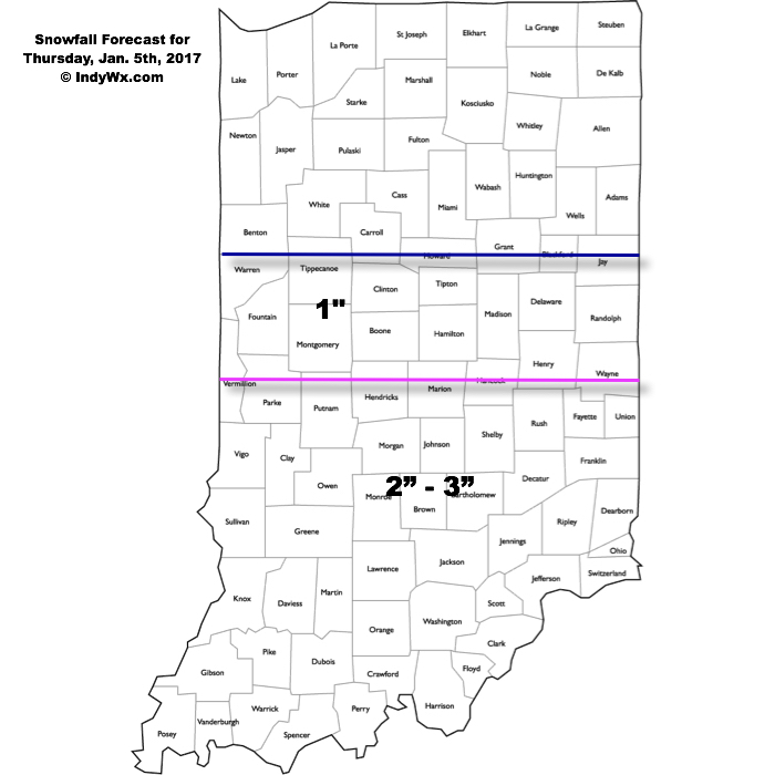
Snowy Thursday…Light snow developed during the predawn hours and made for a slick morning commute across central Indiana. We note a steadier band of snow currently falling south of the city for places like Bedford, Columbus, and Seymour as of this update (9:30a). As additional energy pushes across the state late morning into the afternoon, look for snow to expand in coverage and intensity for a time across more of central Indiana around lunchtime into the early afternoon before sliding off to the east. Our ongoing snowfall forecast remains unchanged:
Conditions will remain bitterly cold (most of today is spent in the 10s), and with even the slightest bit of snow cover, conditions will turn even more frigid to end the week. Area-wide single digits can be expected to begin the day Friday (Saturday and Sunday, as well) with wind chills below zero. Dry conditions return this weekend. We’ll watch as our friends to the south enjoy a winter storm from Alabama, northern GA, into the Carolinas.
Moderating temperatures return early next week and as the warm advection begins Monday, it could help produce a wintry mix by evening before precipitation transitions to rain Tuesday, along with a breezy SW wind.
Upcoming 7-Day Precipitation Forecast:
- Snowfall: 1″ – 3″
- Rainfall: 0.75″ – 1.00″